jc456
Diamond Member
- Dec 18, 2013
- 160,363
- 40,065
- 2,180
Well again, the point that ice froze is a single point in time. It is one number and not an average.And that is different from oxygen isotopes how? Which is the accepted temperature record of the planet. So at what point do you say there's no evidence for glacial cycles? Because there's a shit ton corroborating evidence that supports the evidence you are dismissing for no good reason.
One site.
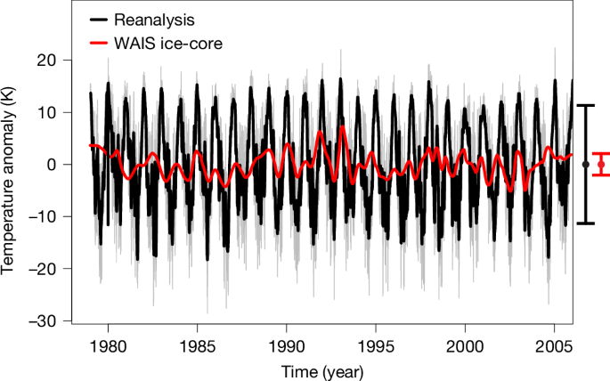

arising from: T. R. Jones et al. Nature Seasonal temperatures in West Antarctica during the Holocene - Nature (2023).
Resolving seasonal variations in long proxy records is an outstanding challenge in paleoclimate research. Jones et al.1 (referred to as J23) report on the continuous reconstruction of seasonal temperatures over the last 11,000 years from the West Antarctic Ice Sheet Divide ice-core (WDC) record.