Mushroom
Gold Member
I will admit, this is something that has long bothered me.
I watch a lot of documentaries, especially about geology. And almost every time it is more or less like this one:
In other words, placing the asteroid impact as if it was on top of our planet today.
However, that is dead wrong. Because our planet did not look like that 65 mya. Because if they were really "accurate", this is what they should be showing the planet as looking like when the asteroid hit.
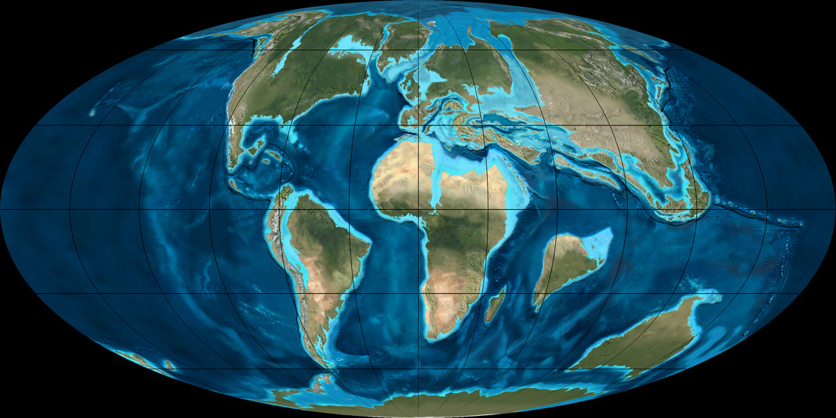
Which is a vastly different planet than we live on today. South America and Africa had only "recently" split apart, and Asia and Europe were still two very different continents. And if one looks at the large island to the east of Madagascar, that is India. It had yet to collide with Asia.
I was thinking of this, because I have long noticed that humans seem to have a 'fixed" position of them in the Universe. And that is where and how they are at this moment. They picture the asteroid that killed the dinosaurs, and just automatically place it on the Earth today. Not the Earth as it was back then. And I was reminded of this when reading somebody stating that they would love to be here and see the collision with the Milky Way and Andromeda galaxies.
Nice thought, but not possible. As that is still around 4.5 gy in our future. At that point, our sun will be a Red Giant, and the Earth will literally be on the outer edges of the solar atmosphere.

Our planet will only be a charred cinder at that point, no life here to witness that. The "Habitable Zone" will actually be out near Jupiter and Saturn, so maybe there will be life on one of their moons to see it.
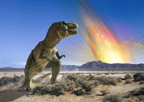
I watch a lot of documentaries, especially about geology. And almost every time it is more or less like this one:
In other words, placing the asteroid impact as if it was on top of our planet today.
However, that is dead wrong. Because our planet did not look like that 65 mya. Because if they were really "accurate", this is what they should be showing the planet as looking like when the asteroid hit.
Which is a vastly different planet than we live on today. South America and Africa had only "recently" split apart, and Asia and Europe were still two very different continents. And if one looks at the large island to the east of Madagascar, that is India. It had yet to collide with Asia.
I was thinking of this, because I have long noticed that humans seem to have a 'fixed" position of them in the Universe. And that is where and how they are at this moment. They picture the asteroid that killed the dinosaurs, and just automatically place it on the Earth today. Not the Earth as it was back then. And I was reminded of this when reading somebody stating that they would love to be here and see the collision with the Milky Way and Andromeda galaxies.
Nice thought, but not possible. As that is still around 4.5 gy in our future. At that point, our sun will be a Red Giant, and the Earth will literally be on the outer edges of the solar atmosphere.
Our planet will only be a charred cinder at that point, no life here to witness that. The "Habitable Zone" will actually be out near Jupiter and Saturn, so maybe there will be life on one of their moons to see it.