Probably. We've only been in an ice age for 3 million years or so.I wonder if the people who invented them and spend their lives studying sea ice know?

Follow along with the video below to see how to install our site as a web app on your home screen.
Note: This feature may not be available in some browsers.
Probably. We've only been in an ice age for 3 million years or so.I wonder if the people who invented them and spend their lives studying sea ice know?
HAVE YOU TOLD THEMProbably. We've only been in an ice age for 3 million years or so.
They already know that solar variability and orbital forcings coupled with albedo of the northern hemisphere have driven all climate fluctuations and environmental uncertainty over the last 3 million years because the planet is uniquely configured for bipolar glaciation and the planet's temperature is at the threshhold for extensive northern hemisphere glaciation.HAVE YOU TOLD THEM
Ice and NASA, NASA does not release the raw data from the satellites. They release, "products". The truth is somewhere in between the product and the raw data.
HAVE YOU TOLD THEM
LOL,An opinion can be nothing more and it can be a fact. My opinion is you operate with half a ******* brain and half a cup of cold noodles.
Satellites, great, post the raw data from NASA. I will save you the time, NASA does not release raw data. Thank you. What is the resolution of the raw data and how do you prove it without the raw data?
How does anyone prove anything that NASA states without the raw data.
They dont. There, I just proved beyond an, "opinion", that you are a moron thinking you were onto something beyond your insults that you began your conversation with me.
Really, I find you to be a complete moron without a brain. It is the complete moron who only has a google search and thinks their well thought out, copy and paste of google links proves they know anything about anything.
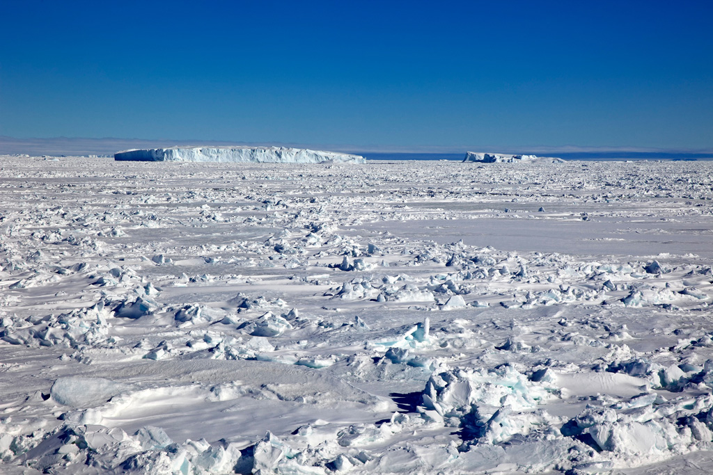
Sea Ice, all the data we have on sea ice from the beginning of time is nothing more than a speck of sand, or the size of your brain, and that is fact.
Without a link to your brain, found with google, you can not prove that fact wrong. So link to show us your are not a monkey at a keyboard.
Do YOU know what the resolution of Satellites measuring Sea Ice?
LOL Damn, you say damn stupid things. Look up the ups and downs of the CO2 and CH4 amounts in the atmosphere for those Milakovitch Cycles.They've told YOU WHY the Earth went thru FOUR different Ice Ages in a row (and brief subsequent warmings). And it had NOTHING to do with fossil fuels or CO2. Did ya miss that? Go look up Milankovich Cycles... It's a "thing".
 www.carbonbrief.org
Sourced data?LOL,
Not a single bit of evidence is posted to support your "opinions" which I have been addressing with sourced evidence and data, yet YOU think I am the moron.
Have YOU seen their RAW data? it is in a language you wouldn't understand and requires modeling parameters to set it up to covert the signals into temperature numbers in C
Wikipedia,
Microwave Sounding Unit temperature measurements refers to temperature measurement using the Microwave Sounding Unit instrument and is one of several methods of measuring Earth atmospheric temperature from satellites. Microwave measurements have been obtained from the troposphere since 1979, when they were included within NOAA weather satellites, starting with TIROS-N. By comparison, the usable balloon (radiosonde) record begins in 1958 but has less geographic coverage and is less uniform.
Microwave brightness measurements do not directly measure temperature. They measure radiances in various wavelength bands, which must then be mathematically inverted to obtain indirect inferences of temperature.
LINK
More in the link about the conversion process.
bolding mine
===
Meanwhile you still fail to handle a simple question,
I have known the answer for years now but you the "opinion" child can't figure how to find the easy to find answer, hint: it is on the satellite website as it is a KNOWN configuration of the instrument designed developed used to scan the sea ice.
Your ignorance of facts/evidence is hurting you.
Well, YOU are the one who makes unverified incorrect opinions over and over through the thread while me and ReinyDays actually have the GALL to post data/facts with links to support what we state to help you see what we think about it then you come back like a jerk.
Apparently, my question was too hard for you to answer and why I asked you about seems to have zoomed over your head also.
I already pointed out your error "It is guess work when it comes to ice" with my reply,
"Satellites lack the resolution to see all of the ice which is why it can only be a ballpark number, but it still has some value when applied over the years consistently."
Then ReinyDays comes along to correctly point out that it sees in TWO dimensions.
"Satellites only give us 2-Dimensional pictures of what is in fact a 3-Dimensional structure ... each successive generation of GOES satellites improve our resolution of spacial positions and the hydrodynamics going on there ... but we're still only as advanced as "high, middle and low" ..."
===
Satellites provide useful data needed especially when it is applied consistently over the years but lacks the needed resolution to see very small ice cover and see water covering over ice thus not counting the ice which means some of the ice isn't being accounted for.
Do you know what the current Resolution is for measuring the ice in the arctic region?
LOL Damn, you say damn stupid things. Look up the ups and downs of the CO2 and CH4 amounts in the atmosphere for those Milakovitch Cycles.
Greenhouse gases
These shifts in the distribution of sun’s energy across the Earth’s surface are not enough to explain the dramatic changes to the climate during ice ages, particularly outside high-latitude regions.
Changes in atmospheric greenhouse gas concentrations – and, in particular, CO2 – play a large role in the development of cold conditions during ice ages and warm conditions during interglacial periods. In this case, CO2 is not the immediate cause of ice ages; rather, it serves as a feedback to amplify changes initiated by orbital variations.
There is a well-known correlation between temperatures and CO2 concentrations over glacial periods. The figure below shows both temperatures (red line) – reconstructed from hydrogen isotope analysis – and atmospheric CO2 concentrations (blue line) from air bubbles trapped in Antarctic ice over the past 800,000 years.
(These ancient air bubbles are accessed by drilling ice cores down through ice sheets and glaciers. Ice cores are just one example of “proxy data”, where climate information from the distant past is gathered from indirect evidence that is locked up in various forms across the Earth.
Explainer: How the rise and fall of CO2 levels influenced the ice ages
In this explainer, Carbon Brief explores how the last ice age provides strong evidence of the role CO2 plays as a “control knob” for the Earth’s climate. It also acts as a cautionary tale of how the climate can experience large changes from relatively small outside “forcings”.
LOL,Sourced data?
All I said was satellites are a poor measure of artic sea ice, and I added that nasal dies nit release the raw data which is a problem.
You then began to insult me.
Insults that begin a conversation makes me believe you are a person of very low intelligence hence I return your insults.
Had you wanted to engage in the exchange of knowledge you would of began by providing knowledge.
So yes, you are blithering idiot who has nothing but a Google result fir a brain. You are here so I can have a discussion with a Google search results?
Now that is your stupidity on display loud and clear.
You are not even Addressing the points I did make, you are off on some bizarre tangent
You're full of itLOL,
It is made profoundly clear by YOU that you have NEVER seen the Raw data you crave thus you speak from ignorance.
Have you ever seen the RAW CO2 data from Mauna Loa as I have courtesy of the Director who gave me temporary access to it in 2009, Yet YOU and many others don't question it.....
===
Did you read this at all and the internal links with it?
I tried to help you understand how complex the RAW the satellite data is, but you get angry when I keep posting evidence/facts to you while you have NEVER posted a single scrap of in the entire thread up to this time.
Stop being a wanker child!
===
Wikipedia,
Microwave Sounding Unit temperature measurements refers to temperature measurement using the Microwave Sounding Unit instrument and is one of several methods of measuring Earth atmospheric temperature from satellites. Microwave measurements have been obtained from the troposphere since 1979, when they were included within NOAA weather satellites, starting with TIROS-N. By comparison, the usable balloon (radiosonde) record begins in 1958 but has less geographic coverage and is less uniform.
Microwave brightness measurements do not directly measure temperature. They measure radiances in various wavelength bands, which must then be mathematically inverted to obtain indirect inferences of temperature.
LINK
===
You originally said it was guesswork which is FALSE! It simply lacks the full resolution capability to see all of the ice of which ReinyDays made clear since it sees in TWO dimensions and that the instruments doing the measuring doesn't have the ability see all the smaller ice floating on the surface.
The Sea Ice data it does have is still valuable well above the level of "guesswork" which is why I keep pointing it out that even getting 90% of the sea ice data is far better than getting zero and provides a databased baseline to build on.
I am the only one posting actual official information, yet you idiotically say I don't provide any knowledge, that is truly stupid since I have posted over 10 links now to your ZERO in the thread.
I am done with you and your childish and stupid replies.
You're full of it
The 'Raw Data' is regularly summarized By NOAA/NASA/NSIDC etc, and confirms AGW.
You Cherry pick 'raw data' to make Misleading graphs, or copy them from WUWT
Pretty much all short term "Down the up escalator" deception attempts.
`
And what do those nebulous, fragmented, inscrutable, Links say to you and why?Show us the RAW data, and you will FAIL since they stopped posting it years ago
The links below isn't raw data; it has already been processed into temperature values when you see this from Global Warming Blog.
"The graph above represents the latest update; updates are usually made within the first week of every month. Contrary to some reports, the satellite measurements are not calibrated in any way with the global surface-based thermometer records of temperature. They instead use their own on-board precision redundant platinum resistance thermometers (PRTs) calibrated to a laboratory reference standard before launch.
The digital data for the above plot, as well as for various sub-regions of the Earth and for three other atmospheric layers, are available at the links below. You can copy and paste the data into a spreadsheet program like Excel to do your own plotting and analysis (in Excel, you might need to use the “Data>Text to Columns” function to get the data separated into columns after pasting):
Lower Troposphere: http://vortex.nsstc.uah.edu/data/msu/v6.0/tlt/uahncdc_lt_6.0.txt
Mid-Troposphere: http://vortex.nsstc.uah.edu/data/msu/v6.0/tmt/uahncdc_mt_6.0.txt
Tropopause: http://vortex.nsstc.uah.edu/data/msu/v6.0/ttp/uahncdc_tp_6.0.txt
Lower Stratosphere: http://vortex.nsstc.uah.edu/data/msu/v6.0/tls/uahncdc_ls_6.0.txt
=====
Wikipedia
Microwave brightness measurements do not directly measure temperature. They measure radiances in various wavelength bands, which must then be mathematically inverted to obtain indirect inferences of temperature.
LINK
===
There is no RAW data here.
The data the IPCC is using is skewed by the urban heat island effect and the low variability solar output datasets. Take out the urban island heat effect and use the high variability solar output dataset used by the team in charge of NASA’s ACRIM sun-monitoring satellites and it shows the warming trend is due to natural causes. Specifically the sun.And what do those nebulous, fragmented, Links say to you and why?
You're doing exactly what I said.
Cherry picking fragments to kinda/fail at showing cooling over some period.
When in fact it's warming.
You cite OSTENSIBLE NOAA Data but Lie-with-stats (classics like "Down the up escalator") to come to different conclusions than they do about the fact it IS warming.
`
First argue with Tommy or FlaCalTeen who aren't even convinced it's warming.The data the IPCC is using is skewed by the urban heat island effect and the low variability solar output datasets. Take out the urban island heat effect and use the high variability solar output dataset used by the team in charge of NASA’s ACRIM sun-monitoring satellites and it shows the warming trend is due to natural causes. Specifically the sun.

It's warming which includes the urban heat island effect. The causes are up for debate. Within thirty years everything you believe will be proven wrong. There is nothing unnatural about any of this. You have falsely correlated it with CO2.First argue with Tommy or FlaCalTeen who aren't even convinced it's warming.
FCT says it stopped in 2008...
and Tommy not only denies it, but has had many several self-impeaching "Pauses" in.. the non warming trend.
Nuts Yes.
These are HIS "Pauses" (aka "Down the up escalator") and you add at least one more HIGHER YET "pause" on the way UP... 2015-2021 where we Considerably warmer yet!
because natural uptrends don't go straight up.
The last 7 Years being the warmest is another "Pause" to him. .. but only if you start with an interim high year (ie 2016) in every 5-10.
LOL
`
Do you think the people who discovered and taughtyou that...missed that?They've told YOU WHY the Earth went thru FOUR different Ice Ages in a row (and brief subsequent warmings). And it had NOTHING to do with fossil fuels or CO2. Did ya miss that?
Your appeal to authority argument is weak, bro. It's not a good look. You might as well change your avie to a white flag.Do you think the people who discovered and taughtyou that...missed that?
HAVE YOU TOLD THEM?!?!?
Won't they be surprised!