P F Tinmore
Diamond Member
- Dec 6, 2009
- 86,763
- 4,928
- 1,815
Wrong as you have been shown before the borders that are detailed in those treaties include what is now Iraq, Syria, Jordan and Israel. They were done that way to make it easy for the promises made to the arab muslims to be kept, they did not grant the itinerant arab muslim wandering workers a nation as you imply. There are no treaties that define the international borders of lesser Palestine, what there is are borders of the original NATIONAL HOME OF THE JEWs. Then the revised NATIONAL HOME OF THE JEWS that allocated most of the land to an arab Palestinian state known as trans Jordan. Later on the UN partitioned this land into two parts for the muslims and the Jews. This was accepted by the Jews and declined by the muslims and led to the Arab Israeli war of 1948. The ICJ later stated that res 181 was valid and legal stopping the arab LIES once and for all.
No it is a valid point as every other nation created at the same time was done so via signed treaties.
Wrong as you have been shown before the borders that are detailed in those treaties include what is now Iraq, Syria, Jordan and Israel.
OK,you made the claim now prove it.
I await your response.
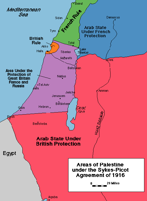
Here you go the graphical illustration of the Sykes-Picot agreement that was the basis for the treaty of Lausannes borders of Palestine. You can discount the green as that was Russian mandated land

Do you want to wade through every single treaty agreed at that time so you can draw your own borders, but be aware that the borders were fluid and changed on an almost daily basis. Start with the one given above that shows the extent of the Palestinian mandates of Britain and France.
Or this
This
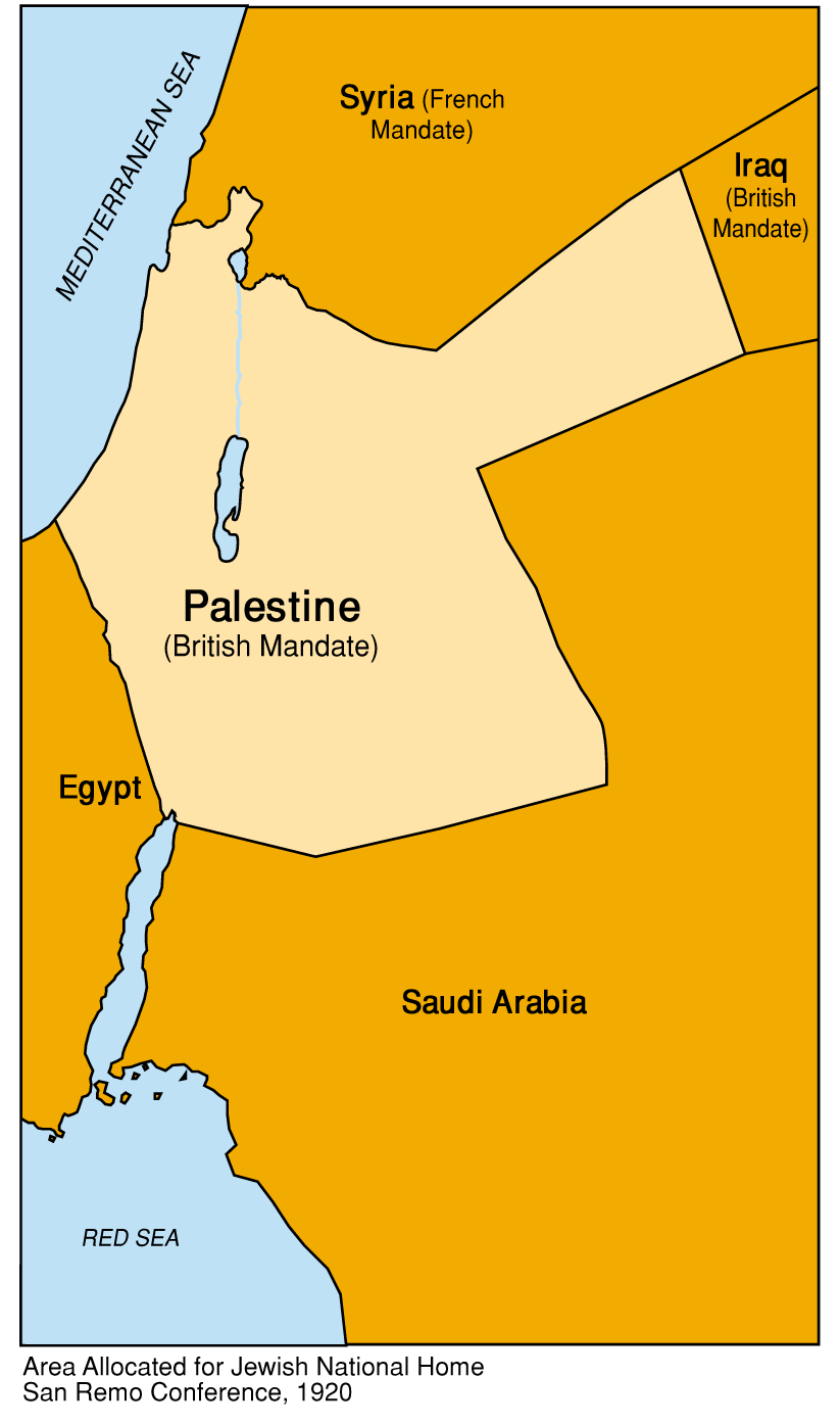
True so far but in 1922 Palestine's final international border was defined with Transjordan. These were the borders of Palestine when it was separated from Turkish control in 1924.

