edthecynic
Censored for Cynicism
- Oct 20, 2008
- 43,044
- 6,883
- 1,830
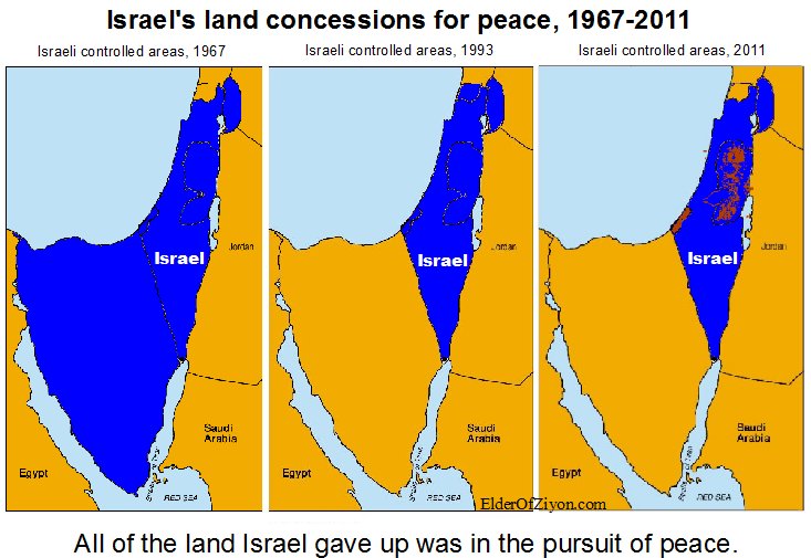
The liar is your Elder of Ziyon. I especially loved his rationalization, that government land before there was an Israeli government belonged to Israel, to call the 1946 map a lie.Clearly it is post 1967, and clearly only involving Palestinian land. The land up to the Suez Canal was Egypt's.At last we are making some progress. Are the lines Obama referred to before (pre) the 1967 war or after (post) the 1967 war? The maps shown on this thread show Israel in control of the entire area, all the way to the Suez Canal after the war. I am sure that is not what he was referring to, so common sense dictates that he meant the lines before (pre) the war. The fact that he didn't use the word 'pre' means nothing.
Would you mutually agree with someone that has vowed before their God to kill you?
I do find it rather amusing that anyone would refer to CNN as conservative.
Here is a map that shows what land would be involved in a return to 1967 borders.
Of course a liar such as yourself knoiwningly and willfully use a lying source to push their own lie
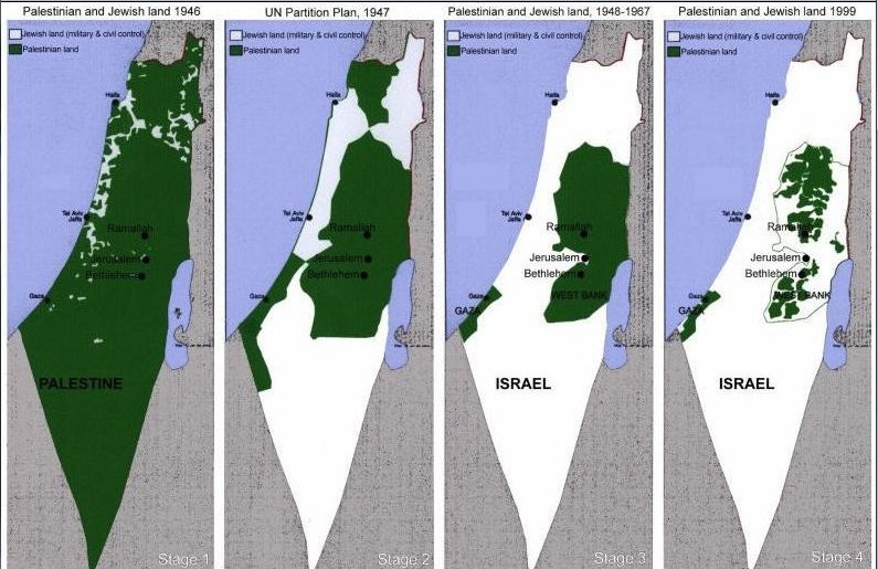
Do not use that map anymore
The map that lies - and one that doesn't
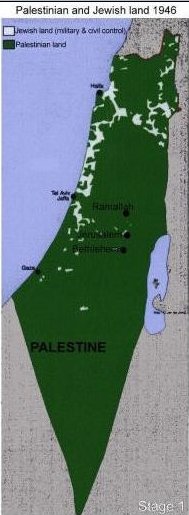
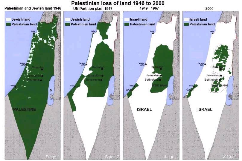
While I presume that the white sections are indeed the land that was privately owned by Jews, the land in green was not privately owned by Arabs.
Only a tiny percentage of land in Palestine was privately owned. The various categories of land ownership included:
Mulk: privately owned in the Western sense.
Miri: Land owned by the government (originally the Ottoman crown) and suitable for agricultural use. Individuals could purchase a deed to cultivate this land and pay a tithe to the government. Ownership could be transferred only with the approval of the state. Miri rights could be transferred to heirs, and the land could be sub-let to tenants. If the owner died without an heir or the land was not cultivated for three years, the land would revert to the state.
Mahlul: Uncultivated Miri lands that would revert to the state, in theory after three years.
Mawat (or Mewat): So-called dead, unreclaimed land. It constituted about 50 to 60% of the land in Palestine. It belonged to the government. ...If the land had been cultivated with permission, it would be registered, at least under the Mandate, free of charge.
Elder of Ziyon: The map that lies - and one that doesn't
This map is a lie.
This one doesn't lie.