Silhouette
Gold Member
- Jul 15, 2013
- 25,815
- 1,938
- 265
Satellite technology offers up all sorts of new speculation. It's really fun when ground excavations and other artifacts seem to line up with one's theory.
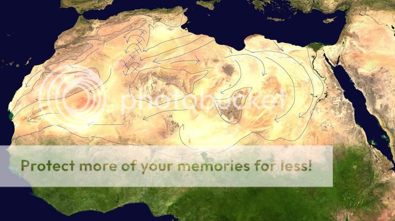
OK, from this link we have an interactive relief map of the Sahara region in Africa. North Africa -- Physical - David Rumsey Historical Map Collection
I've taken a screenshot.
Why are there areas of normal mountain erosion above a certain elevation and then flat plateaus below that scrubbed like a plane? Normal erosion gives way to gradual foothills, not such radical demarcation zones. Looking at it like you'd look at a formation in your backyard, say, it would be obvious some water flow came in and scrubbed the area and drained out there at Mauritania, where the only significant "notch" exists on the coast of upper West Africa. If we're talking wind-erosion to explain this oddity of sudden demarcation, wind speeds pick up nearer the peaks of mountains, not so much at the foothills. So we'd at least expect even erosion processes and not clean demarcation zones of flattened plateaus at lower elevations.
Take that along with the only large significant mud outflow just off Mauritania into the Atlantic Ocean, it fits the theory nicely:
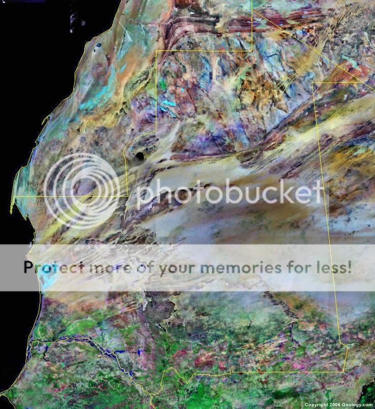
First, Mauritania satellite image showing the notch and strange scraped looking striations along the area in question where I theorize a large flow of water made its way out in an event. Notice surrounding features appear unscathed.
Next an area of large sediment flow spreading up quite a ways north originating from the "notch" of Mauritania into the Atlantic Ocean.
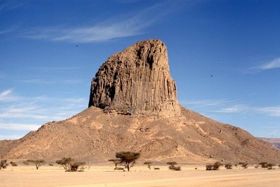
There are anomalies in the Atlas Range of the extreme Northwest corner of the Sahara. Large amounts of sediment pile up nearly to the mountain tops (excavations show this) from some type of flood deposit in the Hauts Plateaux. But at the top of a mountain range?
Examining the relief map at the top more closely, especially using the interactive map link, you can see that there appears to be a channel that goes back up the very northeast corner of that range from the Sahara below; even with some standing water left.
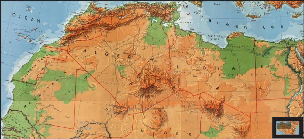
My theory is that a great massive rush of water came from the Mediterranean, possibly a colossal tsunami event, and that it hit the old mountain range (ground flat to plateaus by the flood) traversing from the Atlas Range over to the Plateau du Tademait, thence over to the Tassili Ajjer & Ahagger Ranges. When that great rush of water hit those erstwhile mountains you can still see the remnants of, it shot backwards up into the Atlas at Chott Melrhir & Chott el Hodna into the Hauts Plateaux to fill that great plain there at the top of the range.
While that old mountain range was being scoured flat, the back-pressure sent waters flowing east around the backside of the Ahaggar Range through Libya, Egypt, Northern Sudan, Chad & Niger creating a huge brackish swamp situation. And other theories match with that having been the case at one time in the greater Sahara region. Then as you look down at lower Sudan erosion on the hills begins to look more uniform from their tops to their bases and foothills.
When the main thrust of the flooding finished off that range traversing from the Atlas to Tassili Ajjer & Ahagger Ranges, that massive scouring that broke through left many plateaus where there should have been more rounded foothills. The sediment load was carried from there, scouring (literally) the outflow notch in Mauritania and thence to the seafloor of the Atlantic just off that notch.
If this theory pans out at some point, that must have been one massive flood event. Just mind bending to think about.
Enjoy the topic!
OK, from this link we have an interactive relief map of the Sahara region in Africa. North Africa -- Physical - David Rumsey Historical Map Collection
I've taken a screenshot.
Why are there areas of normal mountain erosion above a certain elevation and then flat plateaus below that scrubbed like a plane? Normal erosion gives way to gradual foothills, not such radical demarcation zones. Looking at it like you'd look at a formation in your backyard, say, it would be obvious some water flow came in and scrubbed the area and drained out there at Mauritania, where the only significant "notch" exists on the coast of upper West Africa. If we're talking wind-erosion to explain this oddity of sudden demarcation, wind speeds pick up nearer the peaks of mountains, not so much at the foothills. So we'd at least expect even erosion processes and not clean demarcation zones of flattened plateaus at lower elevations.
Take that along with the only large significant mud outflow just off Mauritania into the Atlantic Ocean, it fits the theory nicely:
First, Mauritania satellite image showing the notch and strange scraped looking striations along the area in question where I theorize a large flow of water made its way out in an event. Notice surrounding features appear unscathed.
Next an area of large sediment flow spreading up quite a ways north originating from the "notch" of Mauritania into the Atlantic Ocean.
There are anomalies in the Atlas Range of the extreme Northwest corner of the Sahara. Large amounts of sediment pile up nearly to the mountain tops (excavations show this) from some type of flood deposit in the Hauts Plateaux. But at the top of a mountain range?
Examining the relief map at the top more closely, especially using the interactive map link, you can see that there appears to be a channel that goes back up the very northeast corner of that range from the Sahara below; even with some standing water left.
My theory is that a great massive rush of water came from the Mediterranean, possibly a colossal tsunami event, and that it hit the old mountain range (ground flat to plateaus by the flood) traversing from the Atlas Range over to the Plateau du Tademait, thence over to the Tassili Ajjer & Ahagger Ranges. When that great rush of water hit those erstwhile mountains you can still see the remnants of, it shot backwards up into the Atlas at Chott Melrhir & Chott el Hodna into the Hauts Plateaux to fill that great plain there at the top of the range.
While that old mountain range was being scoured flat, the back-pressure sent waters flowing east around the backside of the Ahaggar Range through Libya, Egypt, Northern Sudan, Chad & Niger creating a huge brackish swamp situation. And other theories match with that having been the case at one time in the greater Sahara region. Then as you look down at lower Sudan erosion on the hills begins to look more uniform from their tops to their bases and foothills.
When the main thrust of the flooding finished off that range traversing from the Atlas to Tassili Ajjer & Ahagger Ranges, that massive scouring that broke through left many plateaus where there should have been more rounded foothills. The sediment load was carried from there, scouring (literally) the outflow notch in Mauritania and thence to the seafloor of the Atlantic just off that notch.
If this theory pans out at some point, that must have been one massive flood event. Just mind bending to think about.
Enjoy the topic!
Last edited: