
CaféAuLait
This Space for Rent
Dramatic NASA satellite images show our air getting cleaner
Dramatic NASA satellite images show our air getting cleaner - CBS News

I did wonder what China might look like, other than that this is great news.
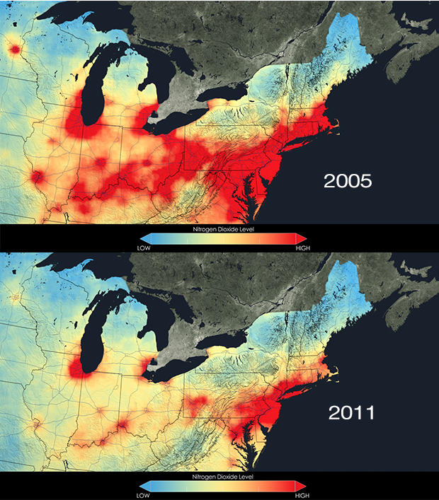
If Americans are breathing easier than they were a decade ago, these new NASA satellite images may help explain why. They show -- in vividly color-coded maps -- that levels of nitrogen dioxide, an important air pollutant, have plummeted across the country over the last decade.
The data comes from a NASA satellite called Aura, which launched in 2004 with the Ozone Monitoring Instrument (OMI) to measure pollutants in columns of air. Goddard data visualizers then plotted the concentrations of various pollutants in each column over a map of the U.S., and in more detail over a number of cities, comparing data collected from 2005 to 2011.
... Over the past decade, technologies for improving gas mileage and scrubbing nitrogen dioxide and other pollutants out of power plant exhaust towers have been implemented across the country.
Dramatic NASA satellite images show our air getting cleaner - CBS News
I did wonder what China might look like, other than that this is great news.