What hiatus?

Nice try Abe.. I think we've discussed the diff between the BTK "re-analyzed" fairy tale and the NOAA data which I prefer.. Even with the NOAA data being closer to empirical conditions, the HISTORICAL portion of those data sets are too sparse to be believed.

It was such a nice try it succeeded completely. Your data are measurements and it isn't the least bit surprising how closely they match the data-constrained model output BTK produced with ORAS4, one of the most advanced ocean climate models in existence. The ocean is getting significantly warmer and the the water below 2000m is getting warmer faster than the water above. That's shown by the DATA.

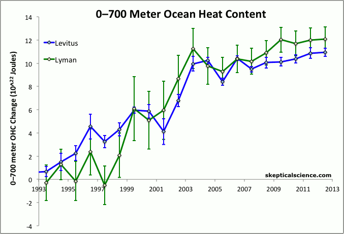
And what was done to cover the globe EVEN WITH the NOAA (or Leviticus) data is just an ancient slide-rule type of "re-analysis" to come up with brain-dead GLOBAL numbers.

Care to back up that nonsense claim? "An ancient slide-rule type of "re-analysis""? From Distinctive climate signals in reanalysis of global ocean heat content - Balmaseda - 2013 - Geophysical Research Letters - Wiley Online Library

Read:

2 The Ocean Reanalysis

[6] ORAS4 has been produced by combining, every 10 days, the output of an ocean model forced by atmospheric reanalysis fluxes and quality controlled ocean observations. These consist of temperature and salinity (T/S) profiles from the Hadley Centre's EN3 data collection [Ingleby and Huddleston, 2007], which include expendable bathythermographs (T only, with depth corrections from Table 1 of Wijffels et al. [2008]), conductivity-temperature-depth sensors (T/S), TAO/TRITON/PIRATA/RAMA moorings (T/S), Argo profilers (T/S), and autonomous pinniped bathythermograph (or elephant seals, T/S). Altimeter-derived along track sea level anomalies from AVISO are also assimilated. Gridded maps of SST from NOAA are used to adjust the heat fluxes via strong relaxation, and altimeter global mean sea-levels are used to constrain the global average of the fresh-water flux. The ocean model horizontal resolution is approximately 1°, refined meridionally down to 1/3° at the equator. There are 42 vertical levels with separations varying smoothly from 10 m at the surface to 300 m at the bottom, with partial cell topography.

[7] A model bias correction [BMW13] is used to reduce potential spurious variability resulting from changes in the observing system. The bias correction first guess—a seasonal cycle of 3-D model error—is estimated from the data-rich Argo period, and applied to ORAS4 from the beginning of the record. This is updated as the analysis progresses via an adaptive scheme (see BMW13 for details; see also Figure S3 of the auxiliary material). The five ensemble members of ORAS4 sample plausible uncertainties in the wind forcing, observation coverage, and the deep ocean. The uncertainty is probably underestimated in ORAS4, because the uncertainty in observations and their quality control [Lyman et al., 2010] is not sampled. Quality improvements in ORAS4 relative to earlier ocean reanalyses stem from the use of improved atmospheric surface fluxes, improved data assimilation, and more comprehensive quality-control of the observation data set, with important corrections to the ocean observations.

[8] The methods section S01 in the auxiliary material provides more specific information on the model, surface forcing, observation data sets, bias correction and ensemble generation. A detailed description and evaluation of ORAS4 is given in BMW13, and a discussion of the sensitivity of the reanalysis to several aspects not included in the ensemble generation.

*********************************************************************

I'd like to see you do that on a slide-rule hot shot. Hell, I'll even give you a good calculator.

BTW --- Have you ever seen this ocean warming plotted on a MAP???? You really should look into that Abraham.. Kinda tells you how dicey it is to try to do this on a GLOBAL scale for the early period before 2000.

Yes, I have seen it plotted on a map.

If you've ever been out to sea for a day or 2 searching for Tuna or Salmon --- you'd understand how dispersed these thermal layers and differences really are.. The FISH know how spotty this thermal biz really is !!!!!

The fish I chase are made from titanium and HY-120 and understand thermal profiles better than you. Did you not catch what I do for a living?
 
Last edited:
SMART folks know the difference between difficult and impossible..

Which explains why you failed at it so badly.

As for the graph.. What was my claim? over the past FIVE YEARS? At great risk to my health, I've retrieved a SkepticalScience chart so that you can analyze the accuracy of my comment..

Your graph stops at 2009/2010, so you look amazingly stupid to claim it shows the past 5 years.

Meanwhile, the graph I showed went to 2013/2014, adding four more years of data to what you showed.

That is, I showed the recent data, you didn't, but you're inexplicably claiming the exact opposite.

So, as I've often asked you before -- are you just a 'tard of epic proportions, or are you being deliberately dishonest?

Your graph was scaled to 65 years, the SkS graph only went back a couple decades. Youre the tard. Its the same data just scaled to look at the period we discussing. Youre not suggesting that SkS might have cut the recent data off because it did not favor their indoctrination efforts are you? Nothing much diff has changed since the end of that plot..

OHC_Denial.gif


Happy now baby ??? I never lie about tthis stuff. Unless SkS lies for me.. Check your crib for a present!!!!
 
It as in civilization would survive fairly without question if we developed fusion and allowed the building of nuclear.

Sure, Solar and wind are all fine and good, but it is only a small part of the solution.

How do you propose lifting the rest of humanity out of the third world without industrialization?

They don't. They are perfectly happy keeping those "brown" people in the third world living short, brutish, Hobsian lives. Try to count off the number of hydroelectric plants that envirowackos have blocked over the past 3/4 century that would have gone a very long way towards bringing those "brown" people into the modern world.
 
I'm not worried about Earth. It will survive long after we have extinguished. But we need to become serious first of all. Detach ourselves from superficiality and move towards higher consciousness that respect other human beings, that respects animals, plants and life in general. In other words, the "revolution" your asking about must start within. Then it can spread to others.

The irony literally drips gnarley. You are so far from detaching yourself from superficiality and moving toward higher consciousness that I am surprised that you can even speak the words. You are driven by emotion and perfectly willing to label anyone who doesn't agree with you a fundamentalist even though you can't even begin to make a rational case in suppprt of your position. Again, you are sadly, laughable.
 
I'm not worried about Earth. It will survive long after we have extinguished. But we need to become serious first of all. Detach ourselves from superficiality and move towards higher consciousness that respect other human beings, that respects animals, plants and life in general. In other words, the "revolution" your asking about must start within. Then it can spread to others.

There is no single path that we can take to lift humanity up out of our present focus on the five senses, but its possible. As long as we remain totally focused on what our government tries to keep us focused on, we can never rise above the filth that we've created. It isn't easy and regression is likely, but consider the alternative: a life wasted on selfish desires that did not advance the species or civilization. As long as we try to take what's "ours" and believe we own persons, places and things, there is no advance.


And hopefully, in 1000 years or so, we will reach Nirvana, and all will be made well and happy. The history of mankind leads me to think it may take a little longer that however.

All that is required to reach that place is 77 or 80 trillion more dollars and about 800 or 900 million more dying at the hands of their socialist masters. Hell, change that make it a few billion. If you are going to do the experiment, you may as well do it right. They believe it didn't work the first few times it was tried because the great tyrants were stopped before their vision was realized. To bad they have their heads to far up their asses to see the reality of that vision.
 
Last edited:
Do you mean the same Argo floats that showed that there was no increase in temperature (trend) down to the level they extend?
...and that`s why all that heat is "estimated" to be below that depth.
Btw. in terms of temperature we are only talking about a 0.2 C "higher" temperature than it was supposedly 43 years ago when the instruments had a ± 0.1 C error range.

Which is a colossal amount of heat, since it's going down 2000m all across the globe.

The near-surface temp anomalies can be much higher. In the central Pacific, it's currently 1.2C hotter, which is why some are now shifting predictions from "El Nino" to "very strong El Nino".

ELNINO1-638x371.jpg

How do you suppose it is slipping, undetected, past ARGO? Then there is the elephant in the room that all you "ocean ate my heat" types are completely ignoring. Why has sea level increase not accelerated due to thermal expansion? Do a different set of physics operate down that deep? If the amount of heat you people claim were down there, it wouldn't be "hiding". It would be obvious in the rate of sea level increase. Sea level increase is slowing down and has been for some time now. There is no heat hiding down there.
 
Last edited:
I wonder how you respond to my genuine critique?

Nothing about you is genuine gnarley. You are contrived and dogmatic. There is nothing genuine there. You are so wrapped up in your dogma that I seriously doubt that you have ever met the real gnarley.
 
Which is a colossal amount of heat, since it's going down 2000m all across the globe.

...And since it's water, whose specific heat capacity is roughly four thousand times that of air on a volume basis.

The added warmth is going all the way to the bottom and the average depth of the world's oceans is almost 3,000 meters. It's not stopping at 2,000, I guarantee.
 
Last edited:
Do you mean the same Argo floats that showed that there was no increase in temperature (trend) down to the level they extend?
...and that`s why all that heat is "estimated" to be below that depth.
Btw. in terms of temperature we are only talking about a 0.2 C "higher" temperature than it was supposedly 43 years ago when the instruments had a ± 0.1 C error range.

Which is a colossal amount of heat, since it's going down 2000m all across the globe.

The near-surface temp anomalies can be much higher. In the central Pacific, it's currently 1.2C hotter, which is why some are now shifting predictions from "El Nino" to "very strong El Nino".

ELNINO1-638x371.jpg

How do you suppose it is slipping, undetected, past ARGO? Then there is the elephant in the room that all you "ocean ate my heat" types are completely ignoring. Why has sea level increase not accelerated due to thermal expansion? Do a different set of physics operate down that deep? If the amount of heat you people claim were down there, it wouldn't be "hiding". It would be obvious in the rate of sea level increase. Sea level increase is slowing down and has been for some time now. There is no heat hiding down there.


I would like to point out that from late Feb to late March there has been a 1.4C increase in that part of the ocean. according to honest abe water has 4000 times the SH of air. and in the tradition of SkS we could say that that is the equivalent of a 5000C increase in atmospheric temperature. in one month, no less.

it is easy to see how CO2 interference in radiative transfer could do that, right? hahahahaha
 
How do you suppose it is slipping, undetected, past ARGO?

Given the ARGO network has been measuring it, that's a bizarre statement.

SSDD said:
Then there is the elephant in the room that all you "ocean ate my heat" types are completely ignoring. Why has sea level increase not accelerated due to thermal expansion? Do a different set of physics operate down that deep? If the amount of heat you people claim were down there, it wouldn't be "hiding". It would be obvious in the rate of sea level increase. Sea level increase is slowing down and has been for some time now. There is no heat hiding down there.

Since sea level increase isn't slowing down, your whole line of reasoning there is invalid. Why are you making such a strange claim?

IanC said:
I would like to point out that from late Feb to late March there has been a 1.4C increase in that part of the ocean. according to honest abe water has 4000 times the SH of air. and in the tradition of SkS we could say that that is the equivalent of a 5000C increase in atmospheric temperature. in one month, no less.

it is easy to see how CO2 interference in radiative transfer could do that, right? hahahahaha

Ian seems more confused, not understand that warm water is _moving_, not suddenly being created.
 
Your graph was scaled to 65 years, the SkS graph only went back a couple decades. Youre the tard. Its the same data just scaled to look at the period we discussing.

Your graph went to 2009/2010, mine went to 2013/2014, yet you claimed yours was more recent. Those evasions you're attempting here don't change that fact.

Youre not suggesting that SkS might have cut the recent data off because it did not favor their indoctrination efforts are you? Nothing much diff has changed since the end of that plot.

I'm suggesting you suffer from Skeptical Science Derangement Syndrome. However, I have little interest in that, as my interest is in the measured increase of heat going into the deep ocean.

Happy now baby ??? I never lie about tthis stuff. Unless SkS lies for me.. Check your crib for a present!!!!

Returned, since you insist on being such a squealing little bitch. I didn't say you were a liar, of course. From your actions here, I can safely conclude the "retard" option is correct. You're simply not bright enough to resist your cult's programming.

I apologize sincerely Mamooth.. I didn't realize it was a reading comprehension issue.. I don't make fun of severe diabilities...

Mamooth --
are you just a 'tard of epic proportions, or are you being deliberately dishonest?

Just consider it a debt I owed you from the time I accidentally Pos Repped you.. :badgrin:

Question is ?? Why is no one plotting Global Surface temps in the same chart as the NOAA OHC above.. Looks like a pretty good match with a 5 or 6 year delay kicked in to the Hiatus.. Which is why the OP has this backwards. The oceans didn't CAUSE the hiatus -- the hiatus is driving the ocean storage.. We're gonna have a lot of fun watching them change their curve fitting and matching machinery to true correlation functions with analysis of different delay periods real soon.. Put money on it...
 
I would like to point out that from late Feb to late March there has been a 1.4C increase in that part of the ocean. according to honest abe water has 4000 times the SH of air. and in the tradition of SkS we could say that that is the equivalent of a 5000C increase in atmospheric temperature. in one month, no less.

it is easy to see how CO2 interference in radiative transfer could do that, right? hahahahaha

I thought you had some science background.

Volume of the world's oceans: 1.3 billion cubic kilometres (310 million cu mi)

Volume of the world's atmosphere using Karman line as upper boundary: 82.09 billion cubic kilometers. If entire atmosphere were at STP, volume would be 4.34 billion cubic kilometers.

Density of air @ STP: 1.225 kg/m^3

Specific heat capacity of dry air @ STP: 1.0035 J/(g·K)

Density of seawater @ STP: 1,031.074 kg/m^3

Specific heat capacity of water @ STP: 4.186 J/(g·K)

Do I need to do the math for you?

And Mamooth was correct when he pointed out that water is not being suddenly heated more than it was but is simply being relocated and has thus produced the false appearance of a hiatus in surface warming.

Although, as I pointed out earlier, cooler surface waters means less heat radiated away from the oceans. It also means a higher heat transfer rate from warm air to cool water. It's like turning your pillow over at night to get the cool side.
 
Last edited:
Given the ARGO network has been measuring it, that's a bizarre statement.

Dream on hairball.


sea level increase isn't slowing down, your whole line of reasoning there is invalid. Why are you making such a strange claim?

Again, only in the world of dreams and computer models. Out here in the real world, sea level increase has been decelerating for quite some time.

Global sea level trend during 1993?2012

Nineteenth and twentieth century sea-level changes in Tasmania and New Zealand

http://pluto.mscc.huji.ac.il/~msdfels/wpapers/Tide gauge location.pdf

And I could continue ad nauseum... decelerating sea level increase is what is going on in the real world...which leads back to the question of why is there no thermal expansion happing if the ocean is eating your heat?
 
Here's a discussion and some data concerning that drop in sea level in 2011.

NASA Satellites Detect Pothole on Road to Higher Seas

Edited: 2011-08-23

Our colleagues at JPL have also been interested in how the global mean sea level is affected by the ENSO (i.e., El Niño and La Niña). They find that GRACE measurements helped to identify the distribution of abnormally high rainfall over land resulting from the recent strong La Niña. This temporary transfer of large volumes of water from the oceans to the land surfaces also helps explain the large drop in global mean sea level. But they also expect the global mean sea level to begin climbing again.

Like mercury in a thermometer, ocean waters expand as they warm. This, along with melting glaciers and ice sheets in Greenland and Antarctica, drives sea levels higher over the long term. For the past 18 years, the U.S./French Jason-1, Jason-2 and Topex/Poseidon spacecraft have been monitoring the gradual rise of the world's ocean in response to global warming.

While the rise of the global ocean has been remarkably steady for most of this time, every once in a while, sea level rise hits a speed bump. This past year, it's been more like a pothole: between last summer and this one, global sea level actually fell by about a quarter of an inch, or half a centimeter.

So what's up with the down seas, and what does it mean? Climate scientist Josh Willis of NASA's Jet Propulsion Laboratory, Pasadena, Calif., says you can blame it on the cycle of El Niño and La Niña in the Pacific.

earth20110823-640.jpg

2011_rel2: GMSL and Multivariate ENSO Index
Edited: 2011-07-29 Share

Discussion
The Multivariate ENSO Index (MEI) is the unrotated, first principal component of six observables measured over the tropical Pacific (see NOAA ESRL MEI, Wolter & Timlin, 1993,1998). To compare the global mean sea level to the MEI time series, we removed the mean, linear trend, and seasonal signals from the 60-day smoothed global mean sea level estimates and normalized each time series by its standard deviation. The normalized values plotted above show a strong correlation between the global mean sea level and the MEI, with the global mean sea level often lagging changes in the MEI. Since the MEI has recently sharply increased (coming out of a strong La Niña), we expect the global mean sea level estimates to also reverse their recent downward trend and begin to increase as the La Niña effects wane.

http://sealevel.colorado.edu/?page=1
 
Last edited:
Sustained mass loss of the northeast Greenland ice sheet triggered by regional warming | CU Sea Level Research Group

Sustained mass loss of the northeast Greenland ice sheet triggered by regional warming

Abstract
The Greenland ice sheet has been one of the largest contributors to global sea-level rise over the past 20 years, accounting for 0.5 mm yr−1 of a total of 3.2 mm yr−1. A significant portion of this contribution is associated with the speed-up of an increased number of glaciers in southeast and northwest Greenland. Here, we show that the northeast Greenland ice stream, which extends more than 600 km into the interior of the ice sheet, is now undergoing sustained dynamic thinning, linked to regional warming, after more than a quarter of a century of stability. This sector of the Greenland ice sheet is of particular interest, because the drainage basin area covers 16% of the ice sheet (twice that of Jakobshavn Isbræ) and numerical model predictions suggest no significant mass loss for this sector, leading to an under-estimation of future global sea-level rise. The geometry of the bedrock and monotonic trend in glacier speed-up and mass loss suggests that dynamic drawdown of ice in this region will continue in the near future.

Full article is available online in several formats.
 
Addressing Questions Regarding the Recent GIA Correction
Edited: 2011-07-18 Share

[Update, 2011/06/20: Media Matters has published a story on the attention our GIA correction has received.]

Regarding the Fox News article by Maxim Lott (derived from previous blogs, e.g., Heartland Institute/Forbes) that questions our application of the glacial isostatic adjustment (GIA) correction to the altimeter-based global mean sea level (GMSL) time series and rate estimates, we would like to direct interest to our Frequently Asked Questions (FAQ) page that discusses the GIA effect and also the differences between our global mean sea level estimates from altimetry and regional/local relative sea level measured by tide gauges. These FAQs were updated in May with content partially derived from the discussion with Mr. Maxim, but much of this important content unfortunately did not get published in the Fox News article or in recent blogs.
We would also suggest consulting the other unaffiliated sea level research groups around the world that independently estimate global mean sea level from altimetry and also apply the scientifically well-understood GIA correction. Their current GMSL rate estimates are listed on the left sidebar of our site for reference. Note that our current rate estimate is actually the lowest of the groups, which does not support the claim that we "doctor the sea level data" to artificially support pro-climate change opinions. Instead, we strive to produce estimates of the global mean sea level time series and rate using the best available information to address the following questions:
How is the volume of the ocean changing?
How much of this is due to thermal expansion?
How much of this is due to addition of water that was previously stored as ice on land?
As the science of sea level change becomes better understood through peer-reviewed research, we include these advances in our global mean sea level estimates. This includes continuously improving some our applied altimetry corrections, such as better satellite orbits, ocean tides, and sea state bias models (all of which, along with the GIA correction, were updated and documented in our last 2011_1 release). For further study, we encourage interested parties to consult the references supplied in the FAQs and cataloged in our library and to also contact other research groups and scientists specifically studying global and regional sea level change.
 

Forum List

Back
Top