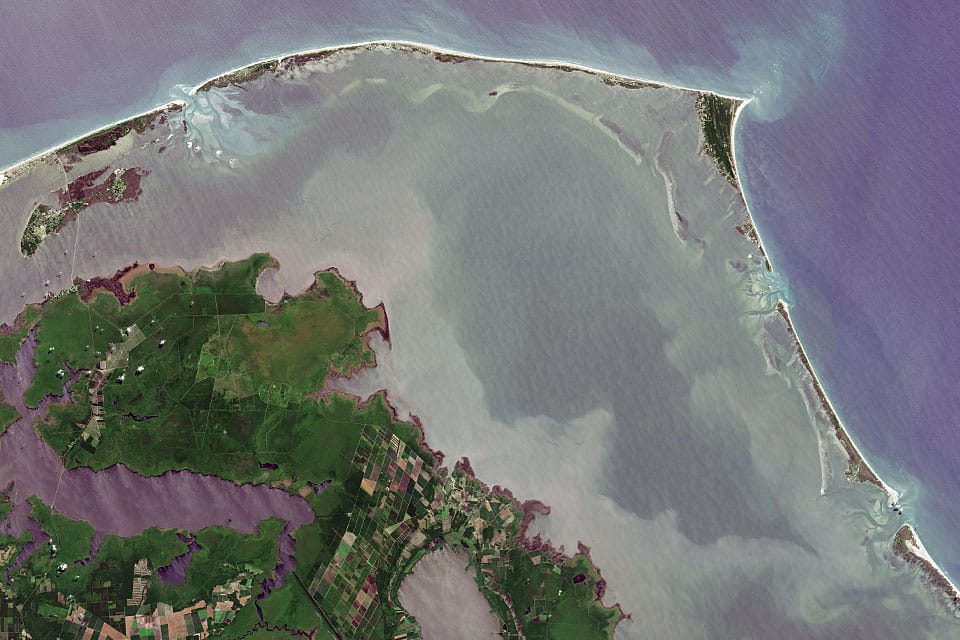
"Most people are surprised to learn that, just as the surface of the Earth is not flat, the surface of the ocean is not flat, and that the surface of the sea changes at different rates around the globe. For instance, the absolute water level height is higher along the West Coast of the United States than the East Coast.
You may have heard the term “global sea level,” which refers to the average height of all of the Earth's ocean basins. "Global sea level rise" refers to the increase in the average global sea level trend.
"Local sea level" refers to the height of the water measured along the coast relative to a specific point on land. Tide stations measure local sea level. "Relative sea level trends" reflect changes in local sea level over time. This relative change is the one most critical for many coastal applications, including coastal mapping, marine boundary delineation, coastal zone management, coastal engineering, sustainable habitat restoration design, and the general public enjoying their favorite beach."
The sea level varies around the globe

oceanservice.noaa.gov
Abstract
Interannual variability of sea surface height (SSH) in western Pacific Ocean and eastern Indian Ocean occurs as a result of the ENSO phenomena. This variability affects SSH difference between both of those oceans. In normal condition, SSH in western Pacific Ocean is higher than in eastern Indian Ocean which causes a current that passes through Indonesia which known as the Indonesian Throughflow (ITF). This study used SSH and geostrophic currents data from 1993 to 2015 which obtained from AVISO satellite altimetry data to determine the variability of SSH difference in ENSO condition which represented by the sea surface temperature (SST) anomaly of Niño 3.4 data from NOAA and its relation to the geostrophic currents in Lombok Strait which is one of the ITF crossing path. The result of the correlation calculation of ENSO condition to SSH difference between western Pacific Ocean and eastern Indian Ocean shows the negative value. It means that SSH difference at both oceans have opposite condition that when El Nino happened SSH in western Pacific Ocean is lower than the eastern Indian Ocean and when La Niña happened SSH in the western Pacific Ocean is higher than the eastern Indian Ocean. The SSH difference does not affect the direction of geostrophic currents but affects its speed.
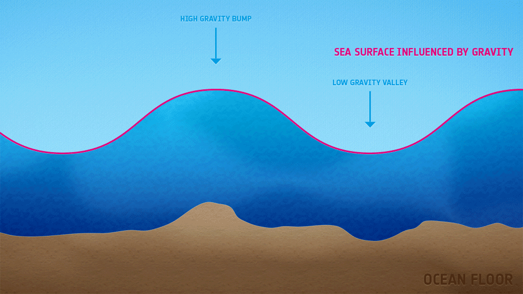
"But while their surface provides a handy reference point, the oceans themselves are not all at the same height above the Earth’s centre. As the strength of the force generated by the Earth’s spin is strongest at the equator, the MSL bulges outward there, putting it further from the centre of the Earth than at the poles."
"Mean sea level (MSL) is widely used as the standard reference for the altitude of towns, mountains and aircraft. That’s because once the effect of tides and waves has been averaged out, sea level depends on just two forces: the strength of gravity and the effect of the Earth’s spin – and these depend on the distance from that ultimate reference point, Earth’s centre."
"Differences in the Earth’s density also affect the strength of gravity, causing MSL variations of as much as 100 metres. MSL is also changing over time, largely through global warming causing seawater to expand and land ice to melt."
Jumping into the deep end or paddling in the shallows, the average sea level isn’t the same everywhere due to the Earth’s forces.

www.sciencefocus.com
For probably the tenth time, that rock was moved in 1921 and you have NO IDEA what the tides were when that photo was taken. The
normal tidal range in Plymouth Harbor is ******* 9.76 feet!! See
Station Home Page - NOAA Tides & Currents.
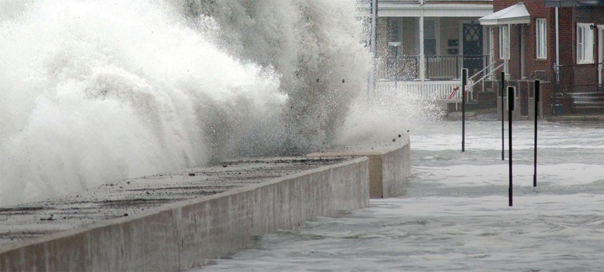
You have to get away from this somewhat common idea that the Earth changing "naturally" doesn't require a cause. Nothing happens without a cause; not a wee puff of a air, not a hurricane, not a drop of rain, not a once-in-a-milennium flood. Sea levels rise and fall in the pre-human past has been caused primarily by temperatures. Falling temperatures shrink the physical volume of the ocean and land-borne ice ties up large volumes of water. Rising temperatures melt that ice and expand the ocean's volume. Temperatures of the land, the air and the oceans have been rising for the past 150 years. That has caused the oceans to expand and for a significant portion of the world's ice to melt - and continute melting. THAT is what is currently causing the world's oceans to rise.
How is it that you seem to feel comfortable making statements for which you KNOW you have no evidentiary support and which hard science clearly refutes.
Visit NASA's portal for an in-depth look at the science behind sea level change.

sealevel.nasa.gov
Sea level is rising -- and at an accelerating rate -- largely in response to global warming. A 2013 fact sheet from the Union of Concerned Scientists.

www.ucsusa.org
Seas are predicted to rise a foot by 2050, regardless of how much global carbon emissions can be reduced. Why is this happening, and what can we do to adapt?

www.nationalgeographic.com
Global average sea level has risen 8-9 inches since 1880, and the rate is accelerating thanks to glacier and ice sheet melt.

www.climate.gov