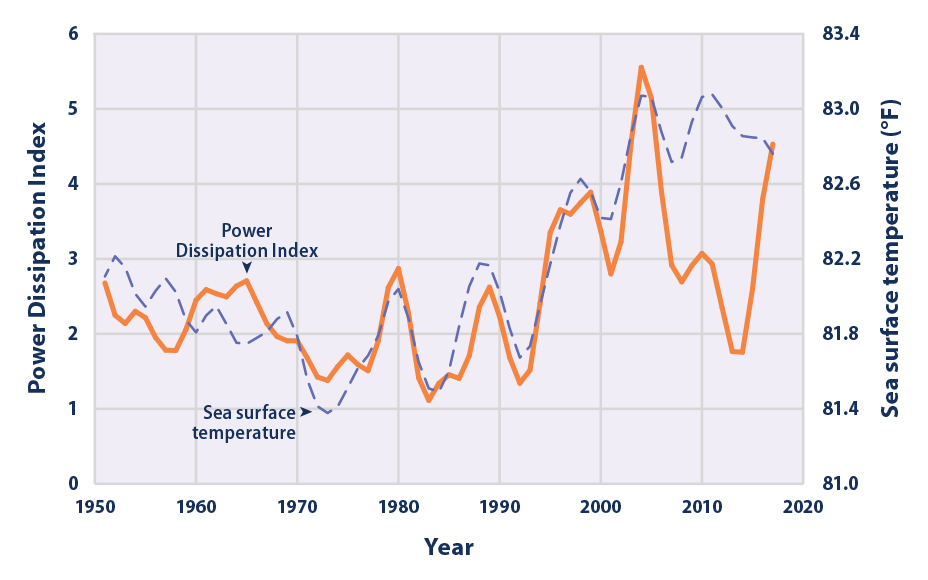
Your linked data make a good case for no increase in hurricane activity from global warming, but there are hurricane parameters that show an impact from increasing warmer sea surface temperatures (SST)
According to the total annual ACE Index,
cyclone intensity has risen noticeably over the past 20 years, and eight of the 10 most active years since 1950 have occurred since the mid-1990s (see Figure 2). Relatively high levels of cyclone activity were also seen during the 1950s and 1960s.Aug 1, 2022
This indicator examines the frequency, intensity, and duration of hurricanes and other tropical storms in the Atlantic Ocean, Caribbean, and Gulf of Mexico.

www.epa.gov
Sea surface temperature, which drives hurricane development, powering storms, has steadily risen
This indicator describes global trends in sea surface temperature.
www.epa.gov
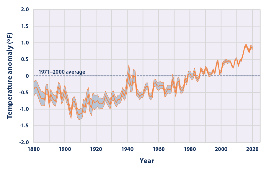
Notice that spike in temperature just after 1940, a point in time when atmospheric temperatures were stagnant or even falling.
Several records have been sent in rapid storm development. What would become Super Typhoon Noru, approaching the Phillipines, went from a 50 knot storm to a Category 5 (>150 kts) cyclone in less than 24 hours. Hurricane Ian, late this last September, was the deadliest storm to strike Florida since 1935 (not reflected in your graphic, of course) and produced a storm surge of 12-18 feet, devastating the low-lying Florida communities it struck. Ian's development met the NOAA criteria for "rapid intensification" its winds gaining 35mph in less than 24 hours.
Hurricane Maria (or PR fame) intensified 70 mph in 18 hours and set a record for Atlantic hurricane intensification.
Highly Unusual Upward Trends in Rapidly Intensifying Atlantic Hurricanes Blamed on Global Warming Read this
|
Figure 1. VIIRS image of Super Typhoon Haiyan at 1619 UTC November 7, 2013. At the time, Haiyan was about to make
landfall near Tacloban in the Philippines as the strongest landfalling tropical cyclone in world recorded history, with
190 mph winds. Image credit: NOAA/CIRA. |