RollingThunder
Gold Member
- Mar 22, 2010
- 4,818
- 525
- 155
- Thread starter
- #241
Whoops! Here's another one! But hey it's only Scientific American, tghey don't know anything!
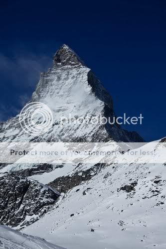
Advancing Alaskan Glacier Holds Clues to Global Sea Level Rise
Scientists aim to find out why an Alaska glacier is ignoring all climate signals as it advances to the sea--and what that means for sea levels around the world.
By Nathan Rice and The Daily Climate | January 4, 2011 |7
MYSTERY IN ICE: Whether Alaskan glaciers--and ice sheets the world over--advance to the sea or melt down will help determine sea levels for centuries to come.Image: Frank Kovalchek, courtesy Flickr
ICY BAY, AlaskaThe icebergs looked impenetrable. Roman Motyka needed a route through.
"If you see an opening anywhere, let me know," said the University of Alaska Fairbanks glaciologist, at the wheel of a small skiff puttering through the ice-choked bay off the Gulf of Alaska.
Beyond the iceberg maze loomed the nose of a glacier that, contrary to a warming climate, is advancing into the sea. Motyka and his team were here - in one of the most ice-covered regions on the planet - to find out why.
Advancing Alaskan Glacier Holds Clues to Global Sea Level Rise: Scientific American
LOL. You senile lying dumb ****. Let's see a bit more of that article;
The source of the ice - the Yahtse Glacier - is one of five glaciers that empty into Icy Bay beneath the towering Saint Elias Mountains. The Yahtse's rogue advance is one stage in what glaciologists call the "tidewater glacier cycle" a drama of growth and retreat that unfolds over centuries.
This process of glacial equilibrium can be sparked by changes in climate but then assume a life of its own. It can lead to runaway glacier retreats seen elsewhere in Alaska and Greenland - big contributors to a rising sea.
But as the Yahtse advances, it is also thinning, underscoring the mystery behind exactly how these glaciers change over time. Recent research has fingered the ocean as a trigger for tidewater glacier retreats. Now Bartholomaus and his team are investigating what happens when this advancing glacier meets the ocean in a region where about 54 glaciers empty into the sea.
By anchoring underwater instruments in front of Yahtse Glacier, they hope to see how it melts beneath the surface. Seismometers measure ice quakes; airborne laser surveys show thinning; global-positioning systems and time-lapse photography reveal movement. Never before have so many tools been used on one glacier for a single project. By blending scientific disciplines, the team will paint a picture of the Yahtse's dynamic forces.
Advancing Alaskan Glacier Holds Clues to Global Sea Level Rise: Scientific American
You really didn't think that anyone would actually read the article, did you?
I allways love the cultist reliance on con man language. "Could" means nothing. History tells us that all of the predictions made by your high priests can't happen. Because they didn't happen the first time around. Something they can't or won't get through their pointy little heads.
But, of course, if they admitted that, their gravy train would end.
And there goes some more brain-dead, reality-free, very moronic posts from the walleyedretard, swirling down the poop tubes into the appropriate place for them. Too bad the walleyedretard remains so thoroughly lost in the denier cult fantasyland. So sad his head is wedged so far up his lying ass that he'll never get it out. Fortunately for the truth of the matter, everything he posts gets debunked immediately. Too bad he can never respond with any kind of intelligent or meaningful reply. But then, what else can you expect from such a brainwashed retarded troll.