Indeependent
Diamond Member
- Nov 19, 2013
- 73,633
- 28,515
- 2,250
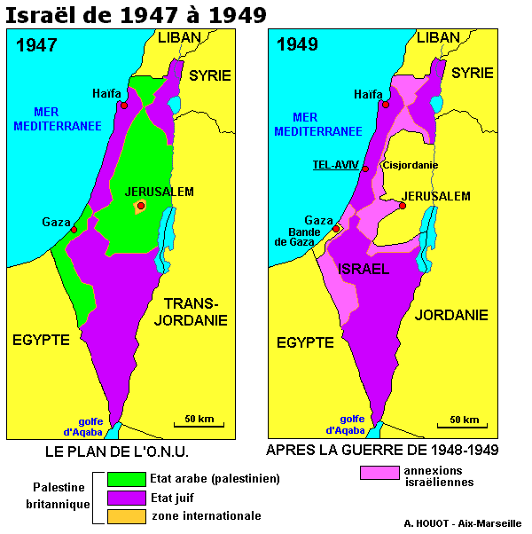
Because you read the hundreds of pages of THE TREATY!The first map is Palestine in 1947 (Before Israel) with the proposed, but never implemented, partition borders.Sure I can, but I asked you first.Can you answer these questions about Palestine?
Do you have a map of Israel that does not use those fake armistice line borders?
A map of Israel has nothing to do with Palestine's history, does it? Answer just a few.
What is your problem posting a map?
original 1948 israeli borders - Google Search:
There are two. Now answer the questions.
The second map has those fake armistice line borders. The armistice agreement specifically stated that the armistice lines were not to be political or territorial borders

You don't have the IQ.


