Extracted from
Facebook posts - Fact-checking a talking point about ‘corrupted’ climate change data | The Paradise News
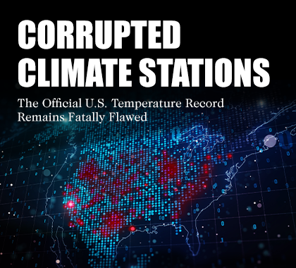
The Heartland Institute cited a report it paid for and produced.
Do you deny this?
That report analyzed a small sample of 128 temperature stations out of several thousand volunteer-run stations
Do you deny this?
“The correct approach is to write a scientific paper and submit it to a scientific journal,” said Zeke Hausfather, a climate scientist currently serving as research lead at Stripe, a San Francisco-based technology company. “In this specific case, the author of the report, Anthony Watts, submitted a paper on the topic around 10 years ago, but was unable to successfully convince other scientists of the validity of his findings and to pass the peer review process.”
Do you deny this? Are you familiar with Zeke Hausfather? He has been an author of 35 climate studies published in peer reviewed journals which have been cited 2,603 times.
Donald J. Wuebbles, a professor of atmospheric science at the University of Illinois, characterized Watts as a “well-known climate denialist.”
Do you deny that Watts is a well-known climate denialist? Professor Wuebbles is the Harry E. Preble Endowed Professor in the Department of Atmospheric Sciences at the University of Illinois at Urbana–Champaign. He was formerly the head of this department from 1994 to 2006, and was the founding director of the University of Illinois' School of Earth, Society, and Environment from 2006 to 2008. He is a fellow of the American Association for the Advancement of Science, the American Geophysical Union, and the American Meteorological Society. He has been a Coordinating Lead Author and contributor for the Intergovernmental Panel on Climate Change's reports. - Wikipedia
How Data is Collected
Scientists, volunteers and automated instruments collect climate data such as air chemistry, temperature, precipitation and wind speed, according to NOAA. Instruments carried on balloons can provide data from points more than 10 miles high. Satellites track temperature, winds and clouds.
NOAA and the National Weather Service have two programs that monitor weather conditions in the U.S., said Robert Rohde, lead scientist at Berkeley Earth, a Berkeley, California, organization providing global temperature data.
Rohde is, as they say, the lead scientist with Berkely Earth. He has a Wikipedia page at Robert Rohde - Wikipedia which you can read at your leisure. It notes that he co-wrote a study which found that 1.6 million people had died early deaths due to pollution in China. I assume you are familiar with the origins of Berkely Earth. If not, please look that up.
One program, the Cooperative Observer Program (COOP), relies on more than 8,700 volunteers who record daily temperature data using weather monitoring equipment.
The other program is a network of about 900 more sophisticated, automated weather stations often set up in connection with airports or weather bureaus, Rohde said. The standards for installing those stations are more rigorous than Cooperative Observer Program stations, he said.
So, the standards for COOP stations, which Watts wrote about, are the looser of the two.
The Heartland report looks exclusively at 128 COOP stations out of thousands. Rohde said that “immediately undermined” its conclusion that 96% of climate data is corrupt. It is unclear how those stations were selected.
According to National Weather Service instructions, COOP stations should be installed over level terrain at least 100 feet from “any extensive concrete or paved surface,” and should not be placed where water or drifting snow collects.
Rohde said that some COOP stations are closer than recommended to structures, artificial surfaces or vegetation. “In the worst cases, local impediments may greatly disturb the temperature readings reported,” he said, resulting in temperature readings “dominated by the surfaces and other features in the immediate vicinity of the sensor.”
Going deeper into the data concerns
The Heartland report argued that such temperature stations, which might be placed near structures or parking lots, resulted in corrupted data.
But that allegation ignores key facts.
First, climate scientists know that weather station data can be impacted by poor siting, and they adjust data accordingly.
Second, climate change analysis focuses on changes over time.
“Siting problems often cause the station to be consistently a bit too hot, or too cold, but that bias often remains more or less uniform over time,” Rohde said. “In such cases, it may still be possible to estimate trends related to climate change even if the observations themselves are not ideal.”
Research has not proved that poor station siting results in biased conclusions, however.
A 2013 study found that the network of stations can provide reliable data on temperature trends even when stations rated “poor” are included.
NOAA spokesperson John Bateman told PolitiFact the agency has known about the concerns caused by problematic station sites for decades, and it has “developed techniques to account for and correct these potential problems.”
The Heartland Institute told PolitiFact that its conclusions were valid because experts did not disagree that some COOP stations are at sites that fail to meet NOAA’s quality recommendations. The group argued that because of those stations, any methods used to adjust the data and remove bias would “actually make the problem worse.”
Data is adjusted, corroborated and widely accepted
In 2009, NOAA acknowledged that the placement of a number of temperature stations did not follow National Weather Service siting recommendations. Still,
a peer-reviewed 2006 study that sought to evaluate the potential bias caused by poor station locations “found no bias in long-term trends,” NOAA said. That study evaluated a small subset of data, so its conclusions had limitations.
Researchers account for temperature station locations and measurement times, said Mark Richardson, a research scientist at the California Institute of Technology’s Jet Propulsion Laboratory who studies climate change.
“So, even if a thermometer is in a warmer place, like a city, the effect of the local warmth is filtered out to prevent it from affecting trends.”
NOAA publishes U.S. weather station data online, and groups such as Berkeley Earth, NASA’s Goddard Institute for Space Studies, the United Kingdom’s Met Office and the Japan Meteorological Agency use it to build climate records.
“The independent groups all agree about the pattern of U.S. and global temperature changes,” Richardson said.
Since 1880, average global temperature has increased by at least 1.9 degrees Fahrenheit (or 1.1 degrees Celsius), according to Goddard Institute for Space Studies’ temperature analysis.
By way of comparison, Richardson said that the Earth cooled about 4 to 6 degrees Celsius tens of thousands of years ago and a nearly 4 kilometer thick mass of ice known as the Laurentide ice sheet spread over Canada and reached parts of the U.S.
“The warming rates we are living through are truly astonishing for Earth, even if they feel slow day to day,” Richardson said.
These trends are corroborated by data from temperature stations that are not in poorly placed areas.
Wuebbles said satellite trends in temperature “exactly match the ground-based observations,” but the Heartland Institute’s study does not analyze that corroboration.
Our ruling
A headline on Facebook claimed “96% of U.S. climate data is corrupted” because the NOAA’s temperature stations were purposefully placed “in man-made hot spots.”
Although some temperature stations are not placed in ideal conditions, experts said they are there to provide a consistent historical record and added that the data is evaluated and adjusted for biases.
There is widespread consensus that annual global average temperatures are rising, experts said.
We rate this claim False.