of course a liar such as yourself knoiwningly and willfully use a lying source to push their own lie
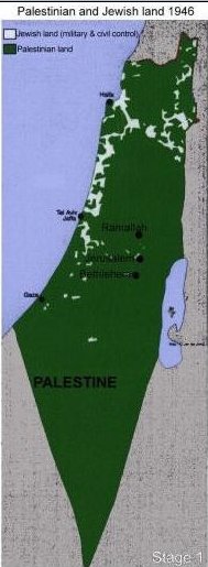
do not use that map anymore
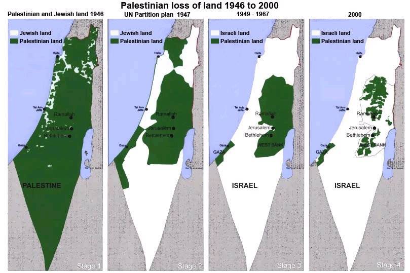
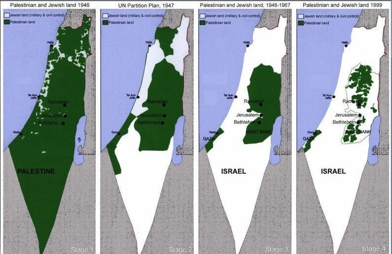
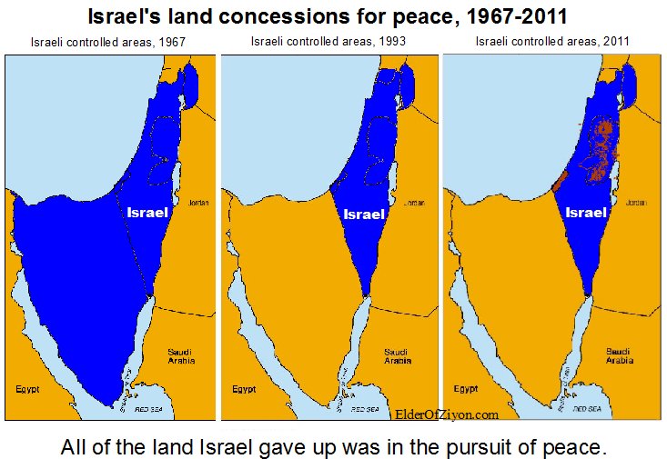
the map that lies - and one that doesn't
while i presume that the white sections are indeed the land that was privately owned by jews, the land in green was not privately owned by arabs.
Only a tiny percentage of land in palestine was privately owned. The various categories of land ownership included:
Mulk: Privately owned in the western sense.
Miri: Land owned by the government (originally the ottoman crown) and suitable for agricultural use. Individuals could purchase a deed to cultivate this land and pay a tithe to the government. Ownership could be transferred only with the approval of the state. Miri rights could be transferred to heirs, and the land could be sub-let to tenants. If the owner died without an heir or the land was not cultivated for three years, the land would revert to the state.
Mahlul: Uncultivated miri lands that would revert to the state, in theory after three years.
Mawat (or mewat): So-called dead, unreclaimed land. It constituted about 50 to 60% of the land in palestine. It belonged to the government. ...if the land had been cultivated with permission, it would be registered, at least under the mandate, free of charge.
elder of ziyon: The map that lies - and one that doesn't
this map is a lie.
THIS ONE DOESN'T LIE