Below is a map drawn by Thomas Jefferson; This was his ideal map of the new lands west of the original 13 states.
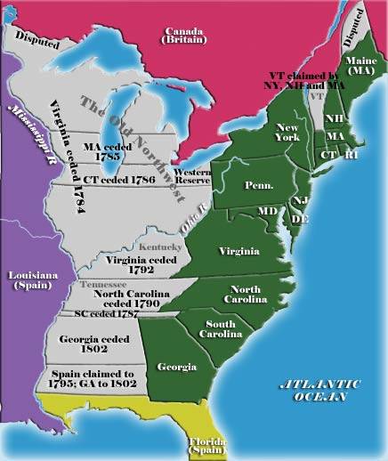
At the bottom of the map are the words Here we see Thomas Jeffersons plan for the division of the states West of the Appalachians; this would become the foundation for further expansion. Of course reality of international relations, geography, practical limitations would interfere with his ideal plan. I think its interesting that his division produced states in the middle range of size as compared to the original ones, and except for those in the south, and present day Ohio bear little resemblance to the end result. It appears to me that Jefferson most had economics in mind, and the economics of geography is the facility of transportation which has always been access to navigable waters. At that time rivers as small as the
Wabash were considered to be navigable rivers.
His was a departure from the original scheme of the colonys claim of western lands or their
western reserves. It was claimed that the landed states had a great potential advantage over the six landless states, so that the landless states projected their latitudinal boundaries westward beyond the colonies to lay a future claim.
It was assumed that the future sale of western lands would enrich the landed states and possibly allow them to operate without any form of taxation. The landless states feared that they would lose residents and dwindle into insignificance.
Click
HERE to read more on the Western Land Reserves