
Aerial mapping project shows how dramatically American cities from New York to Las Vegas have changed over the last 80 years
Historic Aerials is a mapping project based in Tempe, Arizona, that allows viewers to compare aerial maps from different years and decades
The project has collected more than a million aerial maps, some as far back as the 1920s
Historic Aerials is run by Nationwide Environmental Title Research (NETR) and was started around 2005
Today, the project has seven people working on it, but they can publish at least a thousand images every day
It's amazing to see the differences. My one comment was the statement that San Diego was founded in 1848 after the Americans came. The truth is, the Spanish founded it in 1769 when the mission and presidio came about.
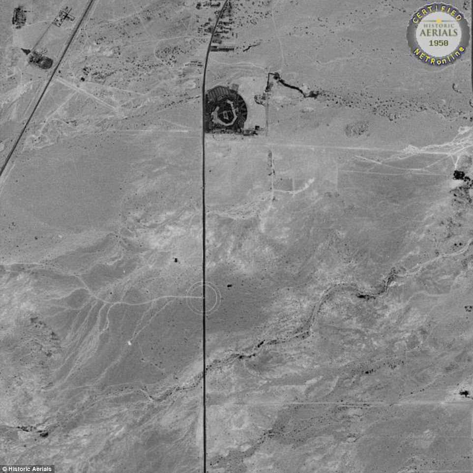
Las Vegas in 1950. When Las Vegas was founded in 1905, the city limits were north of this aerial image, which shows only desert. In 1950 the population of Las Vegas was 24,624, according to the Las Vegas Convention and Visitors Authority The line in the desert just below the structure is present day Flamingo Rd.
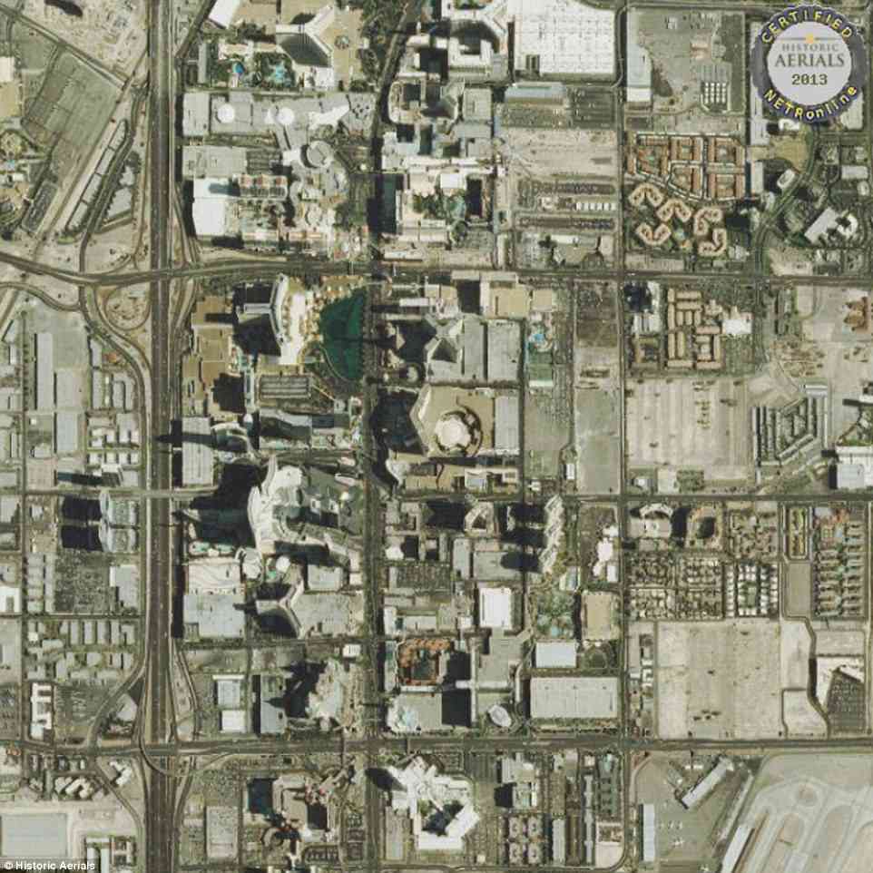
2013, LAS VEGAS: In 2012, the city's population had risen to 594,294 and in 2016 it grew even more to 632,912. The desert that had been in this area in 1950 is long gone
Read more: Aerial mapping project shows how much American cities have changed | Daily Mail Online
Historic Aerials is a mapping project based in Tempe, Arizona, that allows viewers to compare aerial maps from different years and decades
The project has collected more than a million aerial maps, some as far back as the 1920s
Historic Aerials is run by Nationwide Environmental Title Research (NETR) and was started around 2005
Today, the project has seven people working on it, but they can publish at least a thousand images every day
It's amazing to see the differences. My one comment was the statement that San Diego was founded in 1848 after the Americans came. The truth is, the Spanish founded it in 1769 when the mission and presidio came about.
Las Vegas in 1950. When Las Vegas was founded in 1905, the city limits were north of this aerial image, which shows only desert. In 1950 the population of Las Vegas was 24,624, according to the Las Vegas Convention and Visitors Authority The line in the desert just below the structure is present day Flamingo Rd.
2013, LAS VEGAS: In 2012, the city's population had risen to 594,294 and in 2016 it grew even more to 632,912. The desert that had been in this area in 1950 is long gone
Read more: Aerial mapping project shows how much American cities have changed | Daily Mail Online