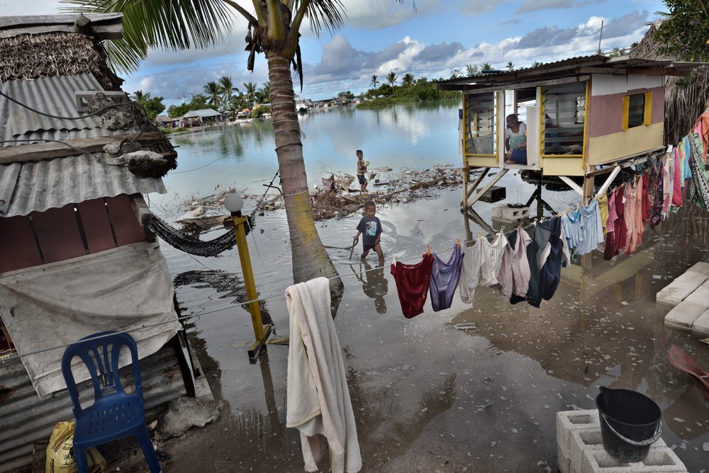
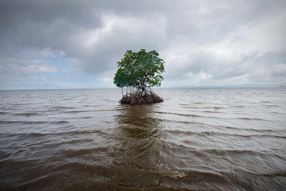
Satellite data indicates sea levels rising faster than expected

And yet you can not provide the experiments which show exactly what man is responsible for and how it has actually affected the earth..

All you got is doom and gloom crapola and no credible science to back up anything you spew.

From atmospheric physicist Billy Bob.

More than 10,000 peer reviewed studies have been published whose results support AGW as a valid description of the behavior of the Earth's climate in the face of human GHG emissions and deforestation. Your contention is demonstrably false. It is YOUR position that has no basis in scientific research.
 
As usual, many of the worst hit are the poorest and have the fewest resources.
Photographer Kadir van Lohuizen: When Paradise Becomes Hell ← Ochre
h_00053371.jpg.1600x1600_q85.jpg

h_00053380.jpg.1000x1000_q85.jpg

===

h_00053436.jpg.1000x1000_q85.jpg

Fiji
====

h_00053511.jpg.1000x1000_q85.jpg


The living room of 75-year-old Kathy Bartle in the United Kingdom. "I moved here 28 years ago, at that time I was told that my house would last at least another 40-60 years. Now I am only 34 meters from the ridge and at 11 meters I will be evacuated. I don't go to the sea, I don't want to see it. Often in the morning I have to put my paintings straight, because the waves banging the cliffs make my house shudder."

====

h_00053270.jpg.1000x1000_q85.jpg

Guna Yala is an autonomous indigenous region of Panama with a population of around 30,000 people.

Funny:

You post up an island that is KNOWN FOR ITS VOLCANIC SUBSIDENCE as proof of sea levels rising... I guess they are for that one small area as the volcanic matter is settling and the island is sinking..

I would be more worried about the volcano that is about to erupt... This subsidence process is one that generally precedes and eruption... (talking geological time scales)
Stupid ass, inflation precedes eruption. Deflaction, or subsidence comes after an emptying of the magma chamber.
You really are a dumb ass.. All volcanoes Inflate, Deflate and move throughout their lives as NORMAL PROCESS. (and you call yourself a geologist?) Even Yellowstone has moved over 2 feet up and down over the last 60 years (most of it occurring in the late 80's and early 90's).

Now apply that normal respiration, as it is called, to these islands.. Now take the porous rocks which all volcanoes make and allow sea water to erode away under these islands with that respiration and you get land subsidence. The reason all volcanic islands sink.

But your a moron and dont know even basic geology.
 
Some more recent research has revealed the fact that sea levels are rising faster now than they ever have in at least the last 2800 years.

Seas Are Rising Way Faster Than Any Time in Past 2,800 Years
ABC News
By SETH BORENSTEIN, AP SCIENCE WRITER
Feb 22, 2016

WireAP_cc68b2eb97d0470dae288eb5f65960e2_16x9_992.jpg

The Associated Press - FILE - In this Oct. 31, 2012 file photo, a view from the air shows the destroyed homes left in the wake of Superstorm Sandy in Ortley Beach, N.J. Sea levels on Earth are rising several times faster than they have in the past 2,800 years and are accelerating because of man-made global warming, according to new studies. An international team of scientists dug into two dozen locations across the globe to see what the sea level was for the past 2,800 years. They charted gently rising and falling seas over centuries and millennia. Until the 1880s and industrialization of society, on average the fastest seas rose was about 1 to 1.5 inches a century, plus or minus a bit. During that time global sea level really didn’t get much higher or lower than three inches above or below the 2,000-year average. (AP Photo/Mike Groll, File)

WASHINGTON — Sea levels on Earth are rising several times faster than they have in the past 2,800 years and are accelerating because of man-made global warming, according to new studies.

An international team of scientists dug into two dozen locations across the globe to chart gently rising and falling seas over centuries and millennia. Until the 1880s and the world's industrialization, the fastest seas rose was about 1 to 1.5 inches (3 to 4 centimeters) a century, plus or minus a bit. During that time global sea level really didn't get much higher or lower than 3 inches above or below the 2,000-year average.

But in the 20th century the world's seas rose 5.5 inches (14 centimeters). Since 1993 the rate has soared to a foot per century (30 centimeters). And two different studies published Monday in the journal Proceedings of the National Academy of Sciences, said by 2100 that the world's oceans will rise between 11 to 52 inches (28 to 131 centimeters), depending on how much heat-trapping gas Earth's industries and vehicles expel.

"There's no question that the 20th century is the fastest," said Rutgers earth and planetary sciences professor Bob Kopp, lead author of the study that looked back at sea levels over the past three millennia. "It's because of the temperature increase in the 20th century which has been driven by fossil fuel use."

To figure out past sea levels and rates of rise and fall, scientists engaged in a "geological detective story," said study co-author Ben Horton, a Rutgers marine scientist. They went around the world looking at salt marshes and other coastal locations and used different clues to figure out what the sea level was at different times. They used single cell organisms that are sensitive to salinity, mangroves, coral, sediments and other clues in cores, Horton said. On top of that they checked their figures by easy markers such as the rise of lead with the start of the industrial age and isotopes only seen in the atomic age.

When Kopp and colleagues charted the sea level rise over the centuries — they went back 3,000 years, but aren't confident in the most distant 200 years — they saw Earth's sea level was on a downward trend until the industrial age.

Sea level rise in the 20th century is mostly man-made, the study authors said. A separate, not-yet-published study by Kopp and others found since 1950, about two-thirds of the U.S. nuisance coastal floods in 27 locales have the fingerprints of man-made warming.

And if seas continue to rise, as projected, another 18 inches of sea level rise is going to cause lots of problems and expense, especially with surge during storms, said study co-author Stefan Rahmstorf of the Potsdam Institute for Climate Impact Research in Germany.

"There is such a tight relationship between sea level and temperature," Horton said. "I wish there wasn't, then we wouldn't be as worried."

The link to temperature is basic science, the study's authors said. Warm water expands. Cold water contracts. The scientists pointed to specific past eras when temperatures and sea rose and fell together.

The Kopp study and a separate one published by another team projected future sea level rise based on various techniques. They came to the same general estimates, despite using different methods, said Anders Levermann, a co-author of the second paper and a researcher at the Potsdam Institute.

If greenhouse gas pollution continues at the current pace, both studies project increases of about 22 to 52 inches (57 to 131 centimeters). If countries fulfill the treaty agreed upon last year in Paris and limit further warming to another 2 degrees Fahrenheit, sea level rise would be in the 11 to 22 inch range (28 to 56 centimeters).

Jonathan Overpeck at the University of Arizona, who wasn't part of the studies, praised them, saying they show a clear cause and effect between warming and sea level rise.

———

Online: Journal: http://www.pnas.org
 
As we have already seen from this year, we will not be able to limit the temperature rise to 2 degrees C. Be lucky if we can keep it below 4 degrees C. And the sea level rise also brings with it storm surges that go much further inland. The increasing amount of heat the water is carrying increases the energy of the storms, as we are seeing in the Pacific Basin. All in all, we are in for some interesting times.
 
"give me your money. I will fix natural earth evolution"
not, but we'll say we can to get your dollar.

BTW, we also won't tell you what the solution to the problem is, we just want your money to punish you for breathing.
 
This is some funny shit.

You must be thinking of your brain, TotallyNutsHalfwit


"give me your money. I will fix natural earth evolution"
Are you insane?

What "natural earth evolution"? The one you pulled out of your ass?

You poor anti-science nutjob!

Carbon Dioxide And Global Warming - How Do We Know?


yeah, we know that when LWIR is decreasing, the earth magically gets warmer. Yeah, go with that one, the sheeples will believe it.
 
And yet you can not provide the experiments which show exactly what man is responsible for and how it has actually affected the earth..

All you got is doom and gloom crapola and no credible science to back up anything you spew.

From atmospheric physicist Billy Bob.

More than 10,000 peer reviewed studies have been published whose results support AGW as a valid description of the behavior of the Earth's climate in the face of human GHG emissions and deforestation. Your contention is demonstrably false. It is YOUR position that has no basis in scientific research.
so how do you get that number of peer reviewed studies? Can you say exaggerate much?
 
As we have already seen from this year
, we will not be able to limit the temperature rise
to 2 degrees C. Be lucky if we can keep it below 4 degrees C. And the sea level rise also brings with it storm surges that go much further inland. The increasing amount of heat the water is carrying increases the energy of the storms, as we are seeing in the Pacific Basin. All in all, we are in for some interesting times.
That is right moron,
, we will not be able to limit the temperature rise
man can not fight MOTHER NATURE!

Old Crock gets one thing right! Amazing. Good job Old Crock!
well thankfully the earth isn't doing what he claims. I supposed it is what he wants, not sure, but seems to go out of his way to say it is, even though there is no evidence to support it. I find that amazingly interesting that position. I also find extremely funny and laugh at him. one day he might post the actual temperature readings that he claims dooms us. Or not!!!!!:cheers2:
 

yeah, we know that when LWIR is decreasing, the earth magically gets warmer. Yeah, go with that one, the sheeples will believe it.

Your gibberish is increasingly incomprehensible, JustCrazy. You should seek professional help.

The Earth receives an enormous amount of energy from the sun every minute, in both the short wave visible spectrum and the long wave infrared portion of the spectrum, with almost half of that total energy in the form of infrared radiation. Pretty much all of that energy from the sun winds up heating the Earth and an equal amount of energy has to be radiated back out into space every day to maintain an energy balance....otherwise the Earth heats up (as it is doing now because of the highly increased level - +43% - of carbon dioxide, a powerful greenhouse gas, that mankind's activities have produced)....but the Earth isn't hot enough to radiate visible light (or short wave radiation)....it sheds heat only as infrared radiation (long wave radiation or LWIR), which has to pass back up through the atmosphere and escape into space....so, for all of the energy of the sunlight that the Earth absorbs, an equal amount of IR radiation must travel from the Earth back to outer space. Greenhouse gases in the atmosphere absorb some of that infrared radiation and re-radiate it in all directions, including back to Earth. In addition, some of that energy that is being absorbed by the greenhouse gas molecules is being transferred to surrounding gas molecules as increased molecular vibration, which IS heat....so the atmosphere warms up some and the Earth's surface warms up some, as a result of the Greenhouse Effect.

Long wave infrared radiation from the Earth is NOT decreasing, you poor delusional nutbagger.

As far as what the Earth is doing, despite your moronic denier cult claims, this is the reality....
RunningMeans_v4.pdf

Recent surface temperature in different temporal resolution. PDF (Data through January 2016 used. Now with GHCN V3.3.0 and ERSST v4. Last modified: 2016/02/12.
 
Last edited:

yeah, we know that when LWIR is decreasing, the earth magically gets warmer. Yeah, go with that one, the sheeples will believe it.

Your gibberish is increasingly incomprehensible, JustCrazy. You should seek professional help.

The Earth receives an enormous amount of energy from the sun every minute, in both the short wave visible spectrum and the long wave infrared portion of the spectrum, with almost half of that total energy in the form of infrared radiation. Pretty much all of that energy from the sun winds up heating the Earth and an equal amount of energy has to be radiated back out into space every day to maintain an energy balance....otherwise the Earth heats up (as it is doing now because of the highly increased level - +43% - of carbon dioxide, a powerful greenhouse gas, that mankind's activities have produced)....but the Earth isn't hot enough to radiate visible light (or short wave radiation)....it sheds heat only as infrared radiation (long wave radiation or LWIR), which has to pass back up through the atmosphere and escape into space....so, for all of the energy of the sunlight that the Earth absorbs, an equal amount of IR radiation must travel from the Earth back to outer space. Greenhouse gases in the atmosphere absorb some of that infrared radiation and re-radiate it in all directions, including back to Earth. In addition, some of that energy that is being absorbed by the greenhouse gas molecules is being transferred to surrounding gas molecules as increased molecular vibration, which IS heat....so the atmosphere warms up some and the Earth's surface warms up some, as a result of the Greenhouse Effect.

Long wave infrared radiation from the Earth is NOT decreasing, you poor delusional nutbagger.

As far as what the Earth is doing, despite your moronic denier cult claims, this is the reality....
RunningMeans_v4.pdf

Recent surface temperature in different temporal resolution. PDF (Data through January 2016 used. Now with GHCN V3.3.0 and ERSST v4. Last modified: 2016/02/12.

Get those nuke plants built before it's too late!
 
Real proof seas are rising...

Five islands in Solomons submerged: study
Sun, May 08, 2016 - RISING SEAS: The five islands that had vanished were all vegetated reef islands up to five hectares that were occasionally used by fishermen, but were not populated
Five islands have disappeared in the Solomon Islands due to rising sea levels and coastal erosion, according to an Australian study that scientists said yesterday could provide valuable insights for future research. A further six reef islands have been severely eroded in a remote area of the Solomons, the study said, with one experiencing 10 houses being swept into the sea between 2011 and 2014. “At least 11 islands across the northern Solomon Islands have either totally disappeared over recent decades or are currently experiencing severe erosion,” the study published in Environmental Research Letters said. “Shoreline recession at two sites has destroyed villages that have existed since at least 1935, leading to community relocations.”

The scientists said the five that had vanished were all vegetated reef islands up to five hectares that were occasionally used by fishermen but were not populated. “They were not just little sand islands,” University of Queensland senior research fellow and lead author of the study Simon Albert told reporters. It is feared that the rise in sea levels would cause widespread erosion and inundation of low-lying atolls in the Pacific.

Albert said that the Solomons was considered a sea-level hotspot because rises there are almost three times higher than the global average. The researchers looked at 33 islands using aerial and satellite imagery from 1947 to 2014, combined with historical insight from local knowledge. They found that rates of shoreline recession were substantially higher in areas exposed to high wave energy, indicating a “synergistic interaction” between sea-level rise and waves, which Albert said could prove useful for future study.

Those islands which were exposed to higher wave energy — in addition to sea-level rise — were found to have a greatly accelerated loss compared with the more sheltered islands. “This provides a bit of an insight into the future,” he said. “There’s these global trends that are happening but the local responses can be very, very localized.” For now, some communities in the Solomons are already adapting to the changed conditions. “In addition to these village relocations, Taro, the capital of Choiseul Province is set to become the first provincial capital globally to relocate residents and services due to the threat of sea-level rise,” the study said.

Five islands in Solomons submerged: study - Taipei Times
 
In spite of the anti-science denier cult propaganda, the scientifically established facts are that sea levels are rising faster now than they have in (at least) several thousand years, and the rate at which sea levels are rising is accelerating. The threats this poses to our civilization and agricultural systems are enormous.

Satellite data indicates sea levels rising faster than expected
Scientists analysing satellite data warn that rises in sea level are increasing threats to coastal cities and food security
By Paul Brown
Climate Change News
Last updated on 27/03/2015

Satellite observations show that sea level rise may have been underestimated, and that annual rises are increasing.

A collaborative effort between maritime organisations and space agencies in measuring sea level rise has come to the conclusion that it has been increasing by 3.1 millimetres a year since 1993 – higher than previous estimates.

The evidence is growing from a number of recent studies of the ice caps that sea level rise is accelerating, posing a threat to many of the world’s largest and most wealthy cities − most of which are also important ports.

Many of these in the developing world have little or no protection against rising sea levels. Some in Europe – such as London and Rotterdam − already have flood barriers to protect areas below high tide or storm surge level, but these will need to be replaced and raised in the next 30 years.

Delta areas in Egypt, Vietnam, Bangladesh and China – vital to each of the nation’s food supply – are already losing land to the sea.


Difficult to measure

One of the problems scientists have had in getting accurate worldwide data is that the sea does not rise evenly around the globe.

This, added to the fact that in some places the land is sinking and in other places is rising, makes exact information difficult to measure from tide gauges.

Since 1991, it has been possible to measure the surface of the oceans across the entire globe by using satellite altimetry, whereby the satellite emits a signal towards the ocean’s surface and receives the reflected echo.

The sea level is calculated from the round-trip time between the satellite and the sea surface and the position of the satellite along its trajectory.

While the data from tide gauges provides information about local changes relative to the land, the use of altimeter satellites enables the recording of data on a global basis.

Luciana Fenoglio-Marc, a scientist specialising in physical and satellite geodesy at the Technical University of Darmstadt, Germany, uses these and other satellite geodetic observation data in her research.

She is working with the European Space Agency and the European Organisation for the Exploitation of Meteorological Satellites, and in close consultation with the German Federal Institute of Hydrology and the Federal Maritime and Hydrographic Agency of Germany.

Comment: As sea levels rise, climate threatens Pacific cultures

The increase of around 3.1mm per year since 1993 indicates a marked rise in the average sea level when compared to previously recorded values, which show a sea level rise of between 1mm and 2mm per year in the 20th century.

In its fifth Assessment Report (AR5, 2013), the Intergovernmental Panel on Climate Change (IPCC) predicted a further increase in the global sea level of 30cm to 70cm by the end of the 21st century, based on a scenario involving a medium rate of global warming.

The report predicted that increases will not be even, but will have a greater impact on some regions than on others. The result could be coastal flooding and rising groundwater levels – an outlook that makes it essential to have a reliable data basis for dealing with the dangers this poses.

Protecting coasts from the rising seas will require considerable adaptations, particularly in such low-lying coastal regions as the North Sea coast of Germany and the many low-lying islands in the tropics.

Another aspect of the work with satellites is measuring ocean density to see how much water expansion − because of warming − is leading to sea level rise.

A direct estimation of mass changes in the Mediterranean Sea show expansion to be the cause of an average sea level rise of about 2.1mm per year since 1993.

According to the IPCC, about 35% of the sea level increase between 1993 and 2010 was the result of thermal expansion, and the rest was due to melting ice and increasing run-off from land. But the latest observation shows this may not be true of the Mediterranean.


Too cautious

There is wide debate about whether the IPCC estimates of sea level rise have been too cautious, suggesting that the sea level will rise more than a metre this century – and some have even suggested that the rise could be two metres.

This is mainly because there has been uncertainty about how much of the huge icecap in Greenland, and most of all in Antarctica, would contribute to sea level rise by 2100 – if at all.

Research published since the IPCC estimates were made show that both icecaps will be large net contributors to sea level rise, and possibly much quicker than previously thought.

This lends credibility to the report last week that European coastal cities are not sufficiently prepared for the threats that climate change poses.

The report − titled Underfunded, Unprepared, Underwater? Cities at Risk – is by the E3G non-governmental organisation, and it says governments across the European Union are leaving their major cities exposed to danger from climate change, including floods, heat waves and sea level rise.

Since it takes an average of 30 years from planning to complete construction of a major flood barrier to protect a city, the report warns that the problem needs to be given urgent consideration and funding.

This article was produced by the Climate News Network

Related posts:

  1. Sea levels are rising faster than previous estimates
  2. Antarctic sea levels rising faster than global average
  3. Satellite data could drive low-carbon shipping sector
  4. Sea level rise faster than feared, say scientists


onoz.gif~c200


Dang Marty.......that made me burst out laughing.

Yes....we all must remember that to a person in this forum, the AGW contingent are a bunch of emotional hemophiliacs!!:up:
 
Real proof seas are rising...

Five islands in Solomons submerged: study
Sun, May 08, 2016 - RISING SEAS: The five islands that had vanished were all vegetated reef islands up to five hectares that were occasionally used by fishermen, but were not populated
Five islands have disappeared in the Solomon Islands due to rising sea levels and coastal erosion, according to an Australian study that scientists said yesterday could provide valuable insights for future research. A further six reef islands have been severely eroded in a remote area of the Solomons, the study said, with one experiencing 10 houses being swept into the sea between 2011 and 2014. “At least 11 islands across the northern Solomon Islands have either totally disappeared over recent decades or are currently experiencing severe erosion,” the study published in Environmental Research Letters said. “Shoreline recession at two sites has destroyed villages that have existed since at least 1935, leading to community relocations.”

The scientists said the five that had vanished were all vegetated reef islands up to five hectares that were occasionally used by fishermen but were not populated. “They were not just little sand islands,” University of Queensland senior research fellow and lead author of the study Simon Albert told reporters. It is feared that the rise in sea levels would cause widespread erosion and inundation of low-lying atolls in the Pacific.

Albert said that the Solomons was considered a sea-level hotspot because rises there are almost three times higher than the global average. The researchers looked at 33 islands using aerial and satellite imagery from 1947 to 2014, combined with historical insight from local knowledge. They found that rates of shoreline recession were substantially higher in areas exposed to high wave energy, indicating a “synergistic interaction” between sea-level rise and waves, which Albert said could prove useful for future study.

Those islands which were exposed to higher wave energy — in addition to sea-level rise — were found to have a greatly accelerated loss compared with the more sheltered islands. “This provides a bit of an insight into the future,” he said. “There’s these global trends that are happening but the local responses can be very, very localized.” For now, some communities in the Solomons are already adapting to the changed conditions. “In addition to these village relocations, Taro, the capital of Choiseul Province is set to become the first provincial capital globally to relocate residents and services due to the threat of sea-level rise,” the study said.

Five islands in Solomons submerged: study - Taipei Times

Five islands made of volcanic material (Sands) which are subsiding around the old volcanic vent tubes as they collapse.. Its called Land Subsidence due to natural causes.. Not CAGW...
 
In spite of the anti-science denier cult propaganda, the scientifically established facts are that sea levels are rising faster now than they have in (at least) several thousand years, and the rate at which sea levels are rising is accelerating. The threats this poses to our civilization and agricultural systems are enormous.

Satellite data indicates sea levels rising faster than expected
Scientists analysing satellite data warn that rises in sea level are increasing threats to coastal cities and food security
By Paul Brown
Climate Change News
Last updated on 27/03/2015

Satellite observations show that sea level rise may have been underestimated, and that annual rises are increasing.

A collaborative effort between maritime organisations and space agencies in measuring sea level rise has come to the conclusion that it has been increasing by 3.1 millimetres a year since 1993 – higher than previous estimates.

The evidence is growing from a number of recent studies of the ice caps that sea level rise is accelerating, posing a threat to many of the world’s largest and most wealthy cities − most of which are also important ports.

Many of these in the developing world have little or no protection against rising sea levels. Some in Europe – such as London and Rotterdam − already have flood barriers to protect areas below high tide or storm surge level, but these will need to be replaced and raised in the next 30 years.

Delta areas in Egypt, Vietnam, Bangladesh and China – vital to each of the nation’s food supply – are already losing land to the sea.


Difficult to measure

One of the problems scientists have had in getting accurate worldwide data is that the sea does not rise evenly around the globe.

This, added to the fact that in some places the land is sinking and in other places is rising, makes exact information difficult to measure from tide gauges.

Since 1991, it has been possible to measure the surface of the oceans across the entire globe by using satellite altimetry, whereby the satellite emits a signal towards the ocean’s surface and receives the reflected echo.

The sea level is calculated from the round-trip time between the satellite and the sea surface and the position of the satellite along its trajectory.

While the data from tide gauges provides information about local changes relative to the land, the use of altimeter satellites enables the recording of data on a global basis.

Luciana Fenoglio-Marc, a scientist specialising in physical and satellite geodesy at the Technical University of Darmstadt, Germany, uses these and other satellite geodetic observation data in her research.

She is working with the European Space Agency and the European Organisation for the Exploitation of Meteorological Satellites, and in close consultation with the German Federal Institute of Hydrology and the Federal Maritime and Hydrographic Agency of Germany.

Comment: As sea levels rise, climate threatens Pacific cultures

The increase of around 3.1mm per year since 1993 indicates a marked rise in the average sea level when compared to previously recorded values, which show a sea level rise of between 1mm and 2mm per year in the 20th century.

In its fifth Assessment Report (AR5, 2013), the Intergovernmental Panel on Climate Change (IPCC) predicted a further increase in the global sea level of 30cm to 70cm by the end of the 21st century, based on a scenario involving a medium rate of global warming.

The report predicted that increases will not be even, but will have a greater impact on some regions than on others. The result could be coastal flooding and rising groundwater levels – an outlook that makes it essential to have a reliable data basis for dealing with the dangers this poses.

Protecting coasts from the rising seas will require considerable adaptations, particularly in such low-lying coastal regions as the North Sea coast of Germany and the many low-lying islands in the tropics.

Another aspect of the work with satellites is measuring ocean density to see how much water expansion − because of warming − is leading to sea level rise.

A direct estimation of mass changes in the Mediterranean Sea show expansion to be the cause of an average sea level rise of about 2.1mm per year since 1993.

According to the IPCC, about 35% of the sea level increase between 1993 and 2010 was the result of thermal expansion, and the rest was due to melting ice and increasing run-off from land. But the latest observation shows this may not be true of the Mediterranean.


Too cautious

There is wide debate about whether the IPCC estimates of sea level rise have been too cautious, suggesting that the sea level will rise more than a metre this century – and some have even suggested that the rise could be two metres.

This is mainly because there has been uncertainty about how much of the huge icecap in Greenland, and most of all in Antarctica, would contribute to sea level rise by 2100 – if at all.

Research published since the IPCC estimates were made show that both icecaps will be large net contributors to sea level rise, and possibly much quicker than previously thought.

This lends credibility to the report last week that European coastal cities are not sufficiently prepared for the threats that climate change poses.

The report − titled Underfunded, Unprepared, Underwater? Cities at Risk – is by the E3G non-governmental organisation, and it says governments across the European Union are leaving their major cities exposed to danger from climate change, including floods, heat waves and sea level rise.

Since it takes an average of 30 years from planning to complete construction of a major flood barrier to protect a city, the report warns that the problem needs to be given urgent consideration and funding.

This article was produced by the Climate News Network

Related posts:

  1. Sea levels are rising faster than previous estimates
  2. Antarctic sea levels rising faster than global average
  3. Satellite data could drive low-carbon shipping sector
  4. Sea level rise faster than feared, say scientists


There is a whole lot of money in saving the planet from global warming. Follow the money to find the truth.
 

Forum List

Back
Top