Wyatt earp
Diamond Member
- Apr 21, 2012
- 69,975
- 16,383
- 2,180
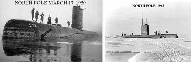
There were subs surfaced at an ice free north pole in the 50s. Furthermore prior to satellite data the ice cover at the north pole was not known. But you go on pretendingAnd nothing has happened. The north pole is still frozen as is Antarctica
Wrong.
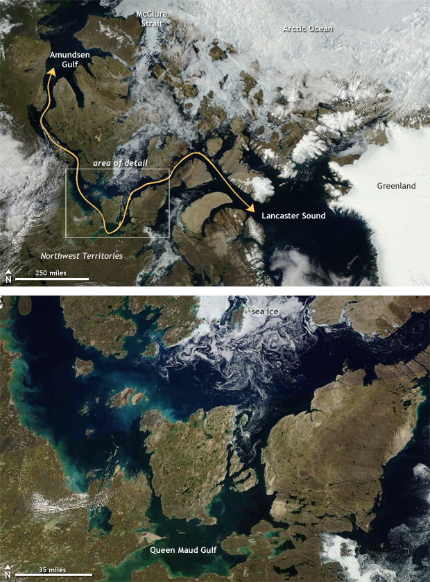
Every summer, ships now traverse the Northwest Passage.
Are you claiming they don't?
Northwest Passage clear of ice again in 2016 | NOAA Climate.gov
Fresh melt off from Greenland is starting to submerge the Gulf Stream and sent Europe off in a mini ice age.
The Antarctic ice shelf is radidly calving.
Mountain tops are becoming bare.
The changes are dramatic and obvious to anyone.
Yawn
Google Image Result for http://wattsupwiththat.files.wordpress.com/2009/04/uss-skate-open-water.jpg
Absolute lie.
There was no open water at the North Pole in the 1960s.
The image of open water was on the way TOO the North Pole.
There are people who took snow mobiles to the North Pole, in the summer, even after the 1950s. They could not have done that if there was ANY possible risk of even a trace of puddles, much less open water.
In fact, it took the USS Natilus days to find a thin vent in the ice so they could break through to the surface.
People always knew what the ice coverage was over the North Pole, because ships were always probing, and natives always traversed for hunting purposes. And you do NOT need satellites. We had lots of planes in the 1950s, which vastly superior technology than one can put into a tiny satellite.
View attachment 263950
Clearly in the image that is NOT open water.
Those are melt off pools on top of thicker ice that would prevent any ship passage.
Clearly the submarines looked for thin ice and punched up through ice that still covered the Arctic Ocean.
While things were already warming up from AGW since 1840, in 1987 there clearly was still no open passage through the Arctic ice.
What does that have to do with the picture at the North Pole?