LOL how is a CAT-3 storm the most destructive storm EVER.......

Sandy knocked out both power and cell towers here for weeks.
Actually what did the most damage was the Nor'Easter that followed Superstorm Sandy.

Some "superstorm" it made landfall with wind speeds of less than 90 miles per hour..

It is all fake news all the time with you guys isn't it...and fake history whenever you think you can get away with it.
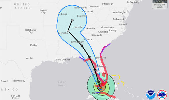
Superstorm Sandy: Unraveling the mystery of a meteorological oddity

One of the more important lessons is the notion that when it comes to storm surge, storm size is just as important as strength of the sustained winds. Big storms such as Isabel (2003) and Ike (2009) have demonstrated very large “integrated kinetic energy” (IKE) – basically, their ability to mobilize massive amounts of seawater out of proportion to their wind intensity alone.

As demonstrated by CWG’s Brian McNoldy, of all the hurricanes tallied over several decades, Sandy sits near the very top of the IKE curve, even though it was only a Category 1 off the Eastern Seaboard.

Never mind the fact that it happened to come assure during a spring tide...pure coincidence in fact, but sinister evidence of man made climate change according to the cult religion...kind of like sacrificing humans to keep the sun coming up every morning.
 
God you are an idiot...........and I rarely use that term in here...............

:spinner:http://www.msn.com/en-us/news/other/dollar150-billion-misfire-how-forecasters-got-irma-damage-wrong/ar-AArKOqd:spinner:


Fucking snowflakes.......they get hysterical about anything.( we need an exploding head emoticon )


One more time for the Illiterati...........
"From there it went sightly out to sea then straight up into the Carolinas. It continues to track due north. It has NEVER veered sharply westward inland towards Tennessee and Kentucky, as they thought."
--- that look like "due north" on the map there, shitforbrains? Hm?

Once again Stupid --- I'm **IN** the Carolinas. There is no Irma here. She went way to the west. You might say, "sharply westward inland toward Tennessee and Kentucky". As they thought. As that map CLEARLY shows.

Fucking retard.

Pogo you are seriously retarded, the storm tracked DUE NORTH after turning when it headed for Florida from Cuba.

So again take your pills please

BULLSHIT. SEE THE FUCKING MAP, STUPID.

I have seen the map, the storm turned due North when exiting Cuba for the keys. How stupid are you? The storm left Cuba traveling North then veered to the East then went up your ass and to your brain.

Kid you really need help

--- and when it got to the Florida panhandle it turned LEFT and went NORTHWEST --- which is exactly what the previous poster denied it did. And, he claims, the storm came here.

Well it didn't. The map proves it, and I can fucking see it out my window. That was bullshit last night and it's still bullshit now and on May 16th of the year 2472 it will STILL be bullshit.

The NWS map above updates every time the page refreshes but here's a composite. Check out where the Carolinas are (Greensboro, Greenville, Charlotte, Raleigh) --- where he claimed the storm came -- and where Nashville is, where he claims it didn't.

hurricane-irma-852253.jpg


Here in fact is a capture of the NWS map as it appeared September 9, when it was still on the north coast of Cuba, before landfall in Key West. Note the projected path going right to Tennessee and Kentucky, not the Carolinas. Note that not only DID it INDEED follow that path, it actually veered even further west of it.

huricane-irma.jpg

But then you're still a fucking liar so at least you're consistent.

None of those are satellite tracks goofy, they are projected drawings set out BEFORE the movement.

How old are you?

Did you take your medication
 
Pogo you are seriously retarded, the storm tracked DUE NORTH after turning when it headed for Florida from Cuba.

So again take your pills please

BULLSHIT. SEE THE FUCKING MAP, STUPID.

I have seen the map, the storm turned due North when exiting Cuba for the keys. How stupid are you? The storm left Cuba traveling North then veered to the East then went up your ass and to your brain.

Kid you really need help

--- and when it got to the Florida panhandle it turned LEFT and went NORTHWEST --- which is exactly what the previous poster denied it did. And, he claims, the storm came here.

Well it didn't. The map proves it, and I can fucking see it out my window. That was bullshit last night and it's still bullshit now and on May 16th of the year 2472 it will STILL be bullshit.

The NWS map above updates every time the page refreshes but here's a composite. Check out where the Carolinas are (Greensboro, Greenville, Charlotte, Raleigh) --- where he claimed the storm came -- and where Nashville is, where he claims it didn't.

hurricane-irma-852253.jpg

But then you're still a fucking liar so at least you're consistent.


Your "map" proves nothing jackass, NOAA is full of shit. It is just a drawing based on one of their earlier models. WATCH THE ACTUAL EYE OF THE STORM going back 144 frames taken from space while you still can and track where that eye went. PHOTOS DON'T LIE.

Data and Imagery -- SSEC

The actual track of Irma is drawn here in blue. Quite a far cry from their predictions! You can still see it on the geostationary satellite image browser at SSEC.


View attachment 148976

LOOK DOOD.

I'm am sitting here **IN** fucking Carolina and I know from looking out my window there was no Irma here. NONE.

You can stick your fingers in your ears and deny reality all you like but you're just looking like a fucking idiot here.

:dig:

Ok, now we are getting somewhere. Why is Irma so important to your life? Other than the obvious obsessive compulsive disorder and obvious delusions of grandeur that is.
 
Hurricane Irma broke a bunch of meteorological records here are some of the biggest
https://webcms.colostate.edu/tropical/media/sites/111/2017/09/Hurricane-Irma-Records.pdf

It'll take months to fully assess the damage to the hardest-hit places, and the recovery and rebuilding process will take years.

But many of the weather records set by the storm are already clear.

Meteorologist Phil Klotzbach tracked Irma with a team at Colorado State University's Tropical Meteorology Project. He published the final summary of the milestones the storm hit after Irma was finally downgraded to a tropical depression Monday night.

You can check out the full list on the CSU site, but here are few of the biggest records the giant storm broke:

Irma sustained 185-mph winds for 37 hours, the longest any cyclone on the globe has maintained that intensity.

****snip****

Hurricane Irma Meteorological Records/Notable Facts Recap Intensity/Day Measures
- 185 mph lifetime max winds – tied with Florida Keys (1935), Gilbert (1988) and Wilma (2005) for second strongest max winds of all time in Atlantic hurricane. Allen had max winds of 190 mph in 1980
- 185 mph lifetime max winds – the strongest storm to exist in the Atlantic Ocean outside of the Caribbean and Gulf of Mexico on record
- 185 mph max winds for 37 hours – the longest any cyclone around the globe has maintained that intensity on record. The previous record was Haiyan in the NW Pacific at 24 hours
- 914 mb lifetime minimum central pressure – lowest in the Atlantic since Dean (2007) and 10th lowest in satellite era (since 1966)
- 914 mb lifetime minimum central pressure – lowest pressure by an Atlantic hurricane outside of the western Caribbean and Gulf of Mexico on record
- First Category 5 hurricane in the Atlantic since Matthew (2016) and first Category 5 hurricane in the tropical Atlantic (7.5-20°N, 60-20°W) since Hugo (1989)
- 3.25 day lifetime as a Category 5 hurricane – tied with Cuba (1932) for longest lifetime as Category 5 in Atlantic
- 3 consecutive days as a Category 5 hurricane – the longest for an Atlantic hurricane in the satellite era (since 1966)
- 12.75 named storm days – the most since Nicole (2016) and tied for 23rd most in satellite era for the Atlantic
- 11.25 hurricane days – the most since Ivan (2004) and tied for 9th most in satellite era (since 1966) for the Atlantic – satellite-era record is Ginger (1971) with a whopping 19.5 hurricane days
- 8.50 major hurricane days – the 2nd most in satellite era (since 1966) for the Atlantic – trailing Ivan (2004).
 
According to the British Isles, this is one of the dumbest OPs in USMB history.
 
I'm am sitting here **IN** fucking Carolina and I know from looking out my window there was no Irma here. NONE.

You can stick your fingers in your ears and deny reality all you like but you're just looking like a fucking idiot here.


That's because what was left of "Irma" went through the Carolinas between the 10th and 11th, pencil brain! It has been long gone for over three days from there. How do you think it stormed Alabama and Georgia but miraculously never went through there! Obviously, you didn't watch the satellite imagery, Irma was no hurricane up there, moron, it was just a tropical low with some cloud and rain at that point which you've already admitted, but you keep right on looking out your window and masturbating as you fantasize on the world trying to deny your ignorance!

Normally when hurricanes down south finally move up here in the Ohio Valley, it rains buckets for days---- this one weakened so fast that by the time it got here, I think my house got maybe 5 drops of rain. Just another colossal screw up of miscalculation that we deserve for putting yet another part of our culture in the hands of the government they have no business being involved with. They can't even delivery my mail right, but they're supposed to get the weather?
 
Hurricane Irma broke a bunch of meteorological records here are some of the biggest
- 185 mph lifetime max winds – tied with Florida Keys (1935), Gilbert (1988) and Wilma (2005) for second strongest max winds of all time in Atlantic hurricane. Allen had max winds of 190 mph in 1980

Those are all fine and good but most of them all overlap the same basic fact: Irma was one of the strongest, largest and longest lived hurricanes on record, but it all occurred far out to sea and only two tiny islands ever really saw any of that. Such high winds were contained right at the eye wall, about 1/100th its total area. Just as a big elephant needs lots of food to live, so did Irma, and once it got down in the straights of Florida with land masses and the dry dry air that was over the eastern seaboard of the USA, it just spun out of gas, especially its lower half, and the only places in the continental US that even saw any real piece of it was the Keys and the Naples region. Shortly after that, it fizzled out pretty quickly, down to about 100 mph at the center by the time it got half way up Florida where NOAA had forecast it to be still at CAT 4 or 3..

Harvey did far greater damage to the US.
 
Who told you that Irma missed Tampa? I live in the bay area and the eye (literally) went right over my house. Hell the storm literally emptied out much of the bay. It takes a 20 second Google search to see that the storm hit Tampa, I mean seriously that's just laziness.

Nice try.

It's always nice to hear someone talk out of their ass while accusing others of laziness.

A). The eye did NOT go right over your house! When people refer to the "storm," they mean the eye where the winds were most severe. At the very best, if you lived on the extreme inland part of the Bay, then the extreme outer edge of what used to be the center of the storm barely brushed your area. It was supposed to hit you dead on as a CAT 4 or 3. You got off with a song. By the time the storm got up to the Tampa area, there wasn't even an eye any longer! What was left of it was tracking up the center of the peninsula at that point as only a CAT 1 system by then with no eye. It was supposed to be a CAT 3 or 4. But don't take my word, you can view the animation of the longwave satellite imagery right here in the geostationary satellite image browser:

Data and Imagery -- SSEC

B). That the storm emptied out your Bay is irrelevant. That doesn't mean the storm "hit" your area. The storm in total area was the size of Texas and covered the whole state and was affecting water levels hundreds of miles away. It probably affected water levels along Corpus Christi. You probably saw winds of 85 mph, but was supposed to see winds over 150 mph! Just be glad it pulled water out of the Bay; in the original NOAA forecast, they had it flooding your area by 10 feet deep over land.

If you want to see people who got /hit/ by the storm, go visit the Keys, the coast of Cuba, or better yet, those couple of Caribbean islands where whole houses were blown away under 185 mph winds with nothing left to show they were ever even there.

-I live in Wesley Chapel (which is a part of the Tampa Bay area), and yes the eye did go over my neighborhood/house. I went through the eye wall twice.

-The eye is where there is no wind, the part where the winds are the most extreme is known as the eye wall, big difference.

-Irma was still a cat 1 storm when it hit the Bay Area


-Around the 7:00 mark you'll see the eye going over the Tampa area (and going directly over Wesley Chapel as I stated).

Honestly the only thing I need to do to discredit you is to use your own words against you. You stated, and I directly quote:

"The storm in total area was the size of Texas and covered the whole state"

So which one is it? Was the storm so large that it covered the whole state, or did the storm only hit portions of the state? At this point you're not even debating me, you're debating yourself.

PS: I never suggested it hit my area as hard as the Keys or even Naples, I simply stated you were wrong in your statement that it didn't hit Tampa at all...and you're too stubborn and proud to admit that you were wrong.


Thanks for pointing out once again what a pencil head Pogo is who says that he lives in the Carolinas and Irma never went anywhere near him.

"In Florida, more than 5 million customers were still without power Tuesday. In Georgia, nearly 1 million residents were in the dark, along with 95,000 in South Carolina, 54,000 in North Carolina and 20,000 in Alabama."

Whadda jackass.

Tell me again how it took out 1 million homes in Georgia and 150,000 homes in the Carolinas when it supposedly tracked west into Tennessee and Kentucky???

You apparently don't have the vaguest idea how hurricanes work. And apparently equally dim on geography.

First of all you CAN'T fly from Florida to either Tennessee/Kentucky OR the Carolinas without going through Georgia. Unless you pull a sharp left back into the Gulf and then a sharp right around Mobile. Therefore, if Florida, then Georgia.

Second, the outer band effects of a hurricane, rotating as it does anticlockwise, exactly would throw rain bands drawn out of that water ONTO those eastern shores of Georgia and South Carolina. That again is to be expected.

But your claim was that the Irma storm, whatever its designation at any particular time, tracked straight north to where I am. NO IT DID NOT. It went northwest toward Tennessee and Kentucky as had been recently predicted. Fatter o' mact it went even more west than predicted, toward Memphis. It did NOT track to here as you claimed. It in fact went in exactly the direction you claimed it did not.

Now being on the eastern edge of a counterclockwise system we got some of that Gulf/Atlantic rain. That's the big picture. Some areas even east of here got tornadoes and/or microbursts and occasional hail and lightning --- all of which are byproducts of turbulence caused by outer winds interacting with normal systems.

But it's not the storm, which in the event was nowhere near here. Here where I am in WNC we got no winds at all. And we know winds around here, trust me. That's because Irma was waaaaaaay out to the west venturing into Tennessee. That's why Nashville -- which is a good 300 miles west of here --- put itself on emergency alert. They got winds there, whatever was left of them. We got nothing.

All of which is already shown on the maps I posted by way of stating the obvious.

ONE MORE TIME for the obtuse ---

636407592995443080-8pm-212313-5day-cone-no-line-and-wind.png

See the orange area? That's the body of outer-effect. See the blue on the coastline? That's the effect of the eastern edge of the system as it's around the Florida panhandle. Now see the white finger pointing to the upper left? That's the track of the storm. And it's going exactly where you said it didn't.

From the same page this image came from, a newspaper in Asheville which is east of here --

>> But the effects of the storm will be felt throughout the region and throughout the state even though the center of the story is still forecast to pass well to the west of WNC.

.... The center of what is now Tropical Storm Irma is expected to go well west of Western North Carolina, but the storm is still large enough to cause problems in the region. <<

At that time those are predictions. But as the maps I've already posted from subsequent days show, that's the path it followed --- NOT "due north".

Here's a map of actual track history, retrieved just now, from Weather Underground, which is a commercial (praised be its holy corporate name) site and not Da EEBIL Gummint:

at201711.gif

See where it says "Tuesday"?? That's in the PAST. What day is today, hm?

Now how the fuck did it get all the way over there if it was tracking "due north"? What did it do, hitchhike?

I really don't understand why you're trying to rewrite the history of a fucking hurricane that is already recorded.
 
Last edited:
Who told you that Irma missed Tampa? I live in the bay area and the eye (literally) went right over my house. Hell the storm literally emptied out much of the bay. It takes a 20 second Google search to see that the storm hit Tampa, I mean seriously that's just laziness.

Nice try.

It's always nice to hear someone talk out of their ass while accusing others of laziness.

A). The eye did NOT go right over your house! When people refer to the "storm," they mean the eye where the winds were most severe. At the very best, if you lived on the extreme inland part of the Bay, then the extreme outer edge of what used to be the center of the storm barely brushed your area. It was supposed to hit you dead on as a CAT 4 or 3. You got off with a song. By the time the storm got up to the Tampa area, there wasn't even an eye any longer! What was left of it was tracking up the center of the peninsula at that point as only a CAT 1 system by then with no eye. It was supposed to be a CAT 3 or 4. But don't take my word, you can view the animation of the longwave satellite imagery right here in the geostationary satellite image browser:

Data and Imagery -- SSEC

B). That the storm emptied out your Bay is irrelevant. That doesn't mean the storm "hit" your area. The storm in total area was the size of Texas and covered the whole state and was affecting water levels hundreds of miles away. It probably affected water levels along Corpus Christi. You probably saw winds of 85 mph, but was supposed to see winds over 150 mph! Just be glad it pulled water out of the Bay; in the original NOAA forecast, they had it flooding your area by 10 feet deep over land.

If you want to see people who got /hit/ by the storm, go visit the Keys, the coast of Cuba, or better yet, those couple of Caribbean islands where whole houses were blown away under 185 mph winds with nothing left to show they were ever even there.

-I live in Wesley Chapel (which is a part of the Tampa Bay area), and yes the eye did go over my neighborhood/house. I went through the eye wall twice.

-The eye is where there is no wind, the part where the winds are the most extreme is known as the eye wall, big difference.

-Irma was still a cat 1 storm when it hit the Bay Area


-Around the 7:00 mark you'll see the eye going over the Tampa area (and going directly over Wesley Chapel as I stated).

Honestly the only thing I need to do to discredit you is to use your own words against you. You stated, and I directly quote:

"The storm in total area was the size of Texas and covered the whole state"

So which one is it? Was the storm so large that it covered the whole state, or did the storm only hit portions of the state? At this point you're not even debating me, you're debating yourself.

PS: I never suggested it hit my area as hard as the Keys or even Naples, I simply stated you were wrong in your statement that it didn't hit Tampa at all...and you're too stubborn and proud to admit that you were wrong.


I'm noticing the same thing. Stupefying how somebody thinks they can just outright deny recorded realities and not be called on it.
 
BULLSHIT. SEE THE FUCKING MAP, STUPID.

I have seen the map, the storm turned due North when exiting Cuba for the keys. How stupid are you? The storm left Cuba traveling North then veered to the East then went up your ass and to your brain.

Kid you really need help

--- and when it got to the Florida panhandle it turned LEFT and went NORTHWEST --- which is exactly what the previous poster denied it did. And, he claims, the storm came here.

Well it didn't. The map proves it, and I can fucking see it out my window. That was bullshit last night and it's still bullshit now and on May 16th of the year 2472 it will STILL be bullshit.

The NWS map above updates every time the page refreshes but here's a composite. Check out where the Carolinas are (Greensboro, Greenville, Charlotte, Raleigh) --- where he claimed the storm came -- and where Nashville is, where he claims it didn't.

hurricane-irma-852253.jpg

But then you're still a fucking liar so at least you're consistent.


Your "map" proves nothing jackass, NOAA is full of shit. It is just a drawing based on one of their earlier models. WATCH THE ACTUAL EYE OF THE STORM going back 144 frames taken from space while you still can and track where that eye went. PHOTOS DON'T LIE.

Data and Imagery -- SSEC

The actual track of Irma is drawn here in blue. Quite a far cry from their predictions! You can still see it on the geostationary satellite image browser at SSEC.


View attachment 148976

LOOK DOOD.

I'm am sitting here **IN** fucking Carolina and I know from looking out my window there was no Irma here. NONE.

You can stick your fingers in your ears and deny reality all you like but you're just looking like a fucking idiot here.

:dig:

Ok, now we are getting somewhere. Why is Irma so important to your life? Other than the obvious obsessive compulsive disorder and obvious delusions of grandeur that is.

It isn't. It's history. And it had no effect here.

But that's the point, it IS history and you can't just walk around rewriting histories to fit your own paranoid tinfoil gummint conspiracy theories, which is apparently this wag's motive in beating this dead horse. You can have opinions on all sorts of things but "what reality is" is simply not up for negotiation.
 
[
Whadda jackass.

Tell me again how it took out 1 million homes in Georgia and 150,000 homes in the Carolinas when it supposedly tracked west into Tennessee and Kentucky???
what t a fuck head .what a typical white male sissy BLOW HARD ...the Hurricane affected more states than it actually touched ...it devastated the Caribbean Puerto Rico the Virgin island and you are blowing off it was nothing..again FUCK YOU
Fuck you bitch boy ...you know nothing of tropical weather
 
Last edited:


Thanks for pointing out once again what a pencil head Pogo is who says that he lives in the Carolinas and Irma never went anywhere near him.

"In Florida, more than 5 million customers were still without power Tuesday. In Georgia, nearly 1 million residents were in the dark, along with 95,000 in South Carolina, 54,000 in North Carolina and 20,000 in Alabama."

Whadda jackass.

Tell me again how it took out 1 million homes in Georgia and 150,000 homes in the Carolinas when it supposedly tracked west into Tennessee and Kentucky???

You yourself claimed Irma was as big as the the state of Texas...if every state was the same size you'd have a point. However if you were to put Texas there it would easily cover parts of Tennessee, Georgia, and the Carolinas...in fact Texasa is bigger than all 4 of those states combines (by roughly 80K square miles...or roughly the size of Nebraska). Again this isn't rocket science.

You've been proven wrong time and time again and yet your ego is so fragile you're incapable of admitting you were wrong. If you weren't so insignificant I might actually feel a little sorry for you.
 
Last edited:
I have seen the map, the storm turned due North when exiting Cuba for the keys. How stupid are you? The storm left Cuba traveling North then veered to the East then went up your ass and to your brain.

Kid you really need help

--- and when it got to the Florida panhandle it turned LEFT and went NORTHWEST --- which is exactly what the previous poster denied it did. And, he claims, the storm came here.

Well it didn't. The map proves it, and I can fucking see it out my window. That was bullshit last night and it's still bullshit now and on May 16th of the year 2472 it will STILL be bullshit.

The NWS map above updates every time the page refreshes but here's a composite. Check out where the Carolinas are (Greensboro, Greenville, Charlotte, Raleigh) --- where he claimed the storm came -- and where Nashville is, where he claims it didn't.

hurricane-irma-852253.jpg

But then you're still a fucking liar so at least you're consistent.


Your "map" proves nothing jackass, NOAA is full of shit. It is just a drawing based on one of their earlier models. WATCH THE ACTUAL EYE OF THE STORM going back 144 frames taken from space while you still can and track where that eye went. PHOTOS DON'T LIE.

Data and Imagery -- SSEC

The actual track of Irma is drawn here in blue. Quite a far cry from their predictions! You can still see it on the geostationary satellite image browser at SSEC.


View attachment 148976

LOOK DOOD.

I'm am sitting here **IN** fucking Carolina and I know from looking out my window there was no Irma here. NONE.

You can stick your fingers in your ears and deny reality all you like but you're just looking like a fucking idiot here.

:dig:

Ok, now we are getting somewhere. Why is Irma so important to your life? Other than the obvious obsessive compulsive disorder and obvious delusions of grandeur that is.

It isn't. It's history. And it had no effect here.

But that's the point, it IS history and you can't just walk around rewriting histories to fit your own paranoid tinfoil gummint conspiracy theories, which is apparently this wag's motive in beating this dead horse. You can have opinions on all sorts of things but "what reality is" is simply not up for negotiation.

Reality is what you have never comprehended..................and never will


Thanks for pointing out once again what a pencil head Pogo is who says that he lives in the Carolinas and Irma never went anywhere near him.

"In Florida, more than 5 million customers were still without power Tuesday. In Georgia, nearly 1 million residents were in the dark, along with 95,000 in South Carolina, 54,000 in North Carolina and 20,000 in Alabama."

Whadda jackass.

Tell me again how it took out 1 million homes in Georgia and 150,000 homes in the Carolinas when it supposedly tracked west into Tennessee and Kentucky???

You apparently don't have the vaguest idea how hurricanes work. And apparently equally dim on geography.

First of all you CAN'T fly from Florida to either Tennessee/Kentucky OR the Carolinas without going through Georgia. Unless you pull a sharp left back into the Gulf and then a sharp right around Mobile. Therefore, if Florida, then Georgia.

Second, the outer band effects of a hurricane, rotating as it does anticlockwise, exactly would throw rain bands drawn out of that water ONTO those eastern shores of Georgia and South Carolina. That again is to be expected.

But your claim was that the Irma storm, whatever its designation at any particular time, tracked straight north to where I am. NO IT DID NOT. It went northwest toward Tennessee and Kentucky as had been recently predicted. Fatter o' mact it went even more west than predicted, toward Memphis. It did NOT track to here as you claimed. It in fact went in exactly the direction you claimed it did not.

Now being on the eastern edge of a counterclockwise system we got some of that Gulf/Atlantic rain. That's the big picture. Some areas even east of here got tornadoes and/or microbursts and occasional hail and lightning --- all of which are byproducts of turbulence caused by outer winds interacting with normal systems.

But it's not the storm, which in the event was nowhere near here. Here where I am in WNC we got no winds at all. And we know winds around here, trust me. That's because Irma was waaaaaaay out to the west venturing into Tennessee. That's why Nashville -- which is a good 300 miles west of here --- put itself on emergency alert. They got winds there, whatever was left of them. We got nothing.

All of which is already shown on the maps I posted by way of stating the obvious.

ONE MORE TIME for the obtuse ---

636407592995443080-8pm-212313-5day-cone-no-line-and-wind.png

See the orange area? That's the body of outer-effect. See the blue on the coastline? That's the effect of the eastern edge of the system as it's around the Florida panhandle. Now see the white finger pointing to the upper left? That's the track of the storm. And it's going exactly where you said it didn't.

From the same page this image came from, a newspaper in Asheville which is east of here --

>> But the effects of the storm will be felt throughout the region and throughout the state even though the center of the story is still forecast to pass well to the west of WNC.

.... The center of what is now Tropical Storm Irma is expected to go well west of Western North Carolina, but the storm is still large enough to cause problems in the region. <<

At that time those are predictions. But as the maps I've already posted from subsequent days show, that's the path it followed --- NOT "due north".

Here's a map of actual track history, retrieved just now, from Weather Underground, which is a commercial (praised be its holy corporate name) site and not Da EEBIL Gummint:

at201711.gif

See where it says "Tuesday"?? That's in the PAST. What day is today, hm?

Now how the fuck did it get all the way over there if it was tracking "due north"? What did it do, hitchhike?

I really don't understand why you're trying to rewrite the history of a fucking hurricane that is already recorded.
There is no hurricane in the picture....................are you aware of that
 

Forum List

Back
Top