My Odyssey

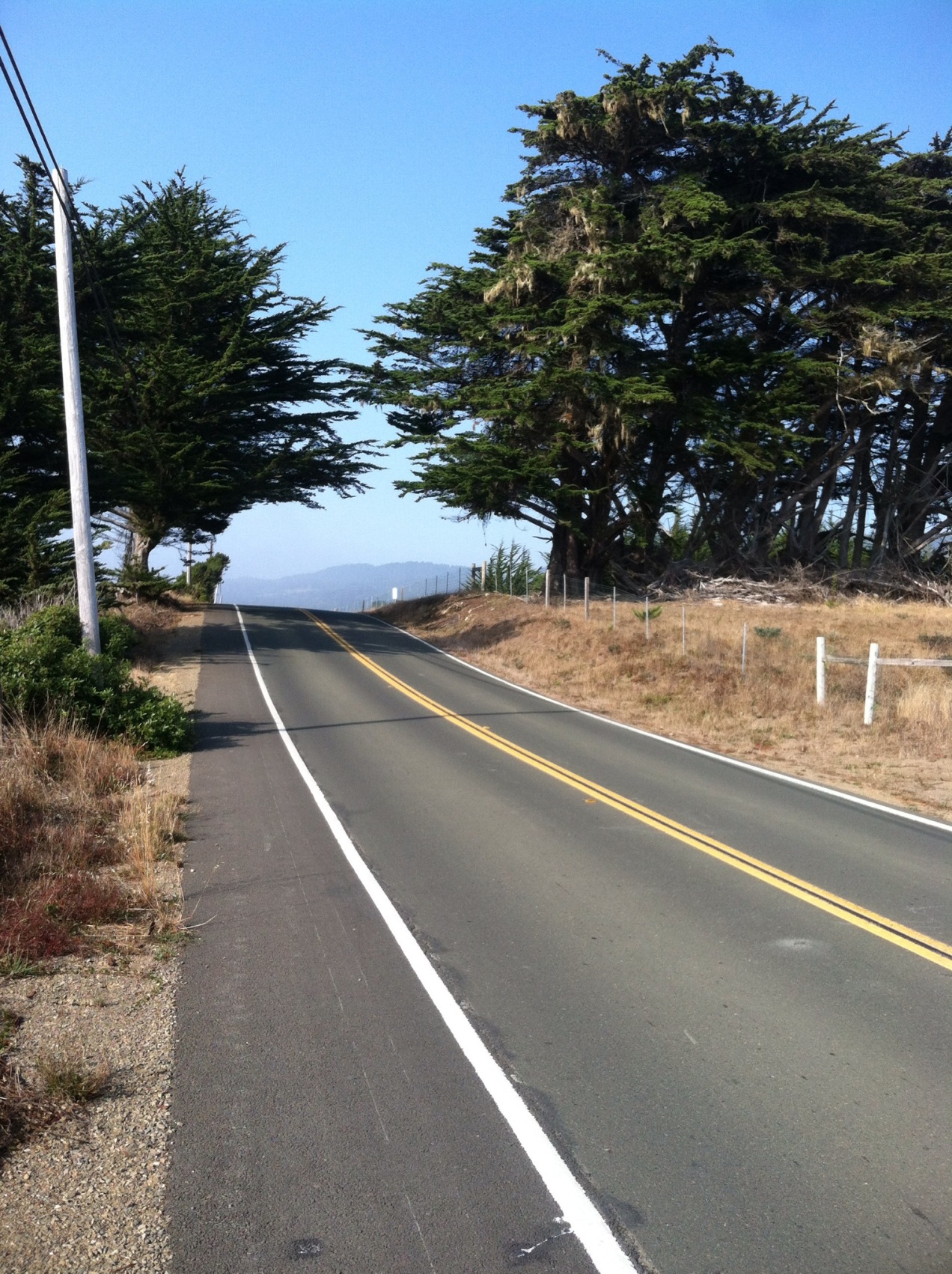
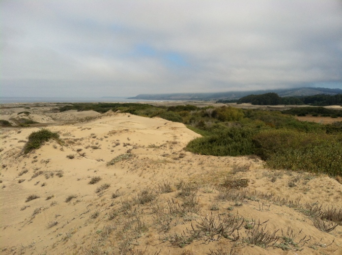
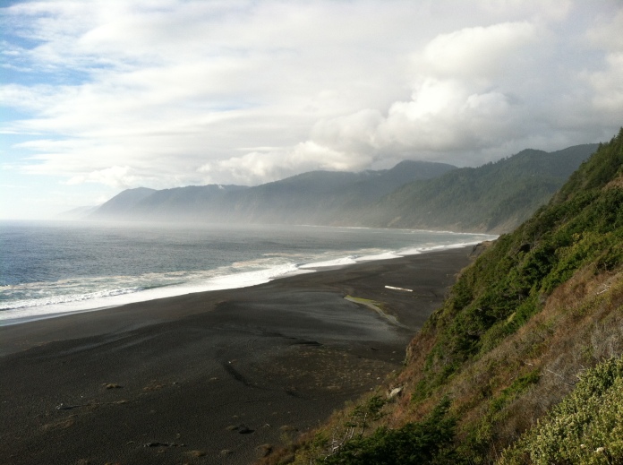
Little towns are distributed along California Hwy 1 North, separated from one another by 10 or 20 miles. They typically have a population of 200-500 people. Exceptions would be the town of Mendocino which boasts 900, and the bustling community of Gualala (1,700). The big city that I would reach toward the end of my road march is Fort Bragg with 7,000 people.

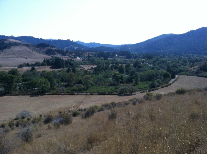
In the morning I crossed the Russian River. I was leaving the old colonial Spanish California and entering territory once colonized by the Russians. They say that the Russians brought communism to California. Thatā€™s always funny.

web photo Russian River crossing;
43186673.jpg


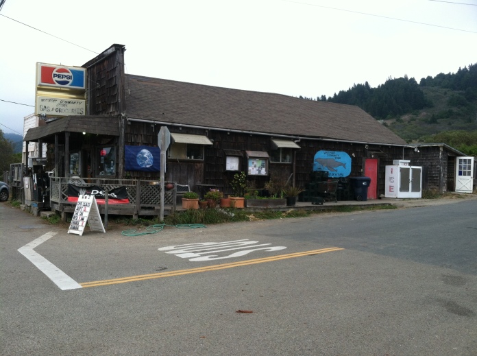
Jenner is one of my favorite little beach towns, situated overlooking the mouth of the river. I walked into a little hippy cafƩ. The bathrooms were at an unattended visitor center next door. I cleaned up a little and returned to the cafƩ. I sat down on a long bench and released my waist belt and chest clip. Inside, I went for the local eggs and bacon on pesto Focaccia bread with a sprout salad. They asked if I wanted coffee, and it smelled so good, but I had to stick with water. I plugged in my phone and went out to the wooden patio. I asked if they had wi-fi. They said no, Jenner only has lo-fi.

In every little town up and down the coast, thereā€™s a local character. Heā€™s kind of an eccentric, but he knows a lot of stories. The Jenner version of that guy arrived on foot, and at the same time an older Subaru pulled over onto the gravel with a paddleboard on the roof racks. The Jennerite pedestrian was an older guy wearing a felt hat. White whiskers grew from of his nostrils. His face was creased with laughing lines. He told me that the Russians used the river quite a bit. The harbor there was a little better than at Fort Ross. They built an overland trail that they used to haul cargo north to their headquarters. Itā€™s a trail that has since disappeared in the hills above the Sonoma Coast. I would have to continue along the highway.

The Russians didnā€™t bring any women with them to their colonies in Alaska or California. They hired Aleuts to work for them as hunters. They employed native Californians to work as laborers around Fort Ross. Relative to the Spaniards, the Russians maintained peaceable business and social relationships with local peoples, many of whom converted to Russian Orthodoxy. With the consent of family in the motherland, and tribal leaders, many interracial marriages were consummated at Fort Ross. The offspring of these unions were called ā€˜Creolesā€™, and they soon made up a majority of children at the colony.

The Subaru in the gravel parking spot belonged to a young woman with wet hair. She had ordered coffee through the window as was sitting on the bench next to my backpack, perhaps half-listening to the Jennerite pedestrian.

The California project was supposed to be a support base for Russian interests in Alaska, where the men were weary of dining on seals and rotisserie eagle. They needed some beets and cabbages to make borscht, and maybe some cows to make the sour cream to scoop on top of that borscht. They needed some potatoes to make vodka. They needed wheat to make rye bread. Typical Russian stuff. So, they established the colony at Fort Ross. But, they ended up buying a lot more vodka than they produced and the colony never turned a profit. The sea otters were quickly harvested, along with other fur-bearing creatures. Troubles in the motherland drew attention away from the Pacific. In 1842, John Sutter bought Fort Ross and the surrounding Russian properties, right before the California gold strike. The Czar sold Alaska in 1867, before the Klondike gold strike. This was all very perplexing to the Aleuts of Alaska and the local peoples of California who wondered by what legal authority that the Russians could sell the land.

Leaving the cafĆ© I bid, ā€œFarewell, Jenneritesā€.
The old storyteller corrected me, ā€œThat would be ā€˜De-Jenneritesā€™.ā€
I hoisted my pack and nodded to the paddle boarder from the Subaru.
ā€œDonā€™t pick me up.ā€ I said. ā€œI have to walk.ā€
ā€œHow many times do you need to tell everyone?ā€ She quipped. And she passed me up about an hour later, without honking, and I saw her disappear around the bend. After that, climbing up and over the hills of the Sonoma Coast, I contemplated the beauty the Subaru womanā€™s Russian eyes.

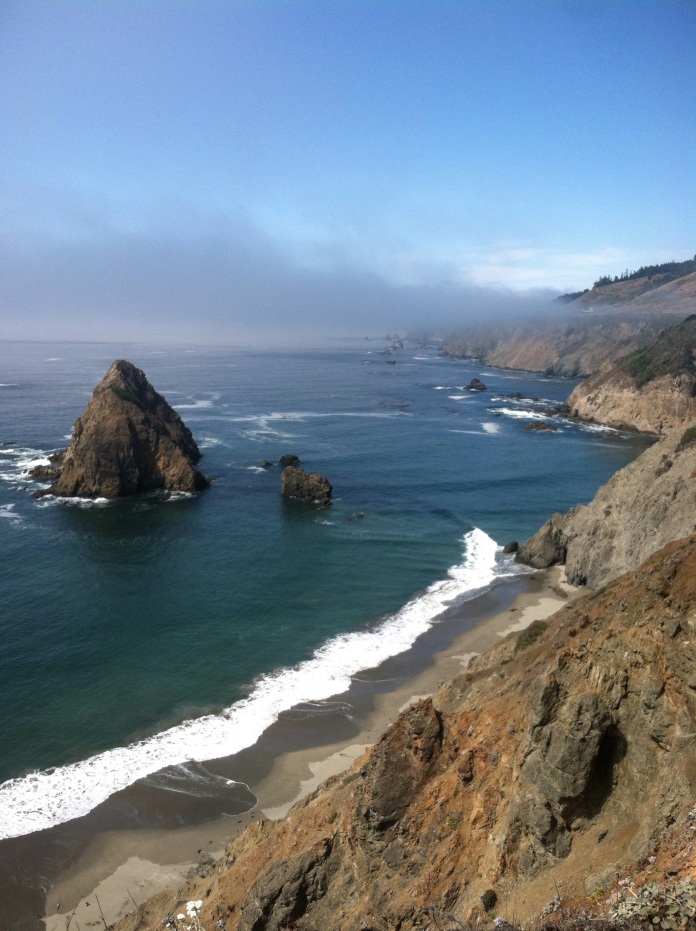
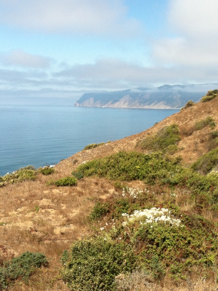
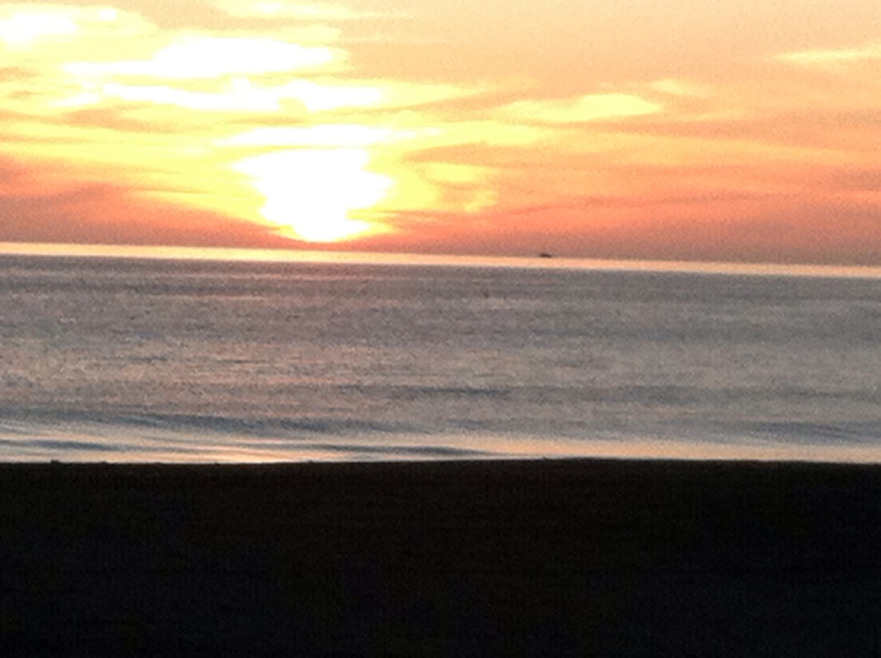
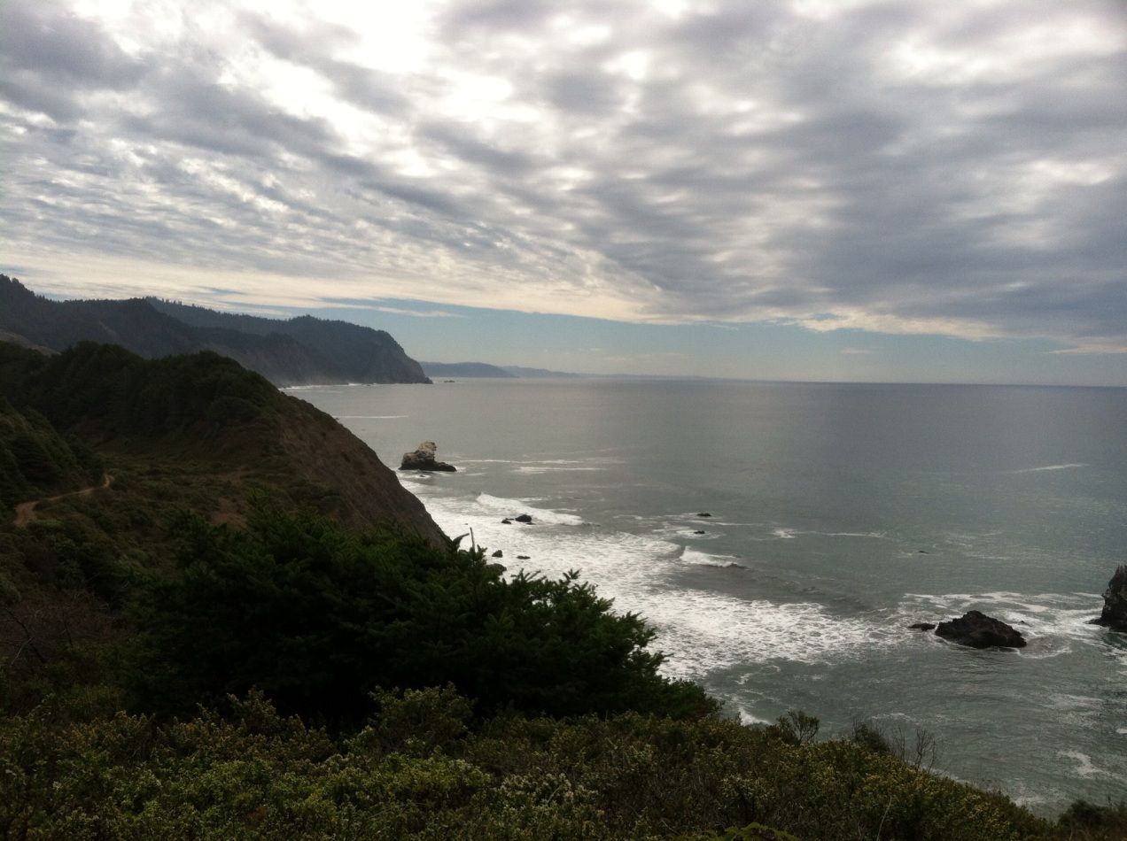
I visited the graveyard at Fort Ross. I walked onward to Salt Point State Park. The Pacific maintained an even calm from the cliffs to the horizon. I slept near a head-high stone with a hole through the top of it. Through the hole in the stone a beam of light from the setting sun shone upon a tree by my camp.
 
Maybe a dozen times Iā€™ve driven the length of Highway 1 from San Francisco to Humboldt County. Iā€™ve hitchhiked it about a half-dozen times. Walking it and watching the landscape pass by at 3mph, I found my home state to be unrecognizable. Salt Point State Park is a huge chunk of land, and I couldnā€™t remember ever noticing it before.

When youā€™re walking the Sonoma Coast, you pass a lot of cows. The cows donā€™t pay any attention to automobiles. To the cow, a car is just a blur that speeds by and makes background noise. They really donā€™t pay attention to bicycles either. When youā€™re walking by, the cows turn their heads and follow your progress as they chew on mouthfuls of grass.

Walking silently, you see a lot of wild animals. You surprise a lot of rabbits and deer. You hear every bird. You hear all the sea lions barking. Walking, you also see and smell the dead animals along the side of the road that you would never notice while driving. You see all the littered garbage. And different locations have different assortments of litter. Walking along Skyline Boulevard, for example, I saw fancy wine bottles. In the hood of South San Francisco, you find more fast food garbage. Up north, there are more bargain priced beer cans. Everywhere, you find cigarette butts. You get a real sense of the habits of drivers by the garbage they throw out the windows.

I had taken notice of the mileage markers along the road. Sometimes there wasnā€™t even a sign, but just a number painted on the asphalt. The markers told me how far I had walked on a given day, and how far I had left to go. Sometimes I intentionally ignored them and tried not to obsess over numbers. I had 23 days to either make my final destination, or just walk as far as I could manage within that time frame.

A short transit bus passed to and fro each day. The thought was tempting, to eliminate almost a week of time from my trip by riding the bus from the Marin Coast to Fort Bragg. ā€œWhy am I being a purist?ā€ I asked myself. Why did I make a seemingly arbitrary rule that I had to walk every step? Out on the road, you find a lot of time to doubt yourself.

I was drying out my sleeping bag and other wet stuff at Black Point. A surfer there offered me a Fuji apple and a big chunk of coffee cake. Little things like that really lighten your step and mood.

Fortunately, there were many miles of nature trails leading into Gualala and I was able to get off the road and contemplate the beautiful things. Past Gualala, I slept on the ground for the first time. I tunneled under the trees and made a fluffy bed of pine needles.

The next day was more walking along the road, being stared at by cows. The mileage markers had reset to zero as I passed from Sonoma County to Mendocino County. I found a real oasis at the market in Point Arena, and hung out briefly with some fellow travelers. But, most of the day was just spent alone with my thoughts and my doubts and mileage numbers swirling around inside my head.

A bicycle packer hailed me as he approached in the opposite direction. He said he had been meditating on the notion that he should give away some of his weed to a needy traveler. Sounded good to me. I had been out of weed for many days. After talking for a minute, a beautiful bike packer woman from France pulled over and asked for information. The campground at Manchester was full, she said, and she didnā€™t know where else to go. I told her where I had left my excellently detailed Sonoma map on the table at the market in Point Arena. The dude who gave me weed agreed to ride with her all the way to Gualala. It seemed karmic, that immediately following his generosity toward myself he hooked up with a gorgeous riding partner with silky chestnut hair, the body of an athlete and an alluring French accent.

I smoked a joint as I walked further north. All of a sudden I felt it coming on, the reason why I was doing this. With my footsteps I was stitching an unbroken thread upon the ground. I was re-experiencing my homeland in a continuous fashion, without abstraction or insulation. I was unifying it within my experience. That really meant something to me in that exact moment, and I ceased to doubt the purpose of my journey.

img_0339.jpg
 
Last edited:
Back in the 16th Century Sir Francis Drake called it the ā€˜New Albionā€™. Thatā€™s how he described the coast of Northern California, as if it were host to the Holy Grailā€¦ as if it were the mystical nucleus of the planet.

I can visualize the sails of Drakeā€™s Golden Hind pregnant with wind, and the crew of his last surviving ship soaking in the exquisite beauty of the onshore view. They would have experienced a bitter-sweet moment, with rending memories of friends who had died along the journey from England. They would have been the last survivors, the first Englishman to have witnessed Northern California in its virgin state.

I envy those people. I envy Jedediah Smith and Mountain Joe Walker. I envy people like Lewis and Clark. I can completely understand why Meriweather Lewis went insane upon returning to society. I understand. I admire Alexander MacKensie. Jim Bridger.
Edmond Hillary was the leader of the first expedition to summit Mt Everest, and he said, ā€œI am a lucky man. I had a dream and it has come true.ā€

Me? I was just walking along the paved road at this point. This is a selfie entitled, ā€œAt high noon a stranger walks into the town of Elk.ā€;

img_0356-0.jpg


I bought three quarts of Pabst Blue Ribbon at the general store in the small town of Elk. I drank one of those bad riders across the street at the State Beach and then I hoisted my pack and got back to walking. I just kept walking north. I was walking alongside the road with a relatively gigantic pack, especially with the addition of the weight of 2 quarts of brew.

Some guy on the side of the road asked me if I wanted to smoke some kind buds. He had a Yuba bicycle with an extensive bike trailer. He looked about my age, wearing a Greenpeace shirt, so I figured he was okay. He figured I was okay because I was walking the road and thatā€™s just a weird thing to do.

Upon further inspection he had really bad teeth, like maybe he had a history with meth. And he was extremely drunk. But, we exchanged buds and smoked it up and I drank my second quart of Pabst. He was okay, until he told me that television is totally fake and that heā€™ll stab everyone in the neck that watches TV. I agreed with him, except for the neck stabbing part. I said yeah, everything on TV is fake, but just donā€™t stab anyone over it. He got into my face a little bit, just to test me, but Iā€™d been hardened by the road and he was totally drunk and I just failed to exhibit any fear.

The weird drunk meth guy had an entire bike trailer full of booze, as if heā€™d just pulled off a heist from some guyā€™s bar. He handed me a dented plastic orange juice jug that he said was filled with a combination of Bombay Safire and Tangueray. Gin is my favorite substance, so I took him up on it. I took a shot and then a few more. Ultimately, we both had schedules to adhere to. We packed up and bailed. I watched him swerve on his bike and booze-filled trailer ahead of me, barely missing the path of a Honda Accord. But, he disappeared into the mists of Albion never to be seen again.

I walked another 10 miles and came upon the town of Albion in early evening. Up on the hill above the general store there was a gathering of hippies. I bought a tallboy of Mickeys Malt Liquor and joined the circle. They had an old boom box playing this sort of techno-rave music with the vocals asking repeatledy, ā€œDo you remember when we were young?ā€ That refrain perpetuated.

There was a hippy girl standing on tip toes, with one hand in the air and with raw scraps of linen over her breasts and groin singing repeatedly the soulful phrase, ā€œI feel it coming on.ā€ ā€œI feel it coming on.ā€

I felt it coming on.

There was a Rastaman drumming on the congos, and a crazy toothless hippy syncopating on second drum along with the Rastaman.To this day, the sound has not left my memory.

I drank my beer and disappeared into the mists of Albion. I walked 23.5 miles that day.
 
Last edited:
I woke up at dawnā€™s light in a temperate rainforest north of the town of Albion. I had draped my rain poncho over my down bag to keep the dew from soaking in. The usual routine ensued; eat some trail food; drink water; put Vaseline on my hip sores; address my foot issues with Neosporin, Band-Aid friction preventer, athletic tape or bandages as needed; find the least disgusting pair of socks; dig a hole with my wooden staff to poo in; etc.. The whole routine lasted 30 minutes once I got it dialed.


Down a hillside I waded through shoulder high ferns. I found an extremely sharp folding knife right there in the bike lane, marking the exact spot where I had plunged into the forest the night before. Weird, but definitely a blade upgrade from my Swiss Army knife.


I lit out on that 14th morning of my project, leaning forward toward the artsy town of Mendocino. Typical of most mornings, the pain in my legs and feet presented itself immediately. The pain subsided as I got my heart pumping, warming everything up with fresh blood. Conversely, my shoulders would start out refreshed and only become sore in the afternoons. By twilight, pretty much everything hurt. Iā€™m not an athlete anymore. Iā€™m just a middle aged druid.


I ate a can of sardines on a bench in the fancy town of Mendocino. I picked up some cell reception there and fired off a few texts and emails. The beach there is gorgeous, and so are the trails along the Mendocino Headlands. I walked north along side roads and trails and had a couple of brief interactions with hikers until I reached the bridge crossing at Russian Gulch.
stevespics-103.jpg


The Albion River, Navarro River, Little River, Big River, Noyo River, Elk Creek and dozens of other creeks are young watersheds pouring from young mountains. They cut deep channels to the sea. By California engineering standards, the coastal bridges of Mendocino County are ancient. They tend to be narrow, and most of them have a raised curb along one side to walk on. Invariably, the curb is very narrow and the concrete railing barely exceeds knee level. Over the edge, the view to the bottom can be over 200 feet. If I had to identify the most frightening facet of my walk, it would be the bridge crossings of Mendocino County.

The backpack gave me a high center of gravity. Iā€™d step up on that bridge curb and remind myself to keep breathing, walking on tidbits of broken glass and stepping over spark plug wires or a hub cap or some other random piece of debris. Iā€™d look down so I wouldnā€™t trip, and there was no escape from the view of the plunge. If a fixed RV or truck mirror were to glance off my pack, I was going overboard. I was going airborne. My life completely depended on someone other than myself. At those moments there isnā€™t anything you can do but try to have confidence in your fellow man.

I found flat grassy strips along Highway 1 where there should have been a trail. I even found designated trails where the grass had been mowed, but the ā€˜trailā€™ was still lumpy and awkward-going as no people had worn a track into the earth. There were quite a few places where there could have been a user-friendly wildman corridor, but for lack of use was not. I stomped through many of these green strips. They tended to yield droops of ripe blackberries. Whether it was to catch a break from road traffic, or to feast on berries, I was inadvertently getting the trail started.


Travelling at 3mp gives a person time to think. Sometimes Iā€™d invent rap lyrics. Sometimes Iā€™d try to build a poem.


Every day thereā€™s turkey vultures
in the sky swirling.
I hope that theyā€™re still just
a little bit early.
Iā€™m tromping out a trail on the
side of the road.
I slept by a creek
in an alder grove.
I slept by the sea on a
bed of pine needles.
I slept by a rock with
an equinox keyhole.
Every day thereā€™s turkey vultures
up in the sky.
But I think that theyā€™re here
a little bit early.
Tromping out a trail on the
side of the road.
Just a couple more days until
I reach the Lost Coast.

img_0359.jpg

mendo coast
 
So if you hike 24/7...where does your food come from?

Do you have a family that is being supported, or are they on the dole?
 
So if you hike 24/7...where does your food come from?

Do you have a family that is being supported, or are they on the dole?

If there's any further interest, I'll address comments and questions after I've finished. I've got about 8 days left of my trip to journal.
 
Those are valid questions. You are going on about walking in the steps of early 19th Century trailblazers like Jedediah Smith and Mountain Joe Walker...so this begs the question...

who foots the bill for your food? Somebody has to. Maybe you're independently wealthy, or have a benefactor?
 
I work in the outdoor sports industry. I took the month of September off. The whole trip cost me $400.00, mostly for food and beer. I'm not wealthy, but I'm not on any form of welfare either.

Hope that answers your questions. I just don't want to clutter things up with sidebars until I'm done journaling.
 
I came through Fort Bragg in the late afternoon. Among other things I bought two rolls of summer sausage, more cheese, more nuts, and more dried fruit. My pack had become delightfully light, and now it was back to being fully weighted. Safeway had a 3 lb. tub of potato salad on sale for $5. I ate 2.5 lbs. of that until I just couldnā€™t continue. I went to The Outdoor Store and bought a Lost Coast map. Maybe it was because my brain was all doped up on potato salad, but I forgot to buy a bear canister.

Thereā€™s a wonderful foot path heading north from Fort Bragg through MacKerricher State Park. I slept in a forest of stunted pines along the bluffs. In the morning, I followed the trail until it ended at a long beach. I figured Iā€™d just head slightly Northeast to return to Highway 1. I crossed a fen and wandered in the dunes for two hours. The way was shut. Only the Great Druid himself could have parted the brambles and willows of Inglenook Creek.

stevespics-111.jpg


Iā€™d taken a wrong turn somewhere and spent a considerable amount of energy getting back on track. Once I did, it was a ten mile walk to Westport. Motivated by the prospect of beer, I power marched along the highway cliffs. The Westport general store would be my last refuge before entering the roadless wilderness. I bought a pack of Anderson Valley Hop Ottinā€™ IPA and drank a couple out on the deck. They had wi-fi, and an outdoor outlet to plug in my phone. I let my people know that I would be out of cell range for five days or more.

stevespics-116.jpg


Just up the road a woman wearing multiple hippy scarves and beads waved to me. Her name was Shakinah. She said she had waved to me earlier, but I had been in a walking trance and hadnā€™t noticed. She was picking blackberries. I shared a beer with her and we picked some berries together, and some old timers of Westport gazed at us with suspicion.

I slept at a State Beach campground that had been abandoned due to the road falling into the sea. There was some water in the pipes and I filled my canteen by bleeding a few ounces from each faucet. There were no trees. I strung my hammock between the beam of a locked bathroom and an empty trash dumpster that I had rolled into position. Through the night I could see the headlights of infrequent cars pass by along the highway, perhaps only one vehicle per hour. The fog rolled in. The nightscape was ghostly. I woke before dawn to listen for Marbled Murrelets returning from the sea, headed home to their mossy nests high up in ancient trees.
 
I tend toward selfishness. I have a selfish nature. This whole trip was an act of selfishness. I could have spent the 23 days with my daughter (though the price tag would have been 1000% higher). I could have spent the 23 days working to fund her future college tuition. You can doubt yourself on the road, because thereā€™s always a good reason to, especially if youā€™re me. But with every step I was closer to visiting my daughter, and I would arrive bearing stories. We texted back and forth while I was in cell range. I sent pictures of places. She would text me back, ā€œIā€™ve never heard of that place.ā€ I would text her back, ā€œThe map store called. Theyā€™ve never heard of you.ā€ Westport was the last pocket of cellular service. I lost all bars on my iPhone north of there.

The Highway departed the coast heading toward an eastern pass. Even having driven this section of Hwy 1 more times than I can remember, I still underestimated the uphill battle. Driving it, you donā€™t feel the pain of climbing. It passes quickly and painlessly. Word to the wise hiker; donā€™t underestimate seven miles of hill climbing, especially when heavy equipment and massive trucks are being used to trim the trees along the side of the road. The road crews didnā€™t know what to do with me, and I didnā€™t really ask. I skirted by like a ground squirrel.

Pumping my arms, powering uphill, a little old brown Ford Ranger slowed down beside me. I could hear the vehicle pulling near. Either they were offering me a ride, or they wanted something. That was my initial thought. But, a millennial that resembled a young Keanu Reeves (albeit wearing glasses) handed me a bag of weed out the window. He said, ā€œThis will make the walk more interesting.ā€ I thanked him, dorkily. I said something like, ā€œThanks and praises! Jah Guide and protect.ā€
A few miles later, I reached the waypost I had been efforting toward for the better part of a week. I reached Mendocino County Road 431.
stevespics-125.jpg


Itā€™s a dirt road, single lane, with so few turnouts that it remains a mystery to me how trucks and Jeeps can come and go. I walked six miles on 431 to Usal Beach, with brutal hill climbs, and the downhills were nearly as challenging as the uphills, but I was ecstatic to finally be off the Highway. Was it six miles? I donā€™t even remember.
stevespics-126.jpg

[along road 431]


At Usal Beach I deployed my wooden staff as a tent post. I used my tarp for a tent. I ate dinner far from my camp. I wrapped my food bag in my rain poncho and buried it 3 feet under the sand. I saw two figures approaching me from the distance. They had recognized me from the road. They were the kids who gave me weed about 4 hours earlier. I say 'kids', because I'm almost 46 years old. The older (maybe 32 yrs old) guy with a red beard and a Viking braid asked me if I knew where I was, and if I knew that I was on the road to nowhere. I said, ā€œIā€™m at Usal Beach. Fucking A!ā€

I high-fived them both. Redbeard said he would have picked me up if he knew I was headed to Usal. I explained that I was on a weird trip where I have to walk and canā€™t accept any rides. The Keanu Reeves kid replied, ā€œThatā€™s what I said.ā€

Redbeard handed me a ham and cheese sandwich, and a family-sized plastic pack of brownies. I explained that I had already buried my food. He said I should just eat it tonight. It wasnā€™t easy, but I choked all that food down, on top of my previous dinner. I ate it far away from my camp. I didn't want any crumbs around where I was sleeping. Iā€™m glad I choked that food down. I needed every single one of those calories on the following day.

We smoked a Hindenburg together. I didn't organize the trip so I would meet family or friends along the way. Nonetheless, I had a welcoming party at Usal Beach.

Redbeard and Keanu departed, without a selfish bone in their bodies.They drove away on road 431. I slept on the sand, half-listening for bears.
 
Last edited:
I spent a month in Costa Rica, back in 1990 (before most of the tourist development) exploring the rainforest and cloud forest. Iā€™ve extensively backpacked the Trinity, Marble Mountains and Siskiyou Wilderness Areas. Iā€™ve spent a fair amount of time in the Sierra and Cascade Mountain Ranges. By any measure of comparison, Sinkyone Wilderness State Park is remote and untamed. It is difficult to access. The average rainfall is 80 inches per year, but thatā€™s just the mean between extremes that can range from 40 inches to 120 or more. The winds in the Sinkyone can knock a grown man off his feet. It is a place that callously chooses winners and losers from among those who enter.

Leaving Usal Beach, the trailhead is difficult to find. The signage is minimal, except for the tsunami signs. ā€œLeaving Tsunami Hazard Zoneā€ ā€“ yeah, thanks, Iā€™m climbing a steep hill. ā€œEntering Tsunami Hazard Zoneā€ ā€“ Yeah, Iā€™m approaching the beach. Coulda figured that one out on my own. There must have been some sort of program to have people hike in tsunami signs to every coastal zone in California. But as far as actual trail markers go, you wonā€™t find many in the Sinkyone, and thatā€™s part of its appeal.

Climbing steeply into the wilderness, I began my first day of the Lost Coast Trail. The movement of the Pacific modestly adorned the silence of an ancient grove. I found a lost kingdom embodied with emerald ferns, golden maple and ruby mushrooms growing from the amber floor at the base of silvery grandmother trees. Before the climbing had nearly slain my lungs, the forest canopy gave way to a sapphire sky and a broad overlook 1,000 feet above a turquoise ocean. The rest of the colors were accounted for in wildflowers and the butterflies perched upon them. The spout of a migrating grey whale puffed mist along the horizon. I lost myself somewhere in all of it.

The wilderness frequently intrudes upon the Lost Coast Trail, including incursions of poison oak branches. Fortunately I am immune to poison oak, as all druids are. Druid or not, it became essential to check for bloodsucking ticks which drop from branches onto unsuspecting mammals. In a variety of ways, the trail never relented, challenging me, tormenting me, and blowing my tiny little mind with successions of exquisite pain and ecstasy. My hike to Wheeler Beach on that first day was 11 miles, with almost two miles of elevation gain and loss. It was part battle, and part surrender.

I allowed some nettles to sting my arm, just to get a 100% positive plant ID, and I picked a bag of them for my dinner. I found a sea palm freshly detached from the rocks and washed up on the shore. I made my first fire of the entire trip in a stone ring at Wheeler Beach. Silly meā€¦ I had carried a little cooking pot and a bag of rice all this way from Santa Cruz County. I cooked the rice with my nettles and kelp on the fire rocks, adding chunks of summer sausage and a small package of seasoned Parmesan cheese powder. I ate dinner down by the edge of the sea, far from my makeshift tent. I buried my food bag just below the high tide line. The tracks of many wild mammals and birds made impressions in the sand. I followed my own tracks across the creek, back toward camp. I watched the sunset. I was as far from lost as I have ever been.

[wheeler beach taken with crappy iPhone]
img_0410.jpg
 
The Lost Coast is fickle.

I had been spending much of the prior 18 months in drought-stricken Central and Southern California, and I had acquired a sense of complacency about the weather. But as I left Wheeler Beach, I sensed a change in the atmosphere. I noted the thickening of the clouds.

img_0448.jpg


I briefly cursed my fate, and then resigned myself to the inevitable exposure to a rainstorm. I could smell the negative ions in the air. A druid can smell the rain before it falls. When the sun is out, a druid gets burned. When it rains, a druid gets drenched. That's just how it has got to be.

I met a group of five backpackers from England along the trail. They passed me in the opposite direction. They warned me to watch out for the elk. One of the Brits seemed to be stricken by PTSD from being terrorized by the creatures. "They don't like to be disturbed," he explained. The Great Harts were in rutting season, all hopped up on testosterone, and they would brook no disturbance of their harems.

Sure enough, a few miles up the trail, a herd of elk rested in the rain. Rain tends to subdue warm blooded creatures. It simmers them down. The bull in charge of the situation allowed me to pass, but a bachelor faced off against me further up the trail. We shared a moment. He had great antlers which he pointed toward me. I had a great wooden staff which I waved in the air and smacked against the trees. A minute passed. The bachelor elk moved off the trail, and I humbly walked by.
img_0445.jpg


I walked a great distance, all the way to the Needle Rock Visitors Center. Just as I climbed the steps and reached the covered porch, sheets of rain pounded the earth.

The visitors center is primitive, with no electricity, and unfiltered water flowing from the outdoor (and indoor) faucet. The docent was absent. I waited under the covered porch for the rain to subside. It slowed to intermittent showers, and I hiked a few miles to the primitive campground at Jones Beach. I had no dry papers left to start a fire, but remembered something from a survival show I had seen on TV. Duct tape makes a great fire starter. I cut some duct tape into strips. I put a lighter to it and the duct tape strips blazed hot and started some skinny wet twigs on fire. Slowly, in the rain, I built that up into a roaring campfire. Upon the grill, I made dinner in my little cooking pot, and then I made a tea from freshly harvested nettles. I had no more rolling papers, so I made a pipe from the butt of a carrot and smoked a bowl of ganja.

I strung my hammock in the trees and strung my tarp above that on a clothes line. I slept well that night in my cocoon. The constant patter of rain continued above and all around me. I remained dry and comfortable, and even overslept until late morning. Eventually, I awoke to witness the bachelor elk walking past my camp.

I packed up in the rain, and what was kept dry overnight became wet that morning. I continued north, following the muddy tracks and grape-sized droppings of the bachelor elk.
 
Last edited:
[(web photo) Aerial view of Shelter Cove. Left: Black Sands Beach commences the sequel to the Lost Coast Trail ]
Shelter+Cove+March+2010+029.jpg


An 1849 party of eight miners are considered to be the first white men to travel by land along The Lost Coast. Among them was LK Wood of Missouri. He described the journey, "Here commenced an expedition the marked and prominent features of which were constant and unmitigated toil, hardship, privation, and suffering. Before us, stretching as far as the eye could reach, lay mountains, high and rugged, deep valleys and difficult canyons, now filled with water by the recent heavy rains." Soon after writing that, LK Wood had his shoulder eaten open and his hip dislocated by a grizzly bear. He miraculously survived.

The California Grizzly was a particularly enormous subspecies, especially along the coast due to a lack of need to hibernate during winter. Even relative to the subspecies (Ursus arctos californicus) the Humboldt Grizz were especially burly. The first gold miners describe their monstrous roars bellowing down the canyons. The last grizzly in Humboldt was shot in 1868.

The Northwest of California is like the Australia of black bears. There used to be a program to relocate problem bears from Tahoe and Yosemite to Humboldt and Trinity County. The decedents of these exiled bears tend to be wily. Bears are not unlike people in the sense that some are crafty, some are smart, some are aggressive, some are just plain crazy, but most just keep to themselves and donā€™t cause any trouble.

I think of black bears as being like gigantic raccoons, mostly just a threat to steal your food. Theyā€™re like pirates, and you can parlay if you give them your stuff. Back in the day, a grizzly bear would just walk up and eat you if you werenā€™t armed or if your powder was wet from the rains. When soaked, those 19th century rifles were as little use as my wooden staff.

Anyway, I had forgotten to buy a bear canister in Fort Bragg. There would be no trees on the beach to hang a food sack, and climbing the sheer cliffs of the Kings Range would be beyond inconvenient. I had been perfecting my food-burying technique each night, eventually burying it just below the high tide so that the waters would wash away all trace of my diggings. The technique seemed solid.

The rain caused boughs of conifer and shrubbery to bend over the trail. Brushing against the branches drenched me more than the rainfall itself. I wore my poncho over everything, to limited effect, causing me to sweat in the 100% humidity.
I used slimy boulders as stepping stones across the energized creek at Whale Gulch, and the trail rose abruptly through rain-laden ferns. The trail became like a brontosaurus spine climbing from tail toward head.

A chameleon lizard could have taken in a simultaneous view of the Pacific down below, and toward the distant and scattered greenhouses of homesteaders toward the east. I labored up the spine-like trail. Fortunately, the air was rich in fresh oxygen. Parts of the trail were extremely steep. Parts were both steep and muddy. I double-fisted my staff and used it like an oar, rowing myself uphill at 1 mile per hour. At some point I crossed an invisible line and passed into Humboldt County. At some point I reached the road, climbed more, and began my descent into Shelter Cove. Tumbling down the road, I lost every foot of elevation I had gained. A sign for the general store said, ā€œCool your brakes and wet your whistleā€. I wet my whistle and headed to Black Sands Beach. Like spotlights, beams of summer sun broke through the clouds. I spread my things over bleached trunks of driftwood. My still-warm body generated fog like a dry ice machine. Waiting for my stuff to dry, I used the knife I had found near Albion to carve another Viking rune in my staff.

Black Sands Beach;
stevespics-181.jpg
 
I heard two guys laughing as they walked down the beach. I hadnā€™t noticed them approaching. They must have viewed me as a madman. I had taken a morning plunge into the freezing-ass ocean to rinse out my pits. I had a 19 day beard growing and my hair had entered the preliminary phase of dreadlocks. I was shirtless and shivering, crouched down inside a sand pit digging frantically with my little cooking pot in search of my food. It took me an hour to find it. I would have to do a better job of marking and pacing off my future caches.

I had spent quite a bit of energy digging, but was relieved that I wouldnā€™t have to climb any hills that day. I was now in the Kings Range National Conservation Area, embarking upon the second part of the Lost Coast Trail. Much of this 25 mile hike would not follow a trail, exactly. Half of it is consists of a walk on the sand and rocks of a narrow ribbon of land below near-vertical cliffs.

From the wide and accommodating Black Sands Beach, the way narrowed and became increasing rocky. The tides had washed enormous amounts of kelp onshore. Across thick layers of slimy, squishy kelp I went, using my staff for balance, disturbing clouds of sand flies with every step. The rocky parts were difficult in my low-top basketball shoes. And my shoes were not effective at keeping out sand. My socks transformed into wet sandpaper. My feet blistered again, just after they had finally healing up.

The multiple stream crossings were about as easy as it gets with the drought and the time of year. At other times, the stream crossings can be difficult. Every few miles a crystal clear stream flowed from a canyon. The water tasted delicious.

Big Creek;
stevespics-198.jpg


The challenge would be the tides. High tide was at just under +6 feet, and the low tide was nearly a whopping +3 feet. It was an extremely high low tide, if that makes sense. My map showed two sections of the ā€˜trailā€™, each four miles long, which were ā€œimpassable at high tideā€. I interpreted the meaning thusly: for a non-druid, those four mile sections are impassible at +4 feet or greater.

I hit the first sketchy section two hours before low tide knowing that I would be alone in there. Everyone hikes this part of the Lost Coast from north to south, due to the prevailing winds. They wouldn't be entering the other side yet. I kept one eye on my footsteps taking care not to twist an ankle on the slippery rocks. My other eye watched for rogue waves which would send me clinging to the side of the cliff. The bottom of my wooden staff is shaped like a hoof, with a dog claw hanging off the back. The rocks quickly blunted the claw and skinned the lower five inches of my staff, removing all varnish.

I survived the first gauntlet and emerged at Big Flat. I checked out some campsites which featured creative and elaborate driftwood shelters. One had a driftwood card table and a flagpole. Another had a pointy wizardā€™s throne. I walked on to Big Creek and found a driftwood shelter that was like a woven basket on three sides, and barely enough room to hang my hammock under the roof. It even had a large driftwood plug for a short front door to prevent bears from accidentally wandering in. I draped my tarp over the roof and wandered up the creek, looking unsuccessfully for bear tracks.
I found no sign of bears, but discovered other beautiful things;
img_0480.jpg


In the evening, I smoked weed from my carrot pipe and studied my map. The carrot had begun to shrivel, and it increasingly resembled an old toe. The sunset shone through cracks in my driftwood house. In the evening, the wind picked up and snapped my tarp against the roof. It began to rain again. In the night, I could hear the waves reaching their high point on the beach, covering all traces of where I'd buried my food. But I had devised a new system so I wouldn't need to dig like a madman in the morning.

Beach Shelter;
stevespics-199.jpg
 
I decided to go sockless. From my driftwood house at Big Creek I enjoyed a brief stretch of sandy beach to walk on. The rain had ceased, but the sea was dark and a thick layer of grey clouds hung low in the morning sky. The light was dim and ghostly bodies of fog passed before me. Beyond all thought, my mind had settled into an elemental state of consciousness. The cry of shorebirds, the whistle of the salty wind, the barking of sea lions, the sound of the sand and stones crunching under my soles, the waves breaking against the rocksā€¦ my entire reality.

Through squinting eyes I saw tracks in the sand near the waterā€™s edge. The big hand and claw prints of a momma bear pointed northward, and close alongside them ran the most adorable prints of a baby bear, perhaps 4-6 months old. Leaning forward, I broke into a trot. My trot became a three legged gallop as I chased the fresh tracks to the end of the sand. I scurried and pole vaulted across a boulder field, but lost the tracks. I turned toward the cliffs and yelled, ā€œHey!ā€ There was no answer but the echo of my own voice. I doubled over until I could recover my breath. Standing back up I muttered, ā€œHey, itā€™s alright, Iā€™m on your teamā€¦ carry on.ā€

At Randall Creek I faced the beginning of the next four mile zone marked as impassible at high tide. The first maneuver was the crux of the problem. I tackled it by siege. I left my pack high and dry to do some nimble reconnaissance; chasing the receding waves back toward the sea to catch glimpses around the rock point, and then outrunning the next sweeping wave up toward the beach. I sussed out the problem. It was a double bumper. I hoisted my pack and waited about 10 minutes for a slight lull in the swell. On the heels of a receding wave, I ran around the first set of jutting rocks and drove my feet into the sand, accelerating into an alcove just ahead of the next wave. I leapt up onto a solitary boulder as the waters surrounded me. I could not afford to tarry there, as the next wave would only be larger and would completely submerge my stone. I splashed through the receding waters around the next set of jutting rocks. I sprinted to safety ahead of a 40 mph sweeper wave. The sea had been my companion for many days, and I had become attuned to its rhythms.

ā€œThe Pacific is my home ocean; I knew it first, grew up on its shoreā€¦ I know its moods, its color, its nature. When one has been long at sea, the smell of land reaches far out to greet one. And the same is true when one has been long inland.ā€ ā€“ John Steinbeck

In absolute solitude, I forged a passage along that dark narrow ribbon between worlds. I sneaked through the sections where the two worlds collided. Eventually, I came to the final problem. Waves battered against a split rock point. There was passage between the inner cliff and the outer rock which had split off. But, the larger waves were violently inundating the space between. My first step would be onto a slippery stone which, at best, was submerged a foot beneath the water. I committed, stepped into the space and chimneyed with my feet against the sides of the passage. I had about ten seconds to make it through, moving steadily and deliberately. Exiting the passage, I leaped off a three foot wall using my staff to vault me an extra couple of feet forward. As I landed in a crouched position, a radial explosion of sea droplets blew out behind me. I looked up and was shocked to find a dozen people staring at me with expressions ranging from astonishment to wry smiles. It was a mixed group of backlogged weekenders waiting for low tide. They were all well-equipped with impenetrable hiking boots, Gore-Tex outer-wear, ski poles for balance, etc..


ā€œSup?ā€ I said.

A young woman, maybe 30, instantly made herself the spokesperson of the group.

ā€œYou made it through?ā€

ā€œAm I through? Rad.ā€

ā€œBut, you got wet.ā€ My olive-green pants were soaked.

I thought, ā€œYeah itā€™s the Lost Coast. Youā€™re going to get wet.ā€ But I didnā€™t say that out loud. I just answered all their questions about the way south, and then coached them up a bit about a couple of the most technical problems. The tide was waning. It would become easier over the next few hours, but I urged them not to wait too long. I told them that they would have to pay their dues passing through the gauntlet of pain, and the payoff would include level trails through the broad meadows of Spanish Flat and Big Flat.


It wasnā€™t long before I was back on a real trail, walking on solid ground. Totally running counter to the usual, a forceful wind pushed at my back from the south. The weekenders would be fighting against it, blinded by airborne sand. A day before, I had seen a calm and sunny Big Flat. The weekenders would be treated to a different experience. Perhaps that would not be so bad for the young couples taking refuge from the wind in small tents.
 
It would be too windy for comfort sleeping on the beach at the mouth of the Mattole River. My plans changed. I slept in a swampy thicket of alder trees in the riparian zone.

The sun returned in the morning and I had a peaceful walk along the river. I passed laden fruit trees and fenced house gardens peaking and pumping out the late-summer produce. The heavy odor of lambā€™s bread filled the morning air. Roosters crowed and chickens free ranged in the road. Goats watched me passing.

My policy all along had been to walk on the left side of the road, all things being equal. That allowed me to see what was coming and step aside if need be. It also communicated to drivers that I wasnā€™t looking for a ride. Along the Mattole River, an old car or truck passed by at ten minute intervals, and virtually everyone slowed to offer me a ride. I was reminded why I had moved to Humboldt County as an unrefined 22 year old idealist.

There was a Sunday breakfast at the community hall in Petrolia. I stopped in and ate local eggs and hash browns with home baked bread. The gathering doubled as a farmerā€™s market, and I bought some local candied walnuts and dried fruit. I was heartened to see the community come together, pot growers and ranchers and small-time loggers; a cohesive mixture of people with names like Cedar and Marina and Merl and Betsy. They all made make their livelihood from the same land, and thatā€™s what binds them together. Thatā€™s what binds any community together- a common way of life defined by the land itself.

It had been 15 years since Iā€™d spent time in the Mattole Valley, and I didnā€™t recognize anyone. Geographically, Humboldt County is the size of the Netherlands, but has a total population of a mere 300,000 people. Rural Humboldt can be characterized by its isolated communities. To drive inter-county from Petrolia to Island Mountain might take 5 hours or more.

Leaving Petrolia, I approached a bar called The Yellow Rose. A guy who had offered me a ride many miles back was smoking outside.
ā€œYou know where youā€™re going? What the hell are you doing?ā€
ā€œIā€™m walking to Ferndale. Itā€™s 30 miles.ā€
ā€œWhat? Why? What is that? You just walk around with that stick? Fuck you, dude. Get in here and Iā€™ll buy you a beer. Walking to Ferndale, pffft. You crazy or something?ā€
ā€œThat would explain a lot.ā€

It was still morning, but I joined the guy for a pint of Steelhead Extra Pale Ale. That's a good morning beer. I had another pint after that. The guy was a trimmer, taking Sunday off to watch football. They had no television or internet at the scene where he was working. The Yellow Rose was playing the 10am game. The guy knew a lot about the game, and I got caught up on all the news about the League. It was comforting to have a normal conversation. I could only stay for an hour. I had 50 miles remaining to reach my home. The Lost Coast had worn me down a bit.

I set out on Wildcat Road. I remembered the old Viking adage, ā€œDonā€™t be tired.ā€ I have no evidence of that ever being a Viking adage. Itā€™s just a hunch. The important thing was, I believed it to be so.

Leaving the Mattole Valley;
stevespics-216.jpg
 
Last edited:
Wildcat Road is lightly traveled. It rises gradually from Petrolia, returns to the sea, climbs inland and leads north over several perpendicular ridges.

I straddled the yellow line in the middle of the road and took a 75 second beer piss. I was on a straightaway paralleling the sea. For at least a mile and a half, I could have heard any car rattling up from the south. I could see a far distance, but there was no sign of any car splashing through the road mirage ahead.

Once in a while a vehicle would come along, and I would zigzag to the opposite side of the road. I left the sea again, climbing slowly up the switchbacks and hobbling down the other sides. The way became increasingly forested. I did my best to find water sources not polluted by cow and sheep effluent. There must have been four serious sets of peaks and valleys to cross. Along the way, exhausted, I set up my hammock and slept in a tree.

Cresting the final ridge before the long descent into Ferndale, I took in the view of Humboldt Bay. Iā€™ve never been so pleased to see the towers of the defunct nuclear plant. I was even glad to see the shuttered pulp mill in Fairhaven. I could see the Coast Guard Station on the north jetty. Hills obstructed the view, but I could actually reach out with my sight and locate the airspace above my house. I was getting close, and I was nearly finished with the relentless hilltopping.

In the Victorian Village of Ferndale, I stopped at The Palace for a couple of beers.
palace-saloon.jpg


On the way out of town I passed through some road construction and picked up a layer of fresh asphalt on the soles of my feet. That was probably a good thing as there wasnā€™t much rubber left on my tread. I crossed the narrow span at Fernbridge and spotted the fallow railroad tracks. No train had ridden those tracks in 20 years. Pampas grass, willows and briars have grown there ever since. I hoped the tracks would serve as an adequate wildman corridor. I would need to find a guerilla camp and sleep out one more night. I was within staging distance of my goal.
 

Forum List

Back
Top