Old Rocks
Diamond Member
No, but we have a civilization that can make life a lot harder for the people in the next tens of genertions.
Follow along with the video below to see how to install our site as a web app on your home screen.
Note: This feature may not be available in some browsers.
No, but we have a civilization that can make life a lot harder for the people in the next tens of genertions.
Scientists are balking at BOTH biomass and re-greening, the only ways, to maximize reduction of greenhouse gasses, so as to minimize both primary and secondary threats, to human and animal habitats, from reactive phenomena.No need, Dillo. We have real scientists with demonstrated competance and sanity.
Do we have any that can control mother nature ?

yup, glaciers are melting. but no where near as fast as in the 1800's
perhaps I should go back and bump that thread about the scare tactics photos of Muir glacier from 1940and 2000. except someone found a picture from 1950 or 60, and it showed that most of the loss had already happened!
The rough periodicity of the Yellowstone Caldera is 600,000 years, and it has been over 600,000 years since it erupted. A freind once asked me if I thought it would erupt in the near future. I stated that I did. His next question was "How soon". I told him probably within the next 50,000 years. He did not seem amused by a geological sense of time.
Yellowstone Has Bulged as Magma Pocket Swells
http://www.shannontech.com/ParkVision/Yellowstone/Yellowstone9.htm
Yellowstone Lake and other areas are rising about an inch, per year, as the 25-35 mile magma chamber fills, which will lead to an eruption, eventually. At Yellowstone Lake, a boat which sunk long ago is now visible, from the rising magma.
This will take out the US breadbasket, when it happens. The no-fly zone will be vast. Likely, the reason the Soviets would even make a 50+ megaton Tsar-bomba would be to cut open the Yellowstone caldera, with smaller nukes, then detonate the big old nuke in the rising ash-cloud. The US would never recover, from the contaminated ash-fall.
There goes Yogi and Boo-Boo and Mr.Ranger. But the Soviets dismantled the Tsar-bomba. Awww. Now the Russians sell oil and suppress global warming facts. Some of them post on forums I read.Yellowstone Lake and other areas are rising about an inch, per year, as the 25-35 mile magma chamber fills, which will lead to an eruption, eventually. At Yellowstone Lake, a boat which sunk long ago is now visible, from the rising magma.
This will take out the US breadbasket, when it happens. The no-fly zone will be vast. Likely, the reason the Soviets would even make a 50+ megaton Tsar-bomba would be to cut open the Yellowstone caldera, with smaller nukes, then detonate the big old nuke in the rising ash-cloud. The US would never recover, from the contaminated ash-fall.
That's sinister.
That's thought provoking.
It's total overkill to detonate a bomb in the ash cloud but it may be the grain of an idea
Indeed. Brainwashed murkins and their slaughter machine of meatheads and hi-tech toys.....run by boys.A supervolcano eruption would be a very bad thing for our civilization but there is no real evidence currently that any of them are getting ready to pop any time soon.
There is something that presents a much more immanent threat in the area of 'earthquakes and volcanoes.

Underwater hydrophones showed a sudden increase in seismic energy about 2.6 hours before the eruption started about 400 kilometers off the Oregon coast, according to the scientific team. The development signals that it might eventually be possible to forecast eruptions of undersea volcanoes. The scientists noticed a cyclic pattern of ground deformation measurements which measures the changes in ground shape which can occur before, during and after an eruption that suggests the Axial Seamount could also erupt again, perhaps as soon as 2018.
For four years before the 2011 eruption, marine geologist Bob Dziak and other team members noted that, while there was a gradual build up in the number of small earthquakes, there was only a small increase in the overall seismic energy produced from those earthquakes. But, just a few hours before Axial erupted on April 6, 2011, that began to change. The hydrophones picked up the signal of literally thousands of small earthquakes within a few minutes, which we traced to magma rising from within the volcano and breaking through the crust, Dziak said. As the magma ascends, it forces its way through cracks and creates a burst of earthquake activity that intensifies as it gets closer to the surface.
Using seismic analysis, the team was able see just how the magma rose within the volcano about two hours before the eruption. Whether the seismic energy signal preceding the eruption is unique to Axial or may be replicated at other volcanoes isnt yet clear, said Dziak, but it gives scientists an excellent base from which to begin.
To make their findings, the Oregon team had some other unique tools at their disposal, including a one-of-a-kind robotic submersible used to bounce sound waves off the seafloor, allowing scientists to map the topography of the Axial Seamount before and after the eruption. Having a before-and-after map allowed geologists to clearly distinguish the lava flows from the 2011 eruption from the flows of previous eruptions in the area. Over the next few years, the researchers will install a number of new underwater instruments and cables around Axial Seamount, which they say will help scientists monitor the ocean and seafloor off the Pacific Northwest.
Source
The U.S. Geological Survey said the quake hit the Queen Charlotte Islands just after 8 p.m. local time Saturday at a depth of about 3 miles (5 kilometers) and was centered 96 miles (155 kilometers) south of Masset, British Columbia. It was one of the biggest earthquakes around Canada in decades and was felt across a wide area around British Columbia.
The National Weather Service issued a tsunami warning for coastal areas of British Columbia, southern Alaska and Hawaii. The first wave of the small tsunami, about 4 inches (101.6 millimeters), hit the southeast Alaska coastal community of Craig.
Dennis Sinnott of the Canadian Institute of Ocean Science said a 69 centimeter (27 inch) wave was recorded off Langara Island on the northeast tip of Haida Gwaii, formerly called the Queen Charlotte Islands. Another 55 centimeter (21 inch) wave hit Winter Harbour on the northeast coast of Vancouver Island. "It appears to be settling down," he said. "It does not mean we won't get another small wave coming through."
The Pacific Tsunami Warning Center originally said there was no threat to the islands of Hawaii, but a warning was issued later Saturday and remains in effect until 7 p.m. Sunday. A small craft advisory is in effect until Sunday morning. The center says the first tsunami wave could hit the islands by about 10:30 p.m. local time.
MORE
The quake hit 125 miles (200km) south-west of Prince Rupert at a depth of 11 miles, said the US Geological Survey. It struck around 03:00 GMT and was followed by a 5.8 magnitude aftershock. Tsunami warnings were issued locally and for Hawaii. Initial waves prompted calls for precautionary measures on the Canadian and Alaskan coasts.
The Pacific Tsunami Warning Centre had at first said it did not expect a threat beyond the immediate area. People in coastal areas of Canada's Haida Gwaii archipelago, formerly known as the Queen Charlotte Islands, were reportedly being moved to higher ground as a precaution.
Urs Thomas, operator of the Golden Spruce hotel in Port Clements, close to the epicentre, said the initial quake lasted about three minutes. "It was a pretty good shock," he told Associated Press. "I looked at my boat outside. It was rocking. Everything was moving. My truck was moving." A resident of the mainland town of Prince Rupert, Grainne Barthe, told AP: "Everything was moving. It was crazy. I've felt earthquakes before but this was the biggest. It was nerve wracking. I thought we should be going under a table."
BBC News - Canada earthquake rocks British Columbia islands

In the past, it has been proposed that the so-called Toba event plunged the world into a volcanic winter, killing animal and plant life and squeezing our species to a few thousand individuals. An Oxford University-led team examined ancient sediments in Lake Malawi for traces of this climate catastrophe. It could find none. "The eruption would certainly have triggered some short-term effects over perhaps a few seasons but it does not appear to have switched the climate into a new mode," said Dr Christine Lane from Oxford's School of Archaeology. "This puts a nail in the coffin of the disaster-catastrophe theory in my view; it's just too simplistic," she told BBC News. The results of her team's investigation are published in the Proceedings of the National Academy of Sciences (PNAS).
Glass signature
The Toba super-eruption was the biggest volcanic blast on Earth in the past 2.5 million years, and probably further back than that as well. Researchers estimate some 2,000-3,000 cubic kilometres of rock and ash were thrown from the volcano when it blew its top on what is now the Indonesian island of Sumatra. Much of that debris landed close by, piling hundreds of metres deep in places. But a lot of it would also have gone into the high atmosphere, blocking out sunlight and cooling the planet. Sulphurous gases emitted in the eruption would have compounded this effect.
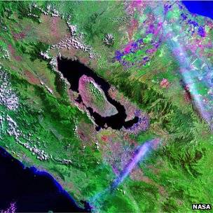
The crater at Mount Toba in Indonesia is itself now the site of a large lake
Some scientists have argued that the winter conditions this would have induced could have posed an immense challenge to early humans and have pointed to some genetic studies that indicated our ancestors likely experienced a dramatic drop in numbers - a population "bottleneck" - around the time of the eruption. The Oxford team reasoned that if this perturbation was so great, it ought to be evident in the sediments of Lake Malawi. This body of water is some 7,000km west of Toba in the East African Rift Valley, from where our Homo sapiens species emerged in the past 100,000 years or so. The lake is said to retain an excellent record of past climate change which can be inferred from the types and abundance of algae and other organic matter found in its bed muds.
Tens of metres of sediments have been drilled to retrieve cores, and it these recordings of past times that Dr Lane and colleagues examined. They identified tiny glass shards mixed in with the muds almost 30m below the lake bed. The shards represent small fragments of magma ejected from a volcano that have "frozen" in flight. "They're smaller than the diameter of a human hair, less than 100 microns in size," explains Dr Lane. "We find them by sieving the sediments in a very long process that goes through every centimetre of core." Chemical analysis ties the fragments to the Toba eruption.
Re-timed droughts
I told him probably within the next 50,000 years. He did not seem amused by a geological sense of time.
Mexico's National Disaster Prevention Center says the white-capped volcano spewed a plume of steam more than a half mile (1 kilometer) into the sky. The volcano shook during Saturday night, sometimes emitting glowing rock over the crater.
The government deployed soldiers and federal police to the area Sunday in the event of a bigger eruption, and officials closed off a seven-square-mile (18-square-kilometer) zone around the cone of the 17,886-foot (5,450-meter) volcano. State authorities prepared shelters.
Popocatepetl has put out small eruptions of ash almost daily since a round of activity began in 1994. The eruptions started strengthening two weeks ago and have increased even more this weekend.
Read more: Mexico readies shelters after volcano tremors increase, steam plume spews into sky | Fox News

At its epicenter, Thursday's 8.1 magnitude quake was stronger than the disaster three decades ago that killed at least 5,000 people in Mexico City, toppling two tower blocks in the historic central neighborhood of Tlatelolco. Mexico City has made major advances since then, with regular earthquake simulations, improved building regulations, and seismic alarms designed to sound long enough before the shock to give residents time to flee. Nearly 100 people are known to have died in the latest quake, none of them in the capital. Yet experts noted the tremor's epicenter was further from Mexico City and two times deeper than in 1985, and warned it would be wrong to assume the capital could now rest easy. Such caution was palpable in Tlatelolco.
Antonio Fonseca, 66, a longtime resident who witnessed the 1985 collapse of the tower blocks in the Nuevo Leon housing complex that killed at least 200 people, said memories of the event sparked panic attacks in the neighborhood when the quake rolled through the city on Thursday. "I'm quite sure that these buildings are very well reinforced," said Fonseca, a local history expert. "But there are many people who are still wary." When the ground began shaking in September 1985, local workers laughed it off at first, continuing with breakfast. Nobody believed Fonseca when he told them Nuevo Leon had fallen, he recalled. Later, Fonseca saw a group of children in the neighborhood's central Plaza de las Tres Culturas who had been waiting for the school bus, their uniforms caked in white dust from the building's collapse.
This time around, residents feared the worst. Streets filled across the city when the quake hit near midnight. Crying and praying, hundreds descended onto the plaza and some stayed for hours, questioning whether it was safe to return home. Minerva de la Paz Uribe, a retiree living on the plaza, was unable to evacuate with her father, who turned 104 the next day. She watched from her window as neighbors scrambled to escape. "People leave running with their dogs. They leave screaming. Are we prepared? No, no, we're not prepared," she said, as a group of friends on the plaza murmured in agreement.
Some 30 buildings in Tlatelolco were rebuilt after the 1985 disaster and a dozen were demolished. Mexico's new skyscrapers include hydraulic shock absorbers and deep foundations. But such safety features are less prevalent in much of the sprawling periphery, which is filled with cheap cinderblock homes like the buildings that collapsed on Thursday in the southern states of Oaxaca and Chiapas near the epicenter.
CRITICISM OF GOVERNMENT
Quake Pitches Past Into Present...
Quake Pitches Past Into Present in Scarred Mexico City District
Sept. 12, 2017) - The powerful earthquake that rocked Mexico City last week had terrifying echoes of a more deadly 1985 shock in one housing project, raising tough questions about how ready one of the world's largest cities is for a major catastrophe.
At its epicenter, Thursday's 8.1 magnitude quake was stronger than the disaster three decades ago that killed at least 5,000 people in Mexico City, toppling two tower blocks in the historic central neighborhood of Tlatelolco. Mexico City has made major advances since then, with regular earthquake simulations, improved building regulations, and seismic alarms designed to sound long enough before the shock to give residents time to flee. Nearly 100 people are known to have died in the latest quake, none of them in the capital. Yet experts noted the tremor's epicenter was further from Mexico City and two times deeper than in 1985, and warned it would be wrong to assume the capital could now rest easy. Such caution was palpable in Tlatelolco.
Antonio Fonseca, 66, a longtime resident who witnessed the 1985 collapse of the tower blocks in the Nuevo Leon housing complex that killed at least 200 people, said memories of the event sparked panic attacks in the neighborhood when the quake rolled through the city on Thursday. "I'm quite sure that these buildings are very well reinforced," said Fonseca, a local history expert. "But there are many people who are still wary." When the ground began shaking in September 1985, local workers laughed it off at first, continuing with breakfast. Nobody believed Fonseca when he told them Nuevo Leon had fallen, he recalled. Later, Fonseca saw a group of children in the neighborhood's central Plaza de las Tres Culturas who had been waiting for the school bus, their uniforms caked in white dust from the building's collapse.
This time around, residents feared the worst. Streets filled across the city when the quake hit near midnight. Crying and praying, hundreds descended onto the plaza and some stayed for hours, questioning whether it was safe to return home. Minerva de la Paz Uribe, a retiree living on the plaza, was unable to evacuate with her father, who turned 104 the next day. She watched from her window as neighbors scrambled to escape. "People leave running with their dogs. They leave screaming. Are we prepared? No, no, we're not prepared," she said, as a group of friends on the plaza murmured in agreement.
Some 30 buildings in Tlatelolco were rebuilt after the 1985 disaster and a dozen were demolished. Mexico's new skyscrapers include hydraulic shock absorbers and deep foundations. But such safety features are less prevalent in much of the sprawling periphery, which is filled with cheap cinderblock homes like the buildings that collapsed on Thursday in the southern states of Oaxaca and Chiapas near the epicenter.
CRITICISM OF GOVERNMENT
"Losing s0n.....because the world has determined that environmental alarmism is gay."A supervolcano eruption would be a very bad thing for our civilization but there is no real evidence currently that any of them are getting ready to pop any time soon.
There is something that presents a much more immanent threat in the area of 'earthquakes and volcanoes.
Fire and Ice: Melting Glaciers Trigger Earthquakes, Tsunamis and Volcanoes
Geologists Say Global Warming Expected to Cause Many New Seismic Events
(excerpts)
Climatologists have been raising alarms about global warming for years, and now geologists are getting into the act, warning that melting glaciers will lead to an increasing number of earthquakes, tsunamis and volcanic eruptions in unexpected places. Ice is extremely heavy—weighing about one ton per cubic meter—and glaciers are massive sheets of ice. When they are intact, glaciers exert enormous pressure on the portion of the Earth’s surface they cover. When glaciers begin to melt—as they are doing now at an increasingly rapid rate due to global warming—that pressure is reduced and eventually released. Geologists say releasing that pressure on the Earth’s surface will cause all sorts of geologic reactions, such as earthquakes, tsunamis (caused by undersea earthquakes) and volcanic eruptions. "What happens is the weight of this thick ice puts a lot of stress on the earth," said Patrick Wu, a geologist at the University of Alberta in Canada, in an interview with the Canadian Press. "The weight sort of suppresses the earthquakes, but when you melt the ice the earthquakes get triggered." Wu said melting ice in Antarctica is already triggering earthquakes and underwater landslides. These events aren’t getting much attention, but they are early warnings of the more serious events that scientists believe are coming. According to Wu, global warming will create “lots of earthquakes.” Writing in New Scientist magazine, Bill McGuire, professor of geological hazards at University College in London, said: "All over the world evidence is stacking up that changes in global climate can and do affect the frequencies of earthquakes, volcanic eruptions and catastrophic sea-floor landslides. Not only has this happened several times throughout Earth's history, the evidence suggests it is happening again."
(In accordance with Title 17 U.S.C. Section 107, this material is distributed without profit to those who have expressed a prior interest in receiving the included information for research and educational purposes.)

Losing s0n.....because the world has determined that environmental alarmism is gay.