Arctic sea ice hits record low

ScienceRocks

Democrat all the way!
Mar 16, 2010
59,455
6,793
1,900
The Good insane United states of America
Arctic sea ice hits record low


19 March 2015
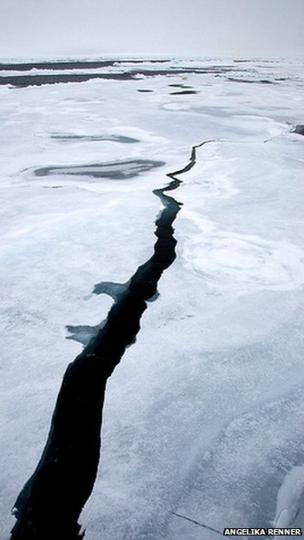
_81781073_leads_seaice_small.jpg

Sea ice in the Arctic Ocean has fallen to the lowest recorded level for the winter season, according to US scientists.
The maximum this year was 14.5 million sq km, said the National Snow and Ice Data Center at the University of Colorado in Boulder.
This is the lowest since 1979, when satellite records began.
A recent study found that Arctic sea ice had thinned by 65% between 1975 and 2012.
Bob Ward of the Grantham Research Institute on Climate Change and the Environment at the London School of Economics said: "The gradual disappearance of ice is having profound consequences for people, animals and plants in the polar regions, as well as around the world, through sea level rise."
The National Snow and Ice Data Center (NSIDC) said the maximum level of sea ice for winter was reached this year on 25 February and the ice was now beginning to melt as the Arctic moved into spring.


http://m.bbc.co.uk/n...onment-31976749

We will just have to see if this results into a record low in September.
 
There is actually satellite data from the early 1970's until 1979, which shows that the AGW crowd chooses to ignore. Why? Does not fit their meme.

There is even data from NIMBUS satellites back to the 1960's.
 
Of course, if we put the pre-satellite data in ...it shows the melt starting around 1970. Again, supporting AGW theory. Oops. Deniers get busted in another outright lie. Same old same old.

Arctic sea ice before satellites Icelights Your Burning Questions About Ice Climate

mean_anomaly_1953-2010-300x190.png


You know, if all the data didn't contradict you deniers, you wouldn't have to always lie about it. The fact that you do always lie about it speaks volumes about your motivation.
 
Image 2 of 4 (play slideshow) Download

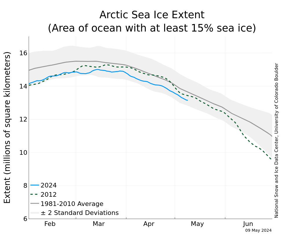
N_stddev_timeseries.png


Arctic Sea Ice News and Analysis Sea ice data updated daily with one-day lag

Northern Hemisphere Sea Ice Area

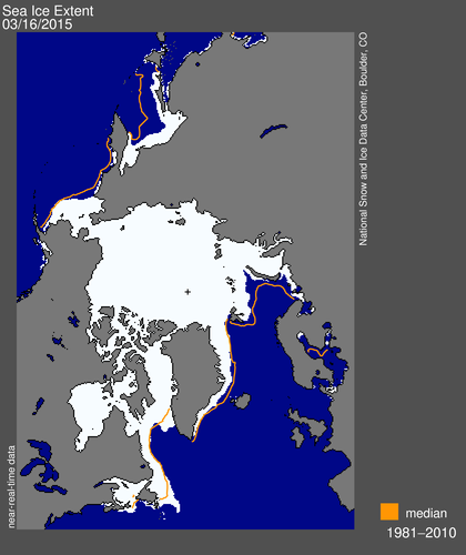
2015 Arctic Sea Ice Maximum Annual Extent Is Lowest On Record NASA

2015 Arctic Sea Ice Maximum Annual Extent Is Lowest On Record

March 19, 2015

The sea ice cap of the Arctic appeared to reach its annual maximum winter extent on Feb. 25, according to data from the NASA-supported National Snow and Ice Data Center (NSIDC) at the University of Colorado, Boulder. At 5.61 million square miles (14.54 million square kilometers), this year’s maximum extent was the smallest on the satellite record and also one of the earliest.

Looks like a lot of other people think this is the lowest maximum that we have experianced thus far.
 
Of course, if we put the pre-satellite data in ...it shows the melt starting around 1970. Again, supporting AGW theory. Oops. Deniers get busted in another outright lie. Same old same old.

Arctic sea ice before satellites Icelights Your Burning Questions About Ice Climate

mean_anomaly_1953-2010-300x190.png


You know, if all the data didn't contradict you deniers, you wouldn't have to always lie about it. The fact that you do always lie about it speaks volumes about your motivation.


Pre satellite data is not the same as satellite data, for obvious reasons, so apples / oranges. But as I mentioned, there is satellite data back to the 1960's with NIMBUS.

There is also a problem wit that chart where pre satellite meets satellite.
 
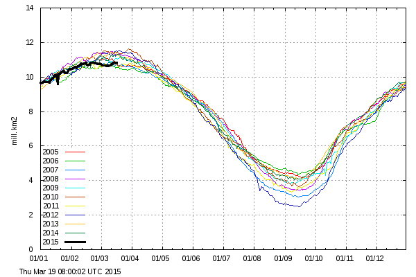
Again, not true. And the thick, multi-year ice has been increasing. The only real area with less ice in the Arctic isn't even in the Arctic Circle.

The only real deficiency is in the Sea of Okhotsk, which is just north of Japan and is not in the Arctic


osisaf_nh_iceextent_daily_5years.png
 
Last edited:
All we know for certain is that there is not a single lab experiment linking an additional wisp of CO2 to temperature increase or ice melt
 
excalibur said:
Pre satellite data is not the same as satellite data, for obvious reasons, so apples / oranges. But as I mentioned, there is satellite data back to the 1960's with NIMBUS.

There is also a problem wit that chart where pre satellite meets satellite.

First you say it's wrong _not_ to show the pre-satellite data. And then when I show it, you spin completely about and declare it's wrong to show the data.

Could you make up your mind?
 

Forum List

Back
Top