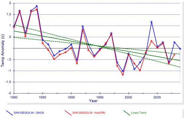
Established in 1929, no moves. San Diego has encroached on three sides, ocean on the other. Expanded runways, parking lot just yards away, jets taxi past it. Seems like a prime location for UHI. Right?
Any warmists out there want to make a stab at what the adjustments are? Perhaps one or two changes for equipment upgrade, and UHI compensation, right?
Obviously I wouldn't bring it up if it made sense would I? Does anyone here have a guess before I put up the numbers? Just an estimate of the size and direction. Anyone?
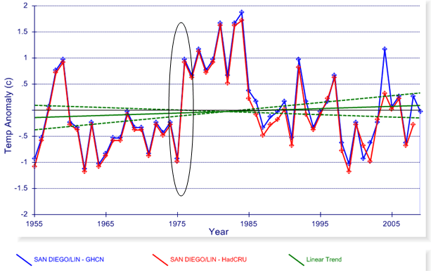