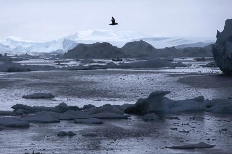
Old Rocks
Diamond Member
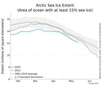
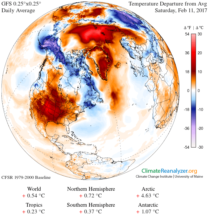
Intereresting to see how this is going to play out. In the meantime, temperatures over central Greenland have been as much as 20 F above normal. And the area of the Arctic Ice is taking a nosedive. Winds?
Arctic Sea Ice News & Analysis
Unusual Arctic warmth as north hemisphere shivers | Reuters
WASHINGTON (Reuters) - While much of the Northern Hemisphere has shivered in a cold snap in recent weeks, temperatures in the Arctic soared to unusually high levels, U.S. scientists reported.
Green Business
This strange atmospheric pattern is caused by natural variability and not by rising levels of greenhouse gases. However, it could affect Arctic ice which in turn may impact global warming, said Mark Serreze, director of the U.S. National Snow and Ice Data Center in Colorado.
"It's very warm over the Arctic, with air temperatures locally at 10 to 15 degrees F (5.6 to 8.4 degrees C) warmer than they should be in certain areas," Serreze said in a telephone interview on Monday.
This contrasts with record or near-record cold over much of the eastern United States and Canada, Europe and Asia for the last two weeks of December and the first days of January, the data center reported.
It's due to a large area of high pressure over the Arctic, and a big area of low pressure at the mid-latitudes, where much of the Northern Hemisphere's population is concentrated.
Usually these areas of differing air pressure would shift and mix in a phenomenon known as the Arctic oscillation. Instead, they've remained stationary in what scientists term a negative phase of the oscillation. A positive phase would have low pressure over the Arctic and high pressure over the mid-latitudes.
Serreze said that as of December, the oscillation was in the most extreme negative phase seen since modern record-keeping began in 1950.
"Normally the circulation of the atmosphere would mix these two (areas of varying air pressure) together, and it's not doing a very good job of that right now, so we have these blobs of warm air over the Arctic and these blobs of cold air over the mid-latitudes, just sitting there," he said.
The blobs appear to be starting to shift, a sign that the negative phase is weakening.