- May 20, 2009
- 144,297
- 66,654
- 2,330
That is simply a lie. There are enormous amounts of empirical evidence to be found in the IPCC's assessment reports. And if you want to make any prediction whatsoever - that global warming has ended, that it's tapering off or that the Earth will boil next week, you will need to use a model. Denier's universal rejection of computer models is simply one more in a long chain of indicators that they HAVE NO EVIDENCE to support the argument they've chosen to adopt.
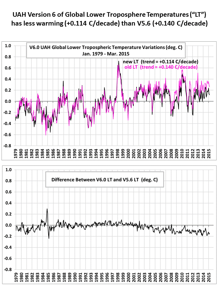
Altered data fed into a computer designed to show warming is still not evidence
Frank, I don't know with what level of conversation your intelligence qualifies you to participate, but this ain't it.
Still no evidence