daveman
Diamond Member
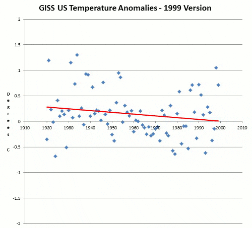
GISS Data Tampering Accounts For 100% Of US Warming
GISS used to show that the US cooled from 1930 through 1999, and that 1934 was much warmer than 1998. But they changed the graph to create the appearance of a non-existent warming trend.