- Mar 16, 2012
- 59,281
- 17,596
- 2,180
- Thread starter
- #781
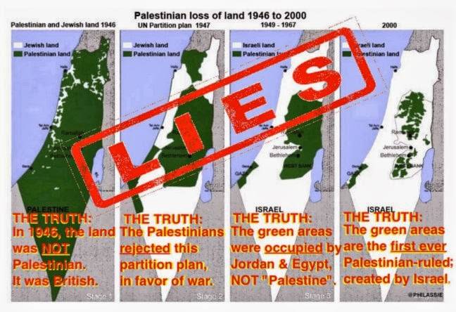
It is a 1946 map modified in 1956 by including some proposed borders that never became borders. If you look at the legend you can find the symbol for the international boundaries for Palestine.Even this Tinnie was not the land area original plan for the division the Jews were to be given(Given being the operative word here)a smaller amount of land......this map is for 1956.from a survey in 1946...I also note it was drawn up as a proposal ad-hoc committee/commission........The map is a Joke,steve.keep up the fight for justice and peace Tinnie...regards to the familySure.Does anybody know the borders of this Palestinian state that never existed in history? Ha ha ha ha.
It may be a 1956 map but it does show the original partition lines in green, so not that much of a joke.
The 1949 UN Armistice Agreements show that Palestine is still there and its international boundaries remained unchanged.
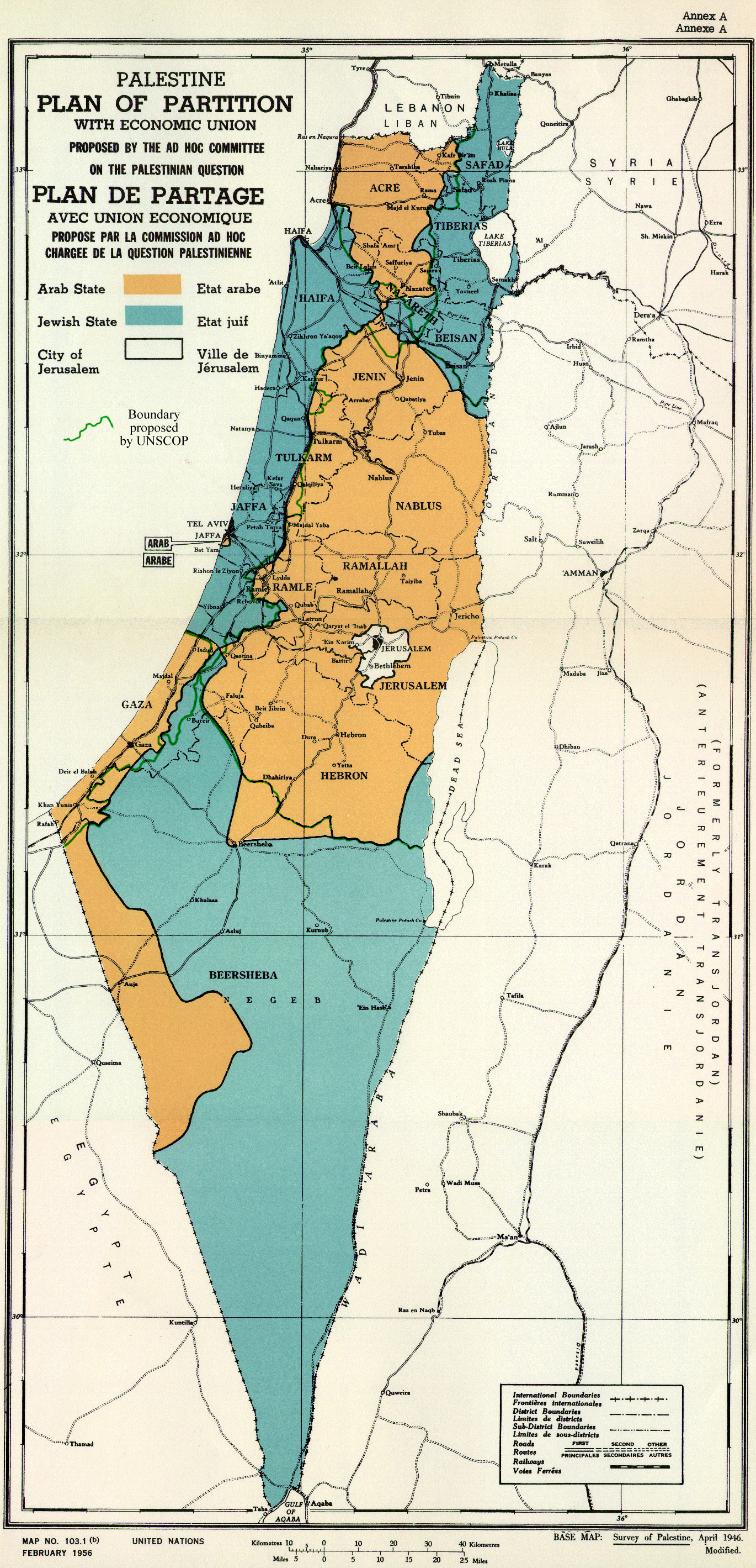
"Armistice" that means an Arab attack occurred. Those aren't Palestinian lands just areas that savage Arabs chopped off from what Israel was supposed to be. The Arabs did not attack Israel to create this mythical Palestine, just to destroy the Jewish state. Here is the intended division for Israel before the Arab attack.