
by directorblue @ Doug Ross Journal blog posts this:
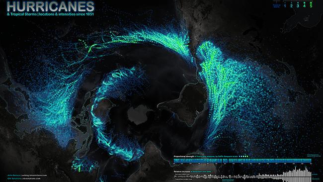
Spotted at Australia's Courier-Mail, stunning graphics created by information architect John Nelson map every tropical typhoon, cyclone and hurricane since 1851:
The storm map offers an unusual perspective of the Earth from below, centered on Antarctica, with the rest of the planet unfurling around the southern continent like flower petals.
While the Caribbean is the clear global hot spot for tropical storm activity, the major southern hemisphere active zone is across Australia's north, with cyclones forming everywhere between Mozambique and Tahiti...
Read more @ Doug Ross @ Journal: DAZZLING: Composite Hurricane Map: 1851 to 2010