
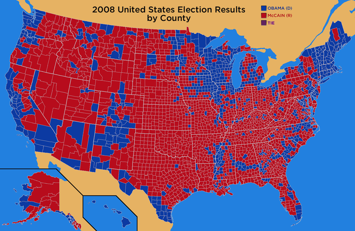
Not sure why they do it this way but Dave Leip's Atlas of U.S. Presidential Elections has a county-by-county breakdown of the 2008 election results:
Here is Wisconsin:
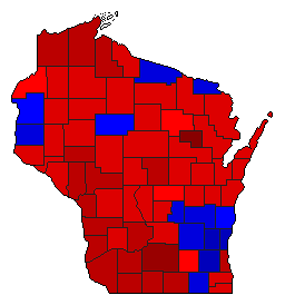
What gets me is that the Obama counties are in Red, the McCain Counties; they have in blue. Seems counter intuitive. Anyway, this just goes to show how comprehensive the President's lock on Wisconsin is.
Secondarily the fuller US map shows the big blob o' blue that the IL-WI border is bathed in--in this map, the blue is the normal color, for Democrats;
No, it's not counter-intuitive- it's much more accurate. Democrats are into wealth redistribution and socialism- like Communists, they are RED.
Seeing Obama win again will make you see red, that's for sure.
 Sorry to disappoint you, but No, it won't. It will not effect me in the slightest. My life will still be awesome. My wife, family, friends and employees will still love me, and I will still love them. I will be surprised though...