- Apr 1, 2011
- 169,942
- 47,187
- 2,180
Sorry, turd, but your claims are not facts, and plenty of credible people dispute the Chicken Little theory of AGW.There is no one reputable that disputes AGW.
It simply is scientific fact, we have increased CO2 in the atmosphere by about 40% and CO2 prevent some heat from radiating back out into space.
It is absolute fact.
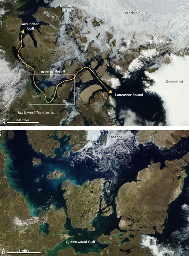
And anyone who remembers the USS Natilus traveling under the Arctic ice in the summer of 1958, will remember that until 2007 the whole Arctic Ocean was impossible to traverse, due to ice. Now you can. In 2007 was the first time you could do that in 10,000 years.
Who and how?
There is absolutely no question global warming is happening. The Northwest Passage opening for the first time in 10,000 years is proof enough of that.
So are you saying that is part of some natural cycle, even though we know that the natural ice age cycle is more like 120 thousand years long?
You are making no sense and giving no details to claims that look pretty silly on their own.