Navigation
Install the app
How to install the app on iOS
Follow along with the video below to see how to install our site as a web app on your home screen.

Note: This feature currently requires accessing the site using the built-in Safari browser.
More options
You are using an out of date browser. It may not display this or other websites correctly.
You should upgrade or use an alternative browser.
You should upgrade or use an alternative browser.
Great Castles Of Europe
- Thread starter mudwhistle
- Start date


- Thread starter
- #22
Warwick Castle, UK


Warwick Castle (/ˈwɒrɪk/ ( listen) WORR-ik) is a medieval castle developed from an original built by William the Conqueror in 1068. Warwick is the county town of Warwickshire, England, situated on a bend of the River Avon. The original wooden motte-and-bailey castle was rebuilt in stone in the 12th century. During the Hundred Years War, the facade opposite the town was refortified, resulting in one of the most recognisable examples of 14th century military architecture. It was used as a stronghold until the early 17th century, when it was granted to Sir Fulke Greville by James I in 1604. Greville converted it to a country house and it was owned by the Greville family, who became Earls of Warwick in 1759, until 1978 when it was bought by the Tussauds Group.
In 2007, the Tussauds Group was purchased by The Blackstone Group which merged it with Merlin Entertainments; Warwick Castle was then sold to Nick Leslau's investment firm Prestbury Group under a sale and leaseback agreement.[1] Merlin continues to operate the site under a renewable 35-year lease.[2][3]
Location

The 1834 Ordnance Survey shows the castle to the south of the town, next to the River Avon.
Warwick Castle is situated in the town of Warwick, on a sandstone bluff at a bend of the River Avon. The river, which runs below the castle on the east side, has eroded the rock the castle stands on, forming a cliff. The river and cliff form natural defences. When construction began in 1068, four houses belonging to the Abbot of Coventry were demolished to provide room. The castle's position made it strategically important in safeguarding the Midlands against rebellion.[4] During the 12th century, King Henry I was suspicious of Roger de Beaumont, 2nd Earl of Warwick. To counter the earl's influence, Henry bestowed Geoffrey de Clinton with a position of power rivalling that of the earl.[5] The lands he was given included Kenilworth – a castle of comparable size, cost, and importance,[6] founded by Clinton[7] – which is about 8 kilometres (5 mi) to the north. Warwick Castle is about 1.6 kilometres (1 mi) from Warwick railway station and less than 3.2 kilometres (2.0 mi) from junction 15 of the M40 motorway; it is also close to Birmingham Airport.[8]
History
Antecedent
An Anglo-Saxon burh was established on the site in 914; with fortifications instigated by Ethelfleda, daughter of Alfred the Great. The burh she established was one of ten which defended Mercia against the invading Danes. Its position allowed it to dominate the Fosse Way, as well as the river valley and the crossing over the River Avon. Though the motte to the south-west of the present castle is now called "Ethelfleda's Mound", it is in fact part of the later Norman fortifications, and not of Anglo-Saxon origin.[9]

Links
Warwick Castle - Wikipedia
Warwick Castle
Warwick Castle (/ˈwɒrɪk/ (
In 2007, the Tussauds Group was purchased by The Blackstone Group which merged it with Merlin Entertainments; Warwick Castle was then sold to Nick Leslau's investment firm Prestbury Group under a sale and leaseback agreement.[1] Merlin continues to operate the site under a renewable 35-year lease.[2][3]
Location

The 1834 Ordnance Survey shows the castle to the south of the town, next to the River Avon.
Warwick Castle is situated in the town of Warwick, on a sandstone bluff at a bend of the River Avon. The river, which runs below the castle on the east side, has eroded the rock the castle stands on, forming a cliff. The river and cliff form natural defences. When construction began in 1068, four houses belonging to the Abbot of Coventry were demolished to provide room. The castle's position made it strategically important in safeguarding the Midlands against rebellion.[4] During the 12th century, King Henry I was suspicious of Roger de Beaumont, 2nd Earl of Warwick. To counter the earl's influence, Henry bestowed Geoffrey de Clinton with a position of power rivalling that of the earl.[5] The lands he was given included Kenilworth – a castle of comparable size, cost, and importance,[6] founded by Clinton[7] – which is about 8 kilometres (5 mi) to the north. Warwick Castle is about 1.6 kilometres (1 mi) from Warwick railway station and less than 3.2 kilometres (2.0 mi) from junction 15 of the M40 motorway; it is also close to Birmingham Airport.[8]
History
Antecedent
An Anglo-Saxon burh was established on the site in 914; with fortifications instigated by Ethelfleda, daughter of Alfred the Great. The burh she established was one of ten which defended Mercia against the invading Danes. Its position allowed it to dominate the Fosse Way, as well as the river valley and the crossing over the River Avon. Though the motte to the south-west of the present castle is now called "Ethelfleda's Mound", it is in fact part of the later Norman fortifications, and not of Anglo-Saxon origin.[9]
Links
Warwick Castle - Wikipedia
Warwick Castle
- Thread starter
- #23
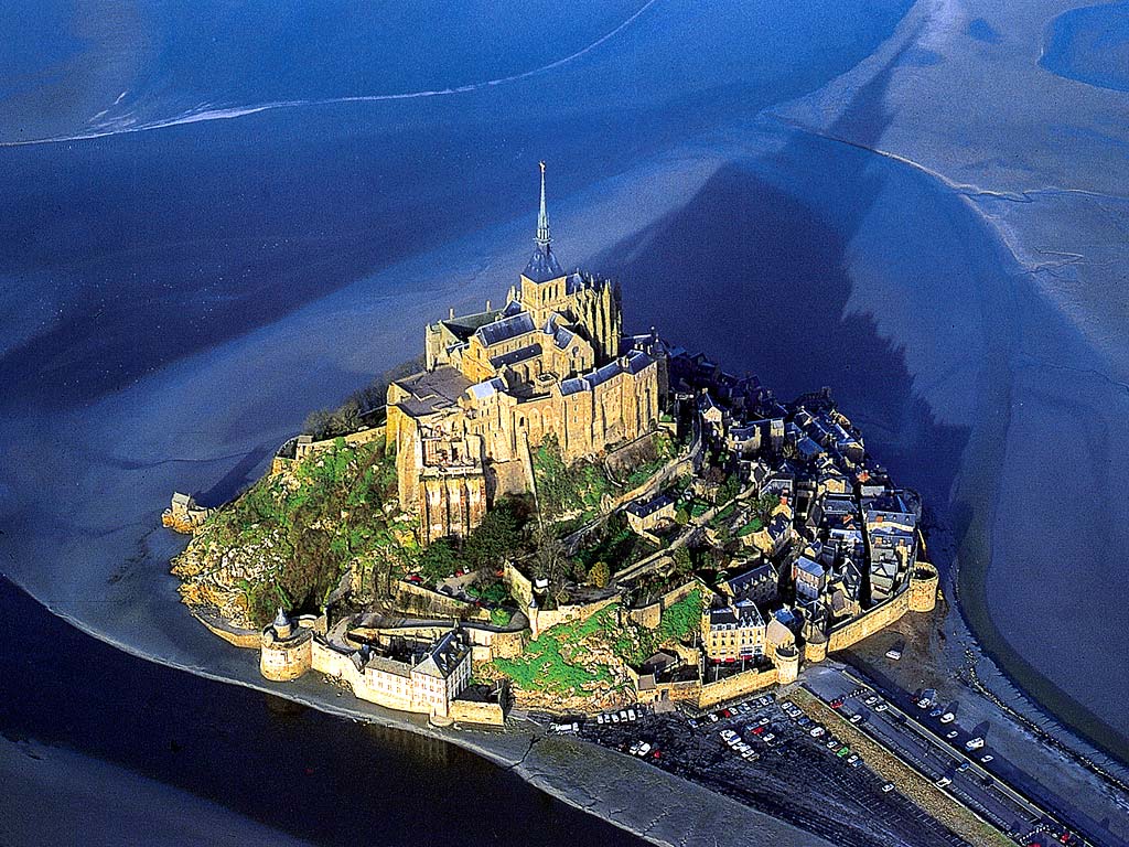
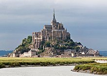
Mont Saint-Michel, France
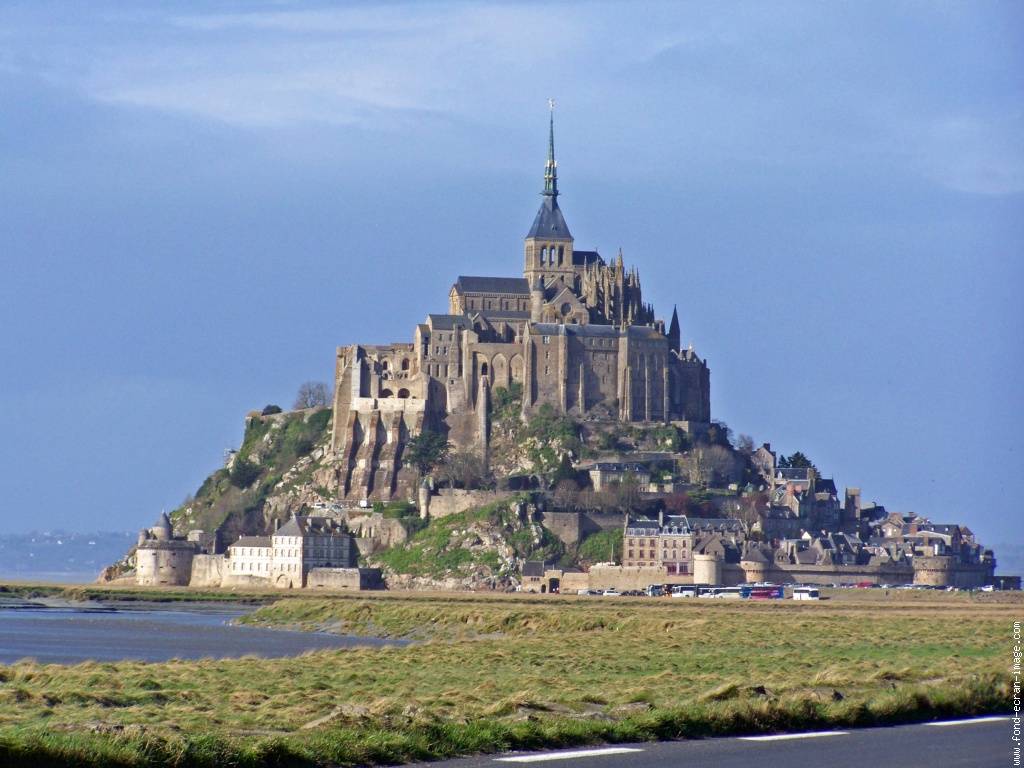
Le Mont-Saint-Michel (pronounced [lə mɔ̃ sɛ̃ mi.ʃɛl]; Norman: Mont Saint Miché, English: Saint Michael's Mount) is an island commune in Normandy, France. It is located about one kilometre (0.6 miles) off the country's northwestern coast, at the mouth of the Couesnon River near Avranches and is 100 hectares (247 acres) in size. As of 2009, the island has a population of 44.[1]
The island has held strategic fortifications since ancient times and since the 8th century AD has been the seat of the monastery from which it draws its name. The structural composition of the town exemplifies the feudal society that constructed it: on top, God, the abbey and monastery; below, the great halls; then stores and housing; and at the bottom, outside the walls, houses for fishermen and farmers.
The commune's position — on an island just 600 metres from land — made it accessible at low tide to the many pilgrims to its abbey, but defensible as an incoming tide stranded, drove off, or drowned would-be assailants. The Mont remained unconquered during the Hundred Years' War; a small garrison fended off a full attack by the English in 1433.[2] The reverse benefits of its natural defence were not lost on Louis XI, who turned the Mont into a prison. Thereafter the abbey began to be used more regularly as a jail during the Ancien Régime.
One of France's most recognizable landmarks, visited by more than 3 million people each year, Mont Saint-Michel and its bay are on the UNESCO list of World Heritage Sites.[3] Over 60 buildings within the commune are protected in France as monuments historiques.[4]
Formation
Now a rocky tidal island, the Mont occupied dry land in prehistoric times. As sea levels rose, erosion reshaped the coastal landscape, and several outcrops of granite emerged in the bay, having resisted the wear and tear of the ocean better than the surrounding rocks. These included Lillemer, the Mont-Dol, Tombelaine (the island just to the north), and Mont Tombe, later called Mont Saint-Michel.
Mont Saint-Michel consists of leucogranite, which solidified from an underground intrusion of molten magma about 525 million years ago, during the Cambrian period, as one of the younger parts of the Mancellian granitic batholith.[5] (Early studies of Mont Saint-Michel by French geologists sometimes describe the leucogranite of the Mont as "granulite", but this granitic meaning of granulite is now obsolete).[6]
The Mont has a circumference of about 960 metres (3,150 ft) and its highest point is 92 metres (302 ft) above sea level.[7]
Tides
The tides can vary greatly, at roughly 14 metres (46 ft) between high and low water marks. Popularly nicknamed "St. Michael in peril of the sea" by medieval pilgrims making their way across the flats, the mount can still pose dangers for visitors who avoid the causeway and attempt the hazardous walk across the sands from the neighbouring coast.
Polderisation and occasional flooding have created salt marsh meadows that were found to be ideally suited to grazing sheep. The well-flavoured meat that results from the diet of the sheep in the pré salé (salt meadow) makes agneau de pré-salé (salt meadow lamb), a local specialty that may be found on the menus of restaurants that depend on income from the many visitors to the mount.
Tidal island

Low tide in 2005

Mont Saint-Michel in 2014 with the new bridge
The connection between Mont Saint-Michel and the mainland has changed over the centuries. Previously connected by a tidal causeway (a path uncovered only at low tide), this was converted into a raised (permanently dry) causeway in 1879, preventing the tide from scouring the silt around the mount. The coastal flats have also been polderised to create pastureland, decreasing the distance between the shore and the island, and the Couesnon River has been canalised, reducing the dispersion of the flow of water. These factors all encouraged silting-up of the bay.
On 16 June 2006, the French prime minister and regional authorities announced a €164 million project (Projet Mont-Saint-Michel)[8] to build a hydraulic dam using the waters of the river Couesnon and the tides to help remove the accumulated silt, and to make Mont Saint-Michel an island again.
The construction of the dam began in 2009. The project also includes the removal of the causeway and its visitor car park. Since 28 April 2012 the new car park on the mainland has been located 2.5 kilometres (1.6 miles) from the island. Visitors can walk or use shuttles to cross the causeway.
On 22 July 2014 the new bridge by architect Dietmar Feichtinger was opened to the public. The light bridge allows the waters to flow freely around the island and improves the efficiency of the now operational dam. The project which cost €209 million was officially opened by President François Hollande.[9]
On rare occasions tidal circumstances produce an extremely high 'supertide'. The new bridge was completely submerged on 21 March 2015, by the highest sea level for at least 18 years, as crowds gathered to snap photos.[10]
History
The original site was founded by an Irish hermit who gathered a following from the local community. Mont Saint-Michel was used in the sixth and seventh centuries as an Armorican stronghold of Gallo-Roman culture and power until it was ransacked by the Franks, thus ending the trans-channel culture that had stood since the departure of the Romans in 460. From roughly the fifth to the eighth century, Mont Saint-Michel belonged to the territory of Neustria, and in the early ninth century was an important place in the marches of Neustria.
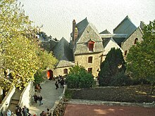
Inside the walls of Mont Saint-Michel
Before the construction of the first monastic establishment in the 8th century, the island was called Mont Tombe (Latin: tumba). According to legend, the archangel Michael appeared in 708 to Aubert of Avranches, the bishop of Avranches, and instructed him to build a church on the rocky islet.[11]
Unable to defend his kingdom against the assaults of the Vikings, the king of the Franks agreed to grant the Cotentin peninsula and the Avranchin, including Mont Saint-Michel traditionally linked to the city of Avranches, to the Bretons in the Treaty of Compiègne (867). This marked the beginning of the brief period of Breton possession of the Mont. In fact, these lands and Mont Saint-Michel were never really included in the duchy of Brittany and remained independent bishoprics from the newly created Breton archbishopric of Dol. When Rollo confirmed Franco as archbishop of Rouen, these traditional dependences of the Rouen archbishopric were retained in it.
The mount gained strategic significance again in 933 when William I Longsword annexed the Cotentin Peninsula from the weakened Duchy of Brittany. This made the mount definitively part of Normandy, and is depicted in the Bayeux Tapestry, which commemorates the 1066 Norman conquest of England. Harold Godwinson is pictured on the tapestry rescuing two Norman knights from the quicksand in the tidal flats during a battle with Conan II, Duke of Brittany. Norman ducal patronage financed the spectacular Norman architecture of the abbey in subsequent centuries.

Bayeux Tapestry scenes 16 and 17: William and Harold at Mont Saint-Michel (at top centre); Harold rescuing knights from quicksand
In 1067, the monastery of Mont Saint-Michel gave its support to William the Conqueror in his claim to the throne of England. This he rewarded with properties and grounds on the English side of the Channel, including a small island off the southwestern coast of Cornwall which was modelled after the Mount and became a Norman priory named St Michael's Mount of Penzance.

Cannons abandoned by Thomas de Scales, 7th Baron Scales at Mont Saint-Michel on June 17, 1434. As of June 2013, only the second cannon, the one closer to the wall, is on display inside the entrance to the Mont's outer wall.
During the Hundred Years' War, the Kingdom of England made repeated assaults on the island but were unable to seize it due to the abbey's improved fortifications. The English initially besieged the Mont in 1423–24, and then again in 1433–34 with English forces under the command of Thomas de Scales, 7th Baron Scales. Two wrought-iron bombards that Scales abandoned when he gave up his siege are still on site. They are known as les Michelettes. Mont Saint-Michel's resolute resistance inspired the French, especially Joan of Arc.
When Louis XI of France founded the Order of Saint Michael in 1469, he intended that the abbey church of Mont Saint-Michel become the chapel for the Order, but because of its great distance from Paris, his intention could never be realised.
Mont Saint-Michel
Mont Saint-Michel
UNESCO World Heritage Site
Official name Mont Saint-Michel and its Bay
Location Manche, canton of Pontorson, France
Coordinates
 48°38′09″N 1°30′37″W
Area 3.97 km2 (42,700,000 sq ft)
Criteria Cultural: i, iii, vi
Reference 80
Inscription 1979 (3rd Session)
Website www.ot-montsaintmichel.com/index.htm?lang=en


Location of Mont Saint-Michel
[edit on Wikidata]
The wealth and influence of the abbey extended to many daughter foundations, including St. Michael's Mount in Cornwall. However, its popularity and prestige as a centre of pilgrimage waned with the Reformation, and by the time of the French Revolution there were scarcely any monks in residence. The abbey was closed and converted into a prison, initially to hold clerical opponents of the republican regime. High-profile political prisoners followed, but by 1836, influential figures—including Victor Hugo—had launched a campaign to restore what was seen as a national architectural treasure. The prison was finally closed in 1863, and the mount was declared a historic monument in 1874. Mont Saint-Michel and its bay were added to the UNESCO list of World Heritage Sites in 1979, and it was listed with criteria such as cultural, historical, and architectural significance, as well as human-created and natural beauty.[3]
Links
Mont Saint-Michel - Wikipedia
Site officiel de loffice de tourisme du mont saint michel - Home page
Mont Saint-Michel
Le Mont-Saint-Michel (pronounced [lə mɔ̃ sɛ̃ mi.ʃɛl]; Norman: Mont Saint Miché, English: Saint Michael's Mount) is an island commune in Normandy, France. It is located about one kilometre (0.6 miles) off the country's northwestern coast, at the mouth of the Couesnon River near Avranches and is 100 hectares (247 acres) in size. As of 2009, the island has a population of 44.[1]
The island has held strategic fortifications since ancient times and since the 8th century AD has been the seat of the monastery from which it draws its name. The structural composition of the town exemplifies the feudal society that constructed it: on top, God, the abbey and monastery; below, the great halls; then stores and housing; and at the bottom, outside the walls, houses for fishermen and farmers.
The commune's position — on an island just 600 metres from land — made it accessible at low tide to the many pilgrims to its abbey, but defensible as an incoming tide stranded, drove off, or drowned would-be assailants. The Mont remained unconquered during the Hundred Years' War; a small garrison fended off a full attack by the English in 1433.[2] The reverse benefits of its natural defence were not lost on Louis XI, who turned the Mont into a prison. Thereafter the abbey began to be used more regularly as a jail during the Ancien Régime.
One of France's most recognizable landmarks, visited by more than 3 million people each year, Mont Saint-Michel and its bay are on the UNESCO list of World Heritage Sites.[3] Over 60 buildings within the commune are protected in France as monuments historiques.[4]
Formation
Now a rocky tidal island, the Mont occupied dry land in prehistoric times. As sea levels rose, erosion reshaped the coastal landscape, and several outcrops of granite emerged in the bay, having resisted the wear and tear of the ocean better than the surrounding rocks. These included Lillemer, the Mont-Dol, Tombelaine (the island just to the north), and Mont Tombe, later called Mont Saint-Michel.
Mont Saint-Michel consists of leucogranite, which solidified from an underground intrusion of molten magma about 525 million years ago, during the Cambrian period, as one of the younger parts of the Mancellian granitic batholith.[5] (Early studies of Mont Saint-Michel by French geologists sometimes describe the leucogranite of the Mont as "granulite", but this granitic meaning of granulite is now obsolete).[6]
The Mont has a circumference of about 960 metres (3,150 ft) and its highest point is 92 metres (302 ft) above sea level.[7]
Tides
The tides can vary greatly, at roughly 14 metres (46 ft) between high and low water marks. Popularly nicknamed "St. Michael in peril of the sea" by medieval pilgrims making their way across the flats, the mount can still pose dangers for visitors who avoid the causeway and attempt the hazardous walk across the sands from the neighbouring coast.
Polderisation and occasional flooding have created salt marsh meadows that were found to be ideally suited to grazing sheep. The well-flavoured meat that results from the diet of the sheep in the pré salé (salt meadow) makes agneau de pré-salé (salt meadow lamb), a local specialty that may be found on the menus of restaurants that depend on income from the many visitors to the mount.
Tidal island

Low tide in 2005

Mont Saint-Michel in 2014 with the new bridge
The connection between Mont Saint-Michel and the mainland has changed over the centuries. Previously connected by a tidal causeway (a path uncovered only at low tide), this was converted into a raised (permanently dry) causeway in 1879, preventing the tide from scouring the silt around the mount. The coastal flats have also been polderised to create pastureland, decreasing the distance between the shore and the island, and the Couesnon River has been canalised, reducing the dispersion of the flow of water. These factors all encouraged silting-up of the bay.
On 16 June 2006, the French prime minister and regional authorities announced a €164 million project (Projet Mont-Saint-Michel)[8] to build a hydraulic dam using the waters of the river Couesnon and the tides to help remove the accumulated silt, and to make Mont Saint-Michel an island again.
The construction of the dam began in 2009. The project also includes the removal of the causeway and its visitor car park. Since 28 April 2012 the new car park on the mainland has been located 2.5 kilometres (1.6 miles) from the island. Visitors can walk or use shuttles to cross the causeway.
On 22 July 2014 the new bridge by architect Dietmar Feichtinger was opened to the public. The light bridge allows the waters to flow freely around the island and improves the efficiency of the now operational dam. The project which cost €209 million was officially opened by President François Hollande.[9]
On rare occasions tidal circumstances produce an extremely high 'supertide'. The new bridge was completely submerged on 21 March 2015, by the highest sea level for at least 18 years, as crowds gathered to snap photos.[10]
History
The original site was founded by an Irish hermit who gathered a following from the local community. Mont Saint-Michel was used in the sixth and seventh centuries as an Armorican stronghold of Gallo-Roman culture and power until it was ransacked by the Franks, thus ending the trans-channel culture that had stood since the departure of the Romans in 460. From roughly the fifth to the eighth century, Mont Saint-Michel belonged to the territory of Neustria, and in the early ninth century was an important place in the marches of Neustria.
.jpg)
Inside the walls of Mont Saint-Michel
Before the construction of the first monastic establishment in the 8th century, the island was called Mont Tombe (Latin: tumba). According to legend, the archangel Michael appeared in 708 to Aubert of Avranches, the bishop of Avranches, and instructed him to build a church on the rocky islet.[11]
Unable to defend his kingdom against the assaults of the Vikings, the king of the Franks agreed to grant the Cotentin peninsula and the Avranchin, including Mont Saint-Michel traditionally linked to the city of Avranches, to the Bretons in the Treaty of Compiègne (867). This marked the beginning of the brief period of Breton possession of the Mont. In fact, these lands and Mont Saint-Michel were never really included in the duchy of Brittany and remained independent bishoprics from the newly created Breton archbishopric of Dol. When Rollo confirmed Franco as archbishop of Rouen, these traditional dependences of the Rouen archbishopric were retained in it.
The mount gained strategic significance again in 933 when William I Longsword annexed the Cotentin Peninsula from the weakened Duchy of Brittany. This made the mount definitively part of Normandy, and is depicted in the Bayeux Tapestry, which commemorates the 1066 Norman conquest of England. Harold Godwinson is pictured on the tapestry rescuing two Norman knights from the quicksand in the tidal flats during a battle with Conan II, Duke of Brittany. Norman ducal patronage financed the spectacular Norman architecture of the abbey in subsequent centuries.

Bayeux Tapestry scenes 16 and 17: William and Harold at Mont Saint-Michel (at top centre); Harold rescuing knights from quicksand
In 1067, the monastery of Mont Saint-Michel gave its support to William the Conqueror in his claim to the throne of England. This he rewarded with properties and grounds on the English side of the Channel, including a small island off the southwestern coast of Cornwall which was modelled after the Mount and became a Norman priory named St Michael's Mount of Penzance.

Cannons abandoned by Thomas de Scales, 7th Baron Scales at Mont Saint-Michel on June 17, 1434. As of June 2013, only the second cannon, the one closer to the wall, is on display inside the entrance to the Mont's outer wall.
During the Hundred Years' War, the Kingdom of England made repeated assaults on the island but were unable to seize it due to the abbey's improved fortifications. The English initially besieged the Mont in 1423–24, and then again in 1433–34 with English forces under the command of Thomas de Scales, 7th Baron Scales. Two wrought-iron bombards that Scales abandoned when he gave up his siege are still on site. They are known as les Michelettes. Mont Saint-Michel's resolute resistance inspired the French, especially Joan of Arc.
When Louis XI of France founded the Order of Saint Michael in 1469, he intended that the abbey church of Mont Saint-Michel become the chapel for the Order, but because of its great distance from Paris, his intention could never be realised.
Mont Saint-Michel
Mont Saint-Michel

UNESCO World Heritage Site
Official name Mont Saint-Michel and its Bay
Location Manche, canton of Pontorson, France
Coordinates
Area 3.97 km2 (42,700,000 sq ft)
Criteria Cultural: i, iii, vi
Reference 80
Inscription 1979 (3rd Session)
Website www.ot-montsaintmichel.com/index.htm?lang=en

Location of Mont Saint-Michel
[edit on Wikidata]
The wealth and influence of the abbey extended to many daughter foundations, including St. Michael's Mount in Cornwall. However, its popularity and prestige as a centre of pilgrimage waned with the Reformation, and by the time of the French Revolution there were scarcely any monks in residence. The abbey was closed and converted into a prison, initially to hold clerical opponents of the republican regime. High-profile political prisoners followed, but by 1836, influential figures—including Victor Hugo—had launched a campaign to restore what was seen as a national architectural treasure. The prison was finally closed in 1863, and the mount was declared a historic monument in 1874. Mont Saint-Michel and its bay were added to the UNESCO list of World Heritage Sites in 1979, and it was listed with criteria such as cultural, historical, and architectural significance, as well as human-created and natural beauty.[3]
Links
Mont Saint-Michel - Wikipedia
Site officiel de loffice de tourisme du mont saint michel - Home page
Mont Saint-Michel
- Thread starter
- #24
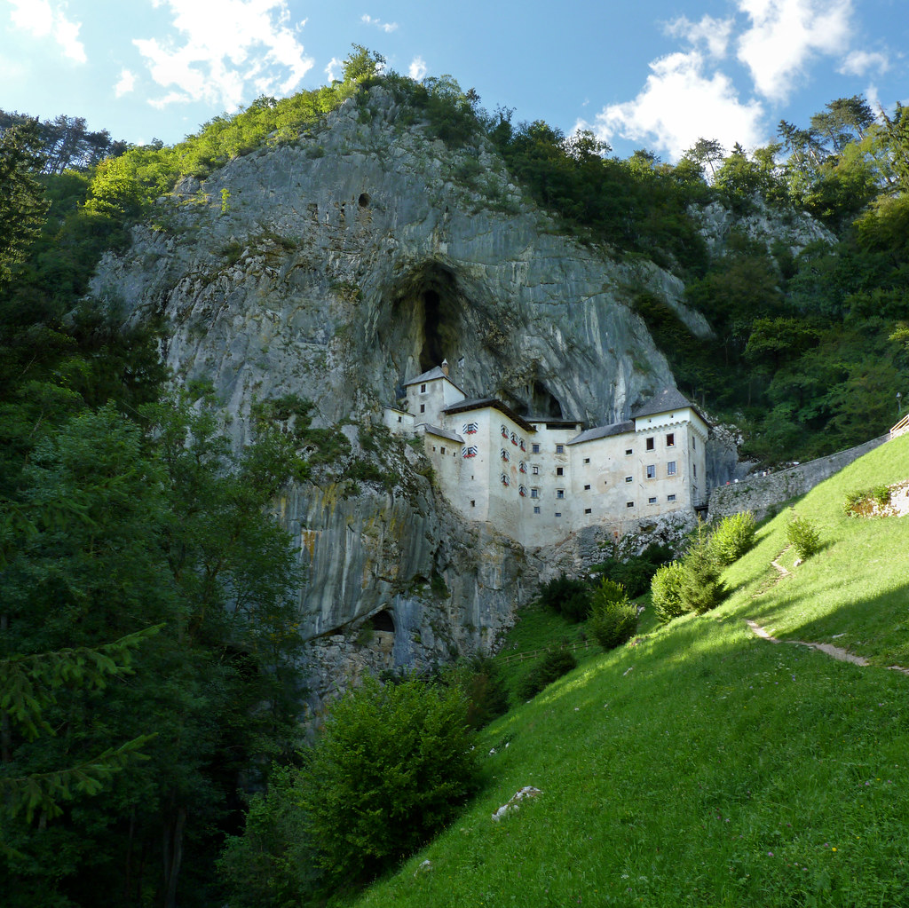
Predjama Castle, Slovenia
https://en.wikipedia.org/wiki/Slovenia

https://en.wikipedia.org/wiki/Slovenia
Predjama Castle (Slovene: Predjamski grad or grad Predjama, German: Höhlenburg Lueg, Italian: Castel Lueghi) is a Renaissance castle built within a cave mouth in south-central Slovenia, in the historical region of Inner Carniola. It is located in the village of Predjama, approximately 11 kilometres from the town of Postojna and 9 kilometres from Postojna Cave.[1]
History of the castle

1816 lithography of the castle by Karl Friedrich Schinkel
The castle was first mentioned in the year 1274 with the German name Luegg, when the Patriarch of Aquileia built the castle in Gothic style. The castle was built under a natural rocky arch high in the stone wall to make access to it difficult. It was later acquired and expanded by the Luegg noble family, also known as the Knights of Adelsberg (the German name of Postojna).
Legend of Erazem of Predjama

Cave of Predjama Castle
The castle became known as the seat of the knight Erazem Lueger (or Luegger), lord of the castle in the 15th century and a renowned robber baron. He was the son of the Imperial Governor of Trieste, Nikolaj Lueger.
According to legend, Erazem came into conflict with the Habsburgs when he killed the commander of the Imperial army, Marshall Pappenheim, who had offended the honour of Erazem's deceased friend, Andrej Baumkircher of Vipava. Fleeing the vengeance of the Holy Roman Emperor, Frederick III, Erazem reached the family fortress of Predjama. From there, he allied himself with King Matthias Corvinus and began to attack Habsburg estates and towns in Carniola. The emperor commissioned the governor of Trieste, Andrej Ravbar, with the capture or killing of Erazem. Erazem was killed after a long siege. Erazem was betrayed by one of his men and was killed by a shot from a cannon.[2]
After the reconstruction
After the siege and destruction of the original castle, its ruins were acquired by the Oberburg family. In 1511, the second castle, built by the Purgstall family in the first decade of the 16th century, was destroyed in an earthquake. In the year 1567, Archduke Charles of Austria leased the castle to baron Philipp von Cobenzl, who paid it off after 20 years. In 1570, the current castle was built in the Renaissance style, pressed next to a vertical cliff under the original Medieval fortification. The castle has remained in this form, virtually unchanged, to the present day.
In the 18th century, it became one of the favourite summer residences of the Cobenzl family. Both the Austrian statesman Philipp von Cobenzl and the diplomat Count Ludwig von Cobenzl spent time in the castle.
In 1810, the castle was inherited by Count Michael Coronini von Cronberg, and in 1846 it was sold to the Windischgrätz family, who remained its owners until the end of World War II, when it was nationalized by the Yugoslav Communist authorities and turned into a museum.
The hidden passageway
A vertical natural shaft leads out of the original castle, which Erazem ordered to be enlarged, and leads to the exit located at the top of the cliff, 25 meters away from the cliff's edge. This shaft allowed Erazem to secretly supply the castle with food in the time of the siege; he also used it to continue with his robberies.
Popular culture
Predjama Castle was used as the castle featured in the 1986 movie Armour of God by Golden Harvest starring Jackie Chan, Alan Tam, Rosamund Kwan and Lola Forner. It was also investigated for paranormal activity in a 2008 episode of Ghost Hunters International on the Sci Fi Channel. It was also the filming location of Laibach's Sympathy For The Devil cover's music video.
The multiplayer map "Castle" from the 2014 Counter-Strike: Global Offensive DLC, Operation Breakout, is based on Predjama Castle.

Links
Predjama Castle - Wikipedia
Predjama Castle - Culture of Slovenia
https://en.wikipedia.org/wiki/Slovenia
https://en.wikipedia.org/wiki/Slovenia
Predjama Castle (Slovene: Predjamski grad or grad Predjama, German: Höhlenburg Lueg, Italian: Castel Lueghi) is a Renaissance castle built within a cave mouth in south-central Slovenia, in the historical region of Inner Carniola. It is located in the village of Predjama, approximately 11 kilometres from the town of Postojna and 9 kilometres from Postojna Cave.[1]
History of the castle

1816 lithography of the castle by Karl Friedrich Schinkel
The castle was first mentioned in the year 1274 with the German name Luegg, when the Patriarch of Aquileia built the castle in Gothic style. The castle was built under a natural rocky arch high in the stone wall to make access to it difficult. It was later acquired and expanded by the Luegg noble family, also known as the Knights of Adelsberg (the German name of Postojna).
Legend of Erazem of Predjama

Cave of Predjama Castle
The castle became known as the seat of the knight Erazem Lueger (or Luegger), lord of the castle in the 15th century and a renowned robber baron. He was the son of the Imperial Governor of Trieste, Nikolaj Lueger.
According to legend, Erazem came into conflict with the Habsburgs when he killed the commander of the Imperial army, Marshall Pappenheim, who had offended the honour of Erazem's deceased friend, Andrej Baumkircher of Vipava. Fleeing the vengeance of the Holy Roman Emperor, Frederick III, Erazem reached the family fortress of Predjama. From there, he allied himself with King Matthias Corvinus and began to attack Habsburg estates and towns in Carniola. The emperor commissioned the governor of Trieste, Andrej Ravbar, with the capture or killing of Erazem. Erazem was killed after a long siege. Erazem was betrayed by one of his men and was killed by a shot from a cannon.[2]
After the reconstruction
After the siege and destruction of the original castle, its ruins were acquired by the Oberburg family. In 1511, the second castle, built by the Purgstall family in the first decade of the 16th century, was destroyed in an earthquake. In the year 1567, Archduke Charles of Austria leased the castle to baron Philipp von Cobenzl, who paid it off after 20 years. In 1570, the current castle was built in the Renaissance style, pressed next to a vertical cliff under the original Medieval fortification. The castle has remained in this form, virtually unchanged, to the present day.
In the 18th century, it became one of the favourite summer residences of the Cobenzl family. Both the Austrian statesman Philipp von Cobenzl and the diplomat Count Ludwig von Cobenzl spent time in the castle.
In 1810, the castle was inherited by Count Michael Coronini von Cronberg, and in 1846 it was sold to the Windischgrätz family, who remained its owners until the end of World War II, when it was nationalized by the Yugoslav Communist authorities and turned into a museum.
The hidden passageway
A vertical natural shaft leads out of the original castle, which Erazem ordered to be enlarged, and leads to the exit located at the top of the cliff, 25 meters away from the cliff's edge. This shaft allowed Erazem to secretly supply the castle with food in the time of the siege; he also used it to continue with his robberies.
Popular culture
Predjama Castle was used as the castle featured in the 1986 movie Armour of God by Golden Harvest starring Jackie Chan, Alan Tam, Rosamund Kwan and Lola Forner. It was also investigated for paranormal activity in a 2008 episode of Ghost Hunters International on the Sci Fi Channel. It was also the filming location of Laibach's Sympathy For The Devil cover's music video.
The multiplayer map "Castle" from the 2014 Counter-Strike: Global Offensive DLC, Operation Breakout, is based on Predjama Castle.
Links
Predjama Castle - Wikipedia
Predjama Castle - Culture of Slovenia
- Thread starter
- #25
Hunyad Castle, Romania

Hunedoara (Romanian pronunciation: [huneˈdo̯ara]; German: Eisenmarkt; Hungarian: Vajdahunyad, Hungarian pronunciation: [ˈvɒjdɒhuɲɒd] ( listen)) is a city in Hunedoara County, Transylvania, Romania. It is located in southwestern Transylvania near the Poiana Ruscă Mountains, and administers five villages: Boș (Bós), Groș (Grós), Hășdat (Hosdát; Hochstätten), Peștișu Mare (Alpestes) and Răcăștia (Rákosd).
The city includes the most important Gothic-style secular building in Transylvania: the Hunyad Castle, which is closely connected with the Hunyadi family. The castle was destroyed by fire five times, but underwent many reconstructions from Austro-Hungarian and later Romanian authorities. Besides the castle, the town developed as a production center for iron and a market for the mountain regions nearby. During the 20th century, Hunedoara's population increased to 86,000 inhabitants. The city contained the largest steel works in Romania (until Galați took the lead), but activity gradually diminished after the fall of the Iron Curtain due to the loss of the market. This was a blow to the overall prosperity of the town, which is now recovering through new investments.
The population consists of a majority of Romanians, with Romani, Hungarians and Germans as the most important minorities. The city contains numerous parks, with poplars and chestnut trees flanking the streets. There are many tourist attractions, including a large dam, with tourist facilities, located a few kilometers from the city, in the mountains.

Etymology
The name of the town seems inexorably linked to the name of the Hunyadi family (also known as Corvinus). The most probable explanation for the Romanian name "Hunedoara" is the transliteration of the Hungarian name "Hunyadvár" meaning "Castle of Hunyad", as many Hungarian towns have this suffix. Historically, the following names were recorded: Hungnod (1265), Huniad (1278), Hwnyadwar (1409), Vayda Hunyadi (1575). The latter Hungarian name Vajdahunyad (voivode Hunyad) is a direct referral to John Hunyadi. The etymology of the Hunyadi family implies a Vlach (Romanian) origin.
History
Stone Age tools were discovered in the Sânpetru (Saint Peter) hill near the castle and in the surrounding villages. The region was very rich in iron, which had been extracted in the area since the Iron Age by Thracian tribes. The Dacian fortresses of Orăştie mountains, most notably Sarmiszegetusa, which became the most important religious and political center of Dacia, was located close to Hunedoara and was supplied by the iron produced here. The remains of eight Dacian iron furnaces have been found at the Sânpetru hill near the castle. The discovery of important monetary treasures of Dacian coins and Roman imperial coins testifies to the importance of the site.
After Dacia was conquered around 106 AD and turned into a Roman province, the iron-rich region attracted the attention of the Romans, who began to exploit it by building furnaces. A "Villa Rustica" emerged in Teliuc, a Roman fortification on Sanpetru hill, outpost of the famous legio XIII Gemina whose main castrum was at Apullum in Dacia. Other Roman artifacts were discovered in the city area, and also in Pestis, where the remains of a Roman village were discovered. The new capital city of the Roman province of Dacia, Ulpia Traiana Sarmizegetusa, was also situated in the proximity.
After the Roman military and administrative retreat during the Migration Period the region had no significant historic sites, although it may be possible that the iron activity continued. The ethnic structure of the region changed significantly, most notably with Goths, Huns, Slavs, Pechenegs, Magyars and Cumans.
There is an ongoing scholarly debate over the ethnicity of Transylvania's population before the Hungarian conquest (see Origin of the Romanians). After 1000, as part of Kingdom of Hungary, under Slavic influence small political feuds grew (ruled by knjazes). South of the Carpathians the Pechenegs and Cumans held political power, and Hunedoara acted as a buffer zone for the Hungarian Crown. In time, the Vlach populations in the mountains nearby developed an original highlander culture. Their land is called "Tara Padurenilor" (Woodlanders Country) and they began to dominate the area demographically. The region also had a sizable population of German Saxons, colonizers brought by the Hungarian Crown after the Mongol Invasion and later, Romani who migrated from the Indian subcontinent.
The first recorded evidence of the city was made in 1265 under the name Hungnod as a hub for leather tanning and wool processing. The city of Hunedoara became an important iron extracting and processing center in Transylvania. "Corpus Inscriptiorum Latinorum" refers to a local inhabitant as "natas ibi, ubi ferum nascitur", that is, "born where the iron was born". As the backbone for the manufacture of weapons and tools, the town industry was vital for the region.
The city has been known since the 14th century mainly as the residence of the Hunyadi family. On October 18, 1409, Voicu (Vajk in Hungarian, also referenced as Wojk in historical sources), was rewarded for military bravery by Sigismund of Luxembourg, and received the domain of Hunedoara and the title of Knyaz (a Slavic feudal title, see "Universitas Valachorum").
Voicu was a Wallachian, Christian Orthodox faith (later converted to the Roman Catholic Church) from the area of today's Argeş County (Wallachia). In a village called Corbi are the remains of a fortress attributed to Voicu.[1] Voicu's father, Şerban (recorded Serbe) migrated into Transylvania from Wallachia. This is attested by the Medieval writer Thuroczy who said "Quod ad genus tuum attinet, te ab ipsis vetustissimis Valachorum principibus originem ducere, patre natus Stephano Olacho, viro praestanti, cujus etiam aliqui tua familia Daciae Transalpinae, quae nunc Valachorum patria est, principes fuerint." He also continues later "inter quos Valachi gentiles tui minime postremos habent..."[2]
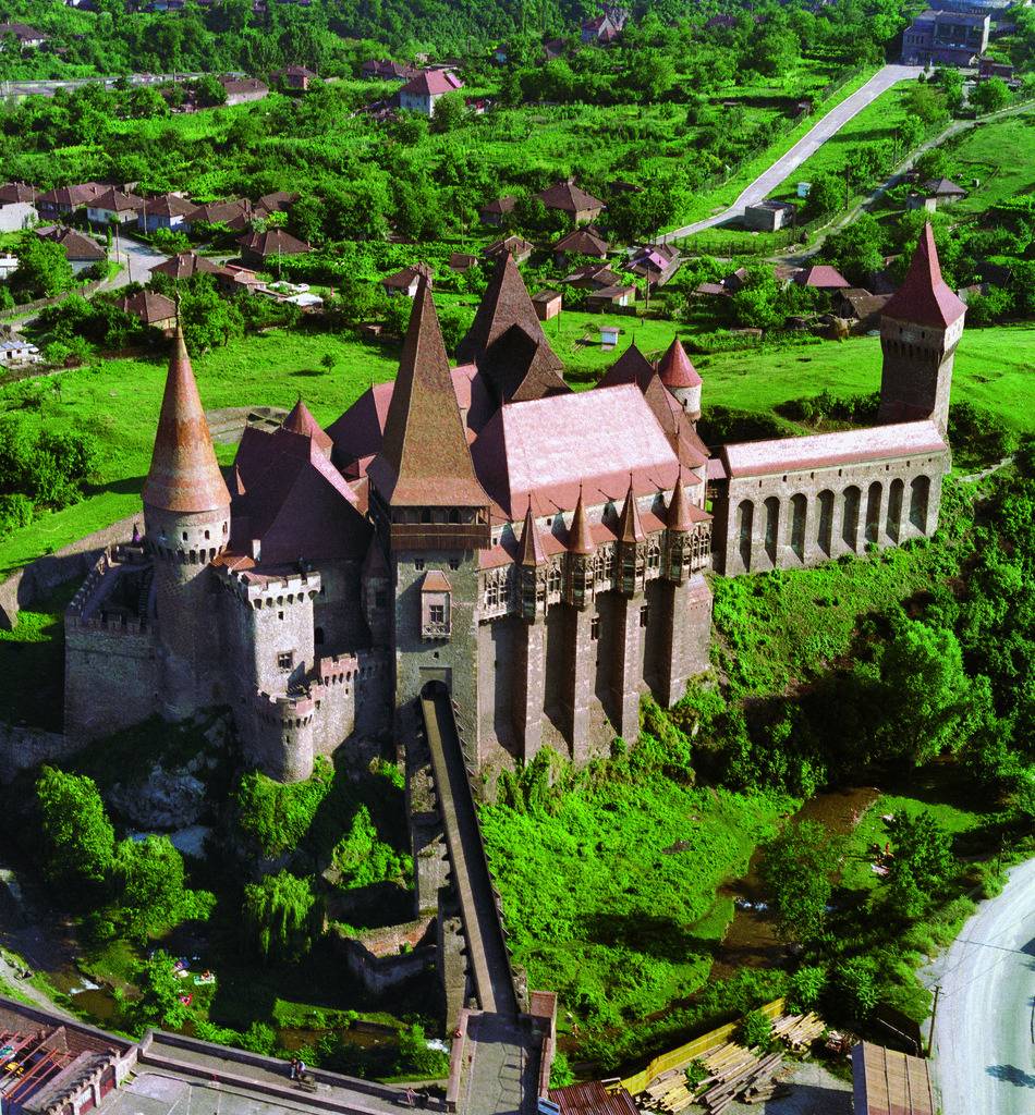
The same document that recorded Voicu's reward for military bravery by Sigismund of Luxembourg also mentions his three sons: Mogoş, Radu and Ioannus Corvinus (Hungarian: János Hunyadi; Romanian: Ioan de Hunedoara; English: John Hunyadi). Both names Mogoş[3] and Radu[4] are of Wallah origin, proving the ethnicity of Voicu once more. Ioannus Corvinus spent his childhood here. His mother was a Hungarian princess with Croatian origins. He married Erzsébet Szilágyi, a Hungarian noblewoman. Hunedoara received town privileges in 1448 from the King of Hungary. John Hunyadi consolidated the citadel on top of an ancient fortress, creating the two main halls, for Diet and Knights. A Franciscan abbey was built nearby the castle in 1448 and John of Capistrano, a famous Italian monk, was sent by the Pope to organize a crusade against the Turks, and lived in the castle. John of Capistrano became instrumental later in inciting the peasantry to crusade, starting from Frankfurt and marching towards Belgrade.
John Hunyadi was to become one of the heroes of the fight against the encroaching Ottoman Empire. He fought in the service of Sigismund, mastering military tactics in the Hussite Wars and the Italian republics, and became the most skillful warrior of Hungary. He was elevated and named Voivode (Prince) of Transylvania, which was at the time an autonomous part of the Kingdom of Hungary. Elected regent of Hungary, he formed a coalition with the principalities of Moldavia and Wallachia and engaged in crusades against the Turks to free Serbia and Bulgaria. The crusade, for a brief period, united the diverging forces of the Balkans, and the victories gained in battles managed to secure the Kingdom of Hungary from Ottoman occupation for over a century. Although he died in a military camp, his son Mátyás (Matthias) later became the most famous of Hungarian kings. Pope Aeneas Sylvius Piccolomini (Pope Pius II) called him Athleta Christi ("Christ's Champion") and The White Knight of Wallachia,[5] also writing "the Hungarians being occupied in the wars with the Turks under the leadership of Hunyadi, remained more as winners than as losers. This man was a Dacian (today we call them Valahi) and not of noble birth, but well learned in weapons, and was the first to show the Hungarians that the Turks could be defeated.". Statues of John Hunyadi can be found in Hunedoara and various other locations in Romania and Hungary.
In 1457 Matthias gave permission to the Wallachian serfs to build an orthodox church, beautifully decorated with paintings and preserved until today. He continued to consolidate the castle and the feudal domain of Hunedoara. The castle of Hunedoara became one of the biggest in the medieval world, standing as a witness to the greatness of his family of noble warriors and statesmen, in an era of war and despair for the region, as the Ottoman Empire approached Central Europe. In the times of Hunyadi rule, Hunedoara became a market (opidum) for iron. Matthias Corvinus named the city a tax-free area, and this privilege lasted until the 17th century. The population varied between 784 people in 1512 and 896 people in the 17th century. After Matthias died, Hunedoara passed to his son, John (Hungarian: János; Romanian: Ioan), but he too died young. His wife, Beatrice de Frangepan, married Georg of Hohenzollern, Marquis of Brandenburg in 1509. But Georg de Brandenburg would not reside in Hunedoara, instead appointed a representative, György Stolcz.

Hunedoara as depicted by Ludwig Rohbock (1820-1883)
In 1514, during the peasant revolt of György Dózsa, some were imprisoned in the castle and probably tortured. The town numbered 184 houses, a considerable size for the time, and was ruled by an appointed Orthodox priest. In 1528 a fire destroyed 124 houses. In 1534 as the Kingdom of Hungary was conquered by the Ottoman Turks, the castle was besieged during the rebellion of Czibak Imre, the bishop of Oradea and two years later John Zápolya donated the castle along with other possessions to Török Bálint making him the richest nobleman of Hungary. In 1557 Török János, a proselytizer of Reformation is mentioned to have killed his unfaithful wife Kendi Anna in the castle. In 1601 the castle was besieged by the Wallachian army of Michael the Brave in his campaign - while ruling Wallachia, Moldavia and Transylvania - against the Ottoman Empire, and to switch the Ottoman vassalage to the Habsburgs.
The town and the castle survived relatively unharmed by the Counter-Reformation of Giorgio Basta, general of the Habsburg Empire. By 1618, ownership of the castle passed to the Bethlen family. Gabriel Bethlen Voivode of Transylvania consolidated and enlarged the castle, and gave it to his nephew Stephen Betlen who lived here with his wife Mary Széchy, famed for her beauty.
The Reformed Church of Hungary was established in Hunedoara in 1634 and Imre Thököly, one the leaders of the Protestant anti-Habsburg uprising and later Prince of Transylvania owned the castle and spent much time living in it. By 1685, the castle passed into the possession of Michael Apafi, the pro-Habsburg Prince of Transylvania. In 1710, the old church was returned to the Franciscans, and in 1725 it reacquired it's monastic rank. By this time, the majority of population was Romanian.
Most of current Hunedoara was at that time a lush plain through which the Cerna river was meandering. The first blast furnace was built by 1603,[citation needed] followed by another four. The modern iron operations began at the foot of Saint Peter hill (Sanpetru), close to the most distant tower of the castle called Nebojša, (Serbian for "have no fear", a tower that was the furthest away from the castle in medieval times, to provide last refuge in the case of a siege; cf. Nebojša Tower). The mine shaft can still be viewed. Iron manufactures were also situated nearby.
In 1667 there was already a steel mill on the Cerna river producing 490 tons of pig iron and 66 tons of iron by 1699. In 1714 Georg Steinhilbert made a second one and a third was made in 1727. In 1743 the operations were handled directly by the Treasury. Of the mills mentioned, one was located under the main bridge and its walls are now in ruins.
The first tall industrial furnace in the world for iron extracting, it has been argued,[citation needed] was built in 1750 in Topliţa near Hunedoara, and a later one in Govăşdia in 1806. Both furnaces can be visited today. To reach it by road could only be through Teliucu Inferior (Alsótelek then) and Teliucu Superior (Felsőtelek then). Until 2001, there was a system of narrow-gauge railway built in the 19th and 20th centuries that ran from Hunedoara castle, near Zlaşti through a 747 and a 42 meter long tunnel through the mountain, and the breathtaking landscape of "Ţara Pădurenilor" (Woodlanders' country) before arriving to Govăjdia. It was dismantled and scrapped from Zlaşti to Govăjdia and Crăciuneasa by the last owner the Talc-Dolomită Zlaşti company. The last remaining 2.3 km (1.43 mi) long narrow-gauge rail system from the Hunedoara castle to Zlaşti was in use by the Talc-Dolomită Zlaşti company till 2007. In the summer of 2009 they have removed this last remaining section of this line. There are efforts now for restoring the train line for tourism purposes.
In the 18th and part of the 19th century, as the town of Hunedoara became more and more industrialized, peasants from regions nearby began to move to the city and the population increased. Only the German, Hungarian and Székelys of Transylvania were represented in the Diet (see Unio Trium Nationum). The Romanians who at the time formed about approx. 50% of the population felt exploited and revolted on several occasions. The peasants of Hunedoara county supported the Revolt of Horea, Cloşca and Crişan in 1784, when they unsuccessfully besieged the nearby fortress of Deva.
The castle in Hunedoara gave refuge to the local nobility, and it was its last function as military defense. Later representatives from the region were sent to the Romanian national assemblies held in Blaj during the 1848 Revolution where Romanians decided to demand equal rights and resist the attempt of Hungary of gaining independence from the Habsburg House. This started a small scale insurrection across Transylvania that was quickly quieted by the Hungarian army, except for the Apuseni Mountains, on the north of Hunedoara, where the tribune Avram Iancu struggled to keep the Hungarian forces away from controlling the gold mines. The subsequent failures of the later Austro-Hungarian monarchy to fulfill to the demands of the Romanians together with the Magyarization campaigns further exacerbated and alienated the Romanian population of Hunedoara.
During World War I the Romanians from Hunedoara county actively supported the Romanian Army and the Romanian National Assembly declared the Union of Transylvania with Romania in 1918. After the ending of the war Transylvania became part of Romania. The Romanian populations in and around the city quickly earned political rights and representation, and industrial development continued at an ever-increasing rate.
During World War II the steel works were part of the war effort for the Axis. The Romanian Army lost 700,000 soldiers on the Eastern Front and the Allies, an additional 400,000 soldiers fighting against the Axis.
After the Soviet occupation and the subsequent communist regime, industry was favored, and Hunedoara had for a time the biggest steel-producing plant in Romania and the Balkans. The city grew larger, and the factories extended so much that they equaled or exceeded the size of the city. The population also increased to over 87,000. The football team, Corvinul Hunedoara, was for a very long time one of the highest-rated football teams in Romania, rivaling Steaua or Dinamo. A large stadium was built along with other sports facilities such as covered swimming pools and a skating ring. Besides the Corvinul sports club, two other sport clubs were constructed, Constructorul and Siderurgistul, each offering different sport facilities. Other notable constructions included a theater house, several large cinemas, many schools and high-schools and an engineering faculty.

Winter 2012 near the Castle
The communist collapse meant that the old markets for steel vanished, and many enterprises had to be closed or abandoned. However, investment from Romanian and foreign capital ventures started offering new job opportunities for the people. Currently Arcelor-Mittal runs what is left of the steel works. The steel mill now operates the No. 2 Electric Steel Mill, Continuous Caster and the rolling mills. Production is scheduled to rise above 500,000 tons of steel in 2007 and beyond. The rest of the production facilities have been demolished or have been sold to private investors.
Links
Hunedoara - Wikipedia
Great Castles of Europe: Hunyad Castle
Hunedoara (Romanian pronunciation: [huneˈdo̯ara]; German: Eisenmarkt; Hungarian: Vajdahunyad, Hungarian pronunciation: [ˈvɒjdɒhuɲɒd] (
The city includes the most important Gothic-style secular building in Transylvania: the Hunyad Castle, which is closely connected with the Hunyadi family. The castle was destroyed by fire five times, but underwent many reconstructions from Austro-Hungarian and later Romanian authorities. Besides the castle, the town developed as a production center for iron and a market for the mountain regions nearby. During the 20th century, Hunedoara's population increased to 86,000 inhabitants. The city contained the largest steel works in Romania (until Galați took the lead), but activity gradually diminished after the fall of the Iron Curtain due to the loss of the market. This was a blow to the overall prosperity of the town, which is now recovering through new investments.
The population consists of a majority of Romanians, with Romani, Hungarians and Germans as the most important minorities. The city contains numerous parks, with poplars and chestnut trees flanking the streets. There are many tourist attractions, including a large dam, with tourist facilities, located a few kilometers from the city, in the mountains.
Etymology
The name of the town seems inexorably linked to the name of the Hunyadi family (also known as Corvinus). The most probable explanation for the Romanian name "Hunedoara" is the transliteration of the Hungarian name "Hunyadvár" meaning "Castle of Hunyad", as many Hungarian towns have this suffix. Historically, the following names were recorded: Hungnod (1265), Huniad (1278), Hwnyadwar (1409), Vayda Hunyadi (1575). The latter Hungarian name Vajdahunyad (voivode Hunyad) is a direct referral to John Hunyadi. The etymology of the Hunyadi family implies a Vlach (Romanian) origin.
History
Stone Age tools were discovered in the Sânpetru (Saint Peter) hill near the castle and in the surrounding villages. The region was very rich in iron, which had been extracted in the area since the Iron Age by Thracian tribes. The Dacian fortresses of Orăştie mountains, most notably Sarmiszegetusa, which became the most important religious and political center of Dacia, was located close to Hunedoara and was supplied by the iron produced here. The remains of eight Dacian iron furnaces have been found at the Sânpetru hill near the castle. The discovery of important monetary treasures of Dacian coins and Roman imperial coins testifies to the importance of the site.
After Dacia was conquered around 106 AD and turned into a Roman province, the iron-rich region attracted the attention of the Romans, who began to exploit it by building furnaces. A "Villa Rustica" emerged in Teliuc, a Roman fortification on Sanpetru hill, outpost of the famous legio XIII Gemina whose main castrum was at Apullum in Dacia. Other Roman artifacts were discovered in the city area, and also in Pestis, where the remains of a Roman village were discovered. The new capital city of the Roman province of Dacia, Ulpia Traiana Sarmizegetusa, was also situated in the proximity.
After the Roman military and administrative retreat during the Migration Period the region had no significant historic sites, although it may be possible that the iron activity continued. The ethnic structure of the region changed significantly, most notably with Goths, Huns, Slavs, Pechenegs, Magyars and Cumans.
There is an ongoing scholarly debate over the ethnicity of Transylvania's population before the Hungarian conquest (see Origin of the Romanians). After 1000, as part of Kingdom of Hungary, under Slavic influence small political feuds grew (ruled by knjazes). South of the Carpathians the Pechenegs and Cumans held political power, and Hunedoara acted as a buffer zone for the Hungarian Crown. In time, the Vlach populations in the mountains nearby developed an original highlander culture. Their land is called "Tara Padurenilor" (Woodlanders Country) and they began to dominate the area demographically. The region also had a sizable population of German Saxons, colonizers brought by the Hungarian Crown after the Mongol Invasion and later, Romani who migrated from the Indian subcontinent.
The first recorded evidence of the city was made in 1265 under the name Hungnod as a hub for leather tanning and wool processing. The city of Hunedoara became an important iron extracting and processing center in Transylvania. "Corpus Inscriptiorum Latinorum" refers to a local inhabitant as "natas ibi, ubi ferum nascitur", that is, "born where the iron was born". As the backbone for the manufacture of weapons and tools, the town industry was vital for the region.
The city has been known since the 14th century mainly as the residence of the Hunyadi family. On October 18, 1409, Voicu (Vajk in Hungarian, also referenced as Wojk in historical sources), was rewarded for military bravery by Sigismund of Luxembourg, and received the domain of Hunedoara and the title of Knyaz (a Slavic feudal title, see "Universitas Valachorum").
Voicu was a Wallachian, Christian Orthodox faith (later converted to the Roman Catholic Church) from the area of today's Argeş County (Wallachia). In a village called Corbi are the remains of a fortress attributed to Voicu.[1] Voicu's father, Şerban (recorded Serbe) migrated into Transylvania from Wallachia. This is attested by the Medieval writer Thuroczy who said "Quod ad genus tuum attinet, te ab ipsis vetustissimis Valachorum principibus originem ducere, patre natus Stephano Olacho, viro praestanti, cujus etiam aliqui tua familia Daciae Transalpinae, quae nunc Valachorum patria est, principes fuerint." He also continues later "inter quos Valachi gentiles tui minime postremos habent..."[2]
The same document that recorded Voicu's reward for military bravery by Sigismund of Luxembourg also mentions his three sons: Mogoş, Radu and Ioannus Corvinus (Hungarian: János Hunyadi; Romanian: Ioan de Hunedoara; English: John Hunyadi). Both names Mogoş[3] and Radu[4] are of Wallah origin, proving the ethnicity of Voicu once more. Ioannus Corvinus spent his childhood here. His mother was a Hungarian princess with Croatian origins. He married Erzsébet Szilágyi, a Hungarian noblewoman. Hunedoara received town privileges in 1448 from the King of Hungary. John Hunyadi consolidated the citadel on top of an ancient fortress, creating the two main halls, for Diet and Knights. A Franciscan abbey was built nearby the castle in 1448 and John of Capistrano, a famous Italian monk, was sent by the Pope to organize a crusade against the Turks, and lived in the castle. John of Capistrano became instrumental later in inciting the peasantry to crusade, starting from Frankfurt and marching towards Belgrade.
John Hunyadi was to become one of the heroes of the fight against the encroaching Ottoman Empire. He fought in the service of Sigismund, mastering military tactics in the Hussite Wars and the Italian republics, and became the most skillful warrior of Hungary. He was elevated and named Voivode (Prince) of Transylvania, which was at the time an autonomous part of the Kingdom of Hungary. Elected regent of Hungary, he formed a coalition with the principalities of Moldavia and Wallachia and engaged in crusades against the Turks to free Serbia and Bulgaria. The crusade, for a brief period, united the diverging forces of the Balkans, and the victories gained in battles managed to secure the Kingdom of Hungary from Ottoman occupation for over a century. Although he died in a military camp, his son Mátyás (Matthias) later became the most famous of Hungarian kings. Pope Aeneas Sylvius Piccolomini (Pope Pius II) called him Athleta Christi ("Christ's Champion") and The White Knight of Wallachia,[5] also writing "the Hungarians being occupied in the wars with the Turks under the leadership of Hunyadi, remained more as winners than as losers. This man was a Dacian (today we call them Valahi) and not of noble birth, but well learned in weapons, and was the first to show the Hungarians that the Turks could be defeated.". Statues of John Hunyadi can be found in Hunedoara and various other locations in Romania and Hungary.
In 1457 Matthias gave permission to the Wallachian serfs to build an orthodox church, beautifully decorated with paintings and preserved until today. He continued to consolidate the castle and the feudal domain of Hunedoara. The castle of Hunedoara became one of the biggest in the medieval world, standing as a witness to the greatness of his family of noble warriors and statesmen, in an era of war and despair for the region, as the Ottoman Empire approached Central Europe. In the times of Hunyadi rule, Hunedoara became a market (opidum) for iron. Matthias Corvinus named the city a tax-free area, and this privilege lasted until the 17th century. The population varied between 784 people in 1512 and 896 people in the 17th century. After Matthias died, Hunedoara passed to his son, John (Hungarian: János; Romanian: Ioan), but he too died young. His wife, Beatrice de Frangepan, married Georg of Hohenzollern, Marquis of Brandenburg in 1509. But Georg de Brandenburg would not reside in Hunedoara, instead appointed a representative, György Stolcz.

Hunedoara as depicted by Ludwig Rohbock (1820-1883)
In 1514, during the peasant revolt of György Dózsa, some were imprisoned in the castle and probably tortured. The town numbered 184 houses, a considerable size for the time, and was ruled by an appointed Orthodox priest. In 1528 a fire destroyed 124 houses. In 1534 as the Kingdom of Hungary was conquered by the Ottoman Turks, the castle was besieged during the rebellion of Czibak Imre, the bishop of Oradea and two years later John Zápolya donated the castle along with other possessions to Török Bálint making him the richest nobleman of Hungary. In 1557 Török János, a proselytizer of Reformation is mentioned to have killed his unfaithful wife Kendi Anna in the castle. In 1601 the castle was besieged by the Wallachian army of Michael the Brave in his campaign - while ruling Wallachia, Moldavia and Transylvania - against the Ottoman Empire, and to switch the Ottoman vassalage to the Habsburgs.
The town and the castle survived relatively unharmed by the Counter-Reformation of Giorgio Basta, general of the Habsburg Empire. By 1618, ownership of the castle passed to the Bethlen family. Gabriel Bethlen Voivode of Transylvania consolidated and enlarged the castle, and gave it to his nephew Stephen Betlen who lived here with his wife Mary Széchy, famed for her beauty.
The Reformed Church of Hungary was established in Hunedoara in 1634 and Imre Thököly, one the leaders of the Protestant anti-Habsburg uprising and later Prince of Transylvania owned the castle and spent much time living in it. By 1685, the castle passed into the possession of Michael Apafi, the pro-Habsburg Prince of Transylvania. In 1710, the old church was returned to the Franciscans, and in 1725 it reacquired it's monastic rank. By this time, the majority of population was Romanian.
Most of current Hunedoara was at that time a lush plain through which the Cerna river was meandering. The first blast furnace was built by 1603,[citation needed] followed by another four. The modern iron operations began at the foot of Saint Peter hill (Sanpetru), close to the most distant tower of the castle called Nebojša, (Serbian for "have no fear", a tower that was the furthest away from the castle in medieval times, to provide last refuge in the case of a siege; cf. Nebojša Tower). The mine shaft can still be viewed. Iron manufactures were also situated nearby.
In 1667 there was already a steel mill on the Cerna river producing 490 tons of pig iron and 66 tons of iron by 1699. In 1714 Georg Steinhilbert made a second one and a third was made in 1727. In 1743 the operations were handled directly by the Treasury. Of the mills mentioned, one was located under the main bridge and its walls are now in ruins.
The first tall industrial furnace in the world for iron extracting, it has been argued,[citation needed] was built in 1750 in Topliţa near Hunedoara, and a later one in Govăşdia in 1806. Both furnaces can be visited today. To reach it by road could only be through Teliucu Inferior (Alsótelek then) and Teliucu Superior (Felsőtelek then). Until 2001, there was a system of narrow-gauge railway built in the 19th and 20th centuries that ran from Hunedoara castle, near Zlaşti through a 747 and a 42 meter long tunnel through the mountain, and the breathtaking landscape of "Ţara Pădurenilor" (Woodlanders' country) before arriving to Govăjdia. It was dismantled and scrapped from Zlaşti to Govăjdia and Crăciuneasa by the last owner the Talc-Dolomită Zlaşti company. The last remaining 2.3 km (1.43 mi) long narrow-gauge rail system from the Hunedoara castle to Zlaşti was in use by the Talc-Dolomită Zlaşti company till 2007. In the summer of 2009 they have removed this last remaining section of this line. There are efforts now for restoring the train line for tourism purposes.
In the 18th and part of the 19th century, as the town of Hunedoara became more and more industrialized, peasants from regions nearby began to move to the city and the population increased. Only the German, Hungarian and Székelys of Transylvania were represented in the Diet (see Unio Trium Nationum). The Romanians who at the time formed about approx. 50% of the population felt exploited and revolted on several occasions. The peasants of Hunedoara county supported the Revolt of Horea, Cloşca and Crişan in 1784, when they unsuccessfully besieged the nearby fortress of Deva.
The castle in Hunedoara gave refuge to the local nobility, and it was its last function as military defense. Later representatives from the region were sent to the Romanian national assemblies held in Blaj during the 1848 Revolution where Romanians decided to demand equal rights and resist the attempt of Hungary of gaining independence from the Habsburg House. This started a small scale insurrection across Transylvania that was quickly quieted by the Hungarian army, except for the Apuseni Mountains, on the north of Hunedoara, where the tribune Avram Iancu struggled to keep the Hungarian forces away from controlling the gold mines. The subsequent failures of the later Austro-Hungarian monarchy to fulfill to the demands of the Romanians together with the Magyarization campaigns further exacerbated and alienated the Romanian population of Hunedoara.
During World War I the Romanians from Hunedoara county actively supported the Romanian Army and the Romanian National Assembly declared the Union of Transylvania with Romania in 1918. After the ending of the war Transylvania became part of Romania. The Romanian populations in and around the city quickly earned political rights and representation, and industrial development continued at an ever-increasing rate.
During World War II the steel works were part of the war effort for the Axis. The Romanian Army lost 700,000 soldiers on the Eastern Front and the Allies, an additional 400,000 soldiers fighting against the Axis.
After the Soviet occupation and the subsequent communist regime, industry was favored, and Hunedoara had for a time the biggest steel-producing plant in Romania and the Balkans. The city grew larger, and the factories extended so much that they equaled or exceeded the size of the city. The population also increased to over 87,000. The football team, Corvinul Hunedoara, was for a very long time one of the highest-rated football teams in Romania, rivaling Steaua or Dinamo. A large stadium was built along with other sports facilities such as covered swimming pools and a skating ring. Besides the Corvinul sports club, two other sport clubs were constructed, Constructorul and Siderurgistul, each offering different sport facilities. Other notable constructions included a theater house, several large cinemas, many schools and high-schools and an engineering faculty.

Winter 2012 near the Castle
The communist collapse meant that the old markets for steel vanished, and many enterprises had to be closed or abandoned. However, investment from Romanian and foreign capital ventures started offering new job opportunities for the people. Currently Arcelor-Mittal runs what is left of the steel works. The steel mill now operates the No. 2 Electric Steel Mill, Continuous Caster and the rolling mills. Production is scheduled to rise above 500,000 tons of steel in 2007 and beyond. The rest of the production facilities have been demolished or have been sold to private investors.
Links
Hunedoara - Wikipedia
Great Castles of Europe: Hunyad Castle
- Thread starter
- #26
Château de Chantilly, France

Chantilly (French pronunciation: [ʃɑ̃.ti.ji]) is a commune in the Oise department in the valley of the Nonette in the Hauts-de-France region of northern France. Surrounded by Chantilly Forest, the town of 11,000 inhabitants falls within the metropolitan area of Paris. It lies 38.4 km (23.9 miles) north-northeast from the centre of Paris and together with six neighbouring communes forms an urban area of 36,474 inhabitants (1999 census).
Intimately tied to the House of Montmorency in the 15th to 17th centuries, the Château de Chantilly was home to the princes of Condé, cousins of the kings of France, from the 17th to the 19th centuries. It now houses the Musée Condé. Chantilly is also known for its horse racing track, the Chantilly Racecourse, where prestigious races are held for the prix du Jockey Club and the prix de Diane. Chantilly and the surrounding communities are home to the largest racehorse-training community in France.
Chantilly is also home to the Living Museum of the Horse, with stables built by the Princes of Condé. It is considered one of the more important tourist destinations in the Paris area. Chantilly gave its name to Chantilly cream and to Chantilly lace. The city was the base for the England National Football Team during the Euro 2016 Championship.

Geography
Chantilly lies in the Parisian basin, at the south end of the region of Hauts-de-France and the north end of the Parisian metropolitan area. It belongs to the historic region of Valois. Chantilly lies 39 km southwest of Beauvais, 79 km south of Amiens, and 38 km north of Paris.
Saint-Maximin lies to the north, Vineuil-Saint-Firmin to the northeast, Avilly-Saint-Léonard to the east, Pontarmé and Orry-la-Ville to the south-east, Coye-la-Forêt to the south, Lamorlaye to the southwest, and Gouvieux to the west.
Chantilly is the center of an urban area that includes the communes of Avilly-Saint-Léonard, Boran-sur-Oise, Coye-la-Forêt, Gouvieux, Lamorlaye, and Vineuil-Saint-Firmin. It's the third-largest urban area in the Oise and the seventh-largest in Hauts-de-France. It has no large businesses or heavy industry and 40% of the population works in Ile-de-France, in other words Paris, or its closer suburbs, which are less than an hour away by train.
Topography

Chantilly straddles the junction of the Paris Basin and the western County of Valois, of which the Nonette river is a boundary. The site of the town was originally a clearing or meadowland, sometimes called a lawn or pelouse, which is mostly occupied today by the racecourse. The remaining open space between the town and the racecourse is always referred to as the "little lawn". The highest point in the area, 112 meters, is at Bois Lorris, in Lamorlaye. The lowest elevation is 35m, at the Canardière on the banks of the Nonette in Gouvieux.
The commune sits on a Lutetian sedimentary limestone plateau covered by Chantilly Forest. Sand created by wind and erosion covers this chalky plateau. Although the sand is less than a meter thick it is very useful for training horses in the forest.
This stone has also been used for building in parts of the region, and still is today in the adjoining commune of Saint-Maximin. It was also used for building in Chantilly itself during the 18th century, when a quarry on the current site of the racecourse produced stone for the court officials' housing and the stables. In the following century the quarry was used to grow mushrooms, then as an air raid shelter during World War II. It now belongs to the Chantilly Estate and is periodically open to the public.[1]
Another geological feature is alluvial accumulations in the river valleys, which have allowed, in the case of the Nonette, the development of community gardens in the locality known as the Canardière.
Hydrology and water supply

The Canardière on the Nonette

Canal of the Machine
The town is bounded at its southern edge by the Thève, a 33 km-long tributary of the Oise River. At this point that valley contains the Commelles ponds, created in the 13th century by the monks of Chaalis Abbey to stock fish.
The Nonette river runs through the town itself. This 44 km-long river is also part of the watershed of the Oise River and is channeled into canals throughout the municipality. In fact, the creation of the château gardens by André Le Nôtre required the complete transformation of the waterway starting in 1663. The riverbed was moved a hundred meters north to create the 2.5 km-long Grand Canal that runs in front of the château. The old riverbed became the 800m-long Canal Saint-Jean, named after a 16th-century chapel demolished when the gardens were created. The Canardière, beneath the actual viaduct, was channeled and cleaned up at this time also.
The Canal de la Machine, perpendicular to the other two and nearly 300 meters long, brought water to the Pavilon du Manse, which fed it to the garden ponds and waterfalls in the western gardens, since disappeared, sending it to a reservoir once located on the lawn. Part of this reservoir still exists near the racecourse, but it no longer contains water. Some of this hydrologic work was used to feed factories in the valley. The gardens that remain were watered by a completely different system based on an aqueduct coming from the area around Senlis.

The Château de Chantilly seen from the road north of town
In the 18th century a mineral water source was discovered in the valley and a garden pavilion was built between 1725 and 1728 to allow the public to come drink from it. This was a separate source from the source of ferruginous water, called Chantilly water, discovered at La Chausée in Gouvieux, and bottled and carbonated there from 1882 into the 20th century.
Also in the 18th century, a supply of drinking water was created by diverting water from the reservoir. In 1823, the last prince of Condé had eighteen fountains installed for the use of residents. In 1895 these were replaced with a supply from a water treatment plant in the neighboring village of Lamorlaye. This brought in water from Chantilly, Lamorlaye and Boran-sur-Oise then distributed the treated water through two water towers on the Mont de Pô in Gouvieux. This water supply has been managed by the private company Lyonnaise des eaux since 1928. In 1999 the average price of a cubic meter of water was 3.25 euros.
The sewer system was installed in 1878 meanwhile, but initially limited to the area around rue d'Aumale, the Condé Hospice and the rue de Paris, now known as the avenue du Maréchal Joffre. It was extended to the entire town in 1910 through a state subsidy financed by a tax on racetrack bets. A sewage treatment plant was built in 1969 at La Canardière, then moved to Gouvieux in 2006. This 22 km network is administered by a regional agency, the syndicat intercommunal pour le traitement des eaux de la vallée de la Nonette (SICTEUV), which covers Apremont, Avilly-Saint-Léonard, Chantilly, Gouvieux et Vineuil-Saint-Firmin.
History
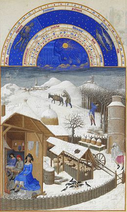
Les tres riches heures du Duc de Berry, February, Musée Condé
Before the city
No traces of inhabitation from the prehistoric or Iron Age eras has ever been found in Chantilly. A Roman-era grave site was however found on the banks of the Nonette, and Gallo-Roman roads have been discovered in the Chantilly Forest. Merovingian tombs from the seventh century were found in the 17th and 19th centuries not far from the Faisanderie.[2]
Around 1223 Guy IV of Senlis made an agreement with the prior of Saint-Leu-d'Esserent that first referred to Terra cantiliaci. He was the royal grand bouteiller, a hereditary position in charge of the king's vineyards, and became the first lord of Chantilly, which at the time was little more than a rock in the middle of a swampy area. A stronghouse was mentioned in the area in a 1227 document. In 1282 an act of the Parliament of Paris mentions Chantilly Forest.[3] A 1358 document mentions the destruction of the château in the Grande Jacquerie. It was rebuilt by Pierre d'Orgemont and completed in 1394. During the Hundred Years' War Anglo-Burgundian forces laid siege to the château and Jacqueline de Paynel, widow of Pierre II d'Orgemont, who died at the battle of Agincourt, and of Jean de Fayel, was forced to surrender it. In return, the lives of those in the château were spared, but the surrounding villages were laid to waste.[4]
The city began as just a few hamlets scattered outside the château. At the beginning of the 16th century, there were four:

The hôtel de Beauvais, built in 1539, is the oldest building in Chantilly today.
In this period, Quinquempoix began to see an extension of the château's functions. It was home to a chapel devoted to Saint Germain mentioned as early as 1219, which disappeared in the 17th century with the extension of the château's gardens. Several houses were built in Quinquempoix to accommodate the prince's court officials. Also, the hôtel de Beauvais, built in 1539, lodged the master of the hunt of constable (connétable) Anne de Montmorency. The hôtel de Quinquempoix, built around 1553, housed the constable's equerry.[6]
In 1515, Anne's father, Guillaume de Montmorency, had obtained a papal bull that gave him the right to have mass said and all the sacraments performed in the chapel of the château, which was one of the first steps toward autonomy from the surrounding parishes.[7]

Links
Château de Chantilly - Wikipedia
Chantilly, Oise - Wikipedia
Château de Chantilly | Paris Adèle
Chantilly (French pronunciation: [ʃɑ̃.ti.ji]) is a commune in the Oise department in the valley of the Nonette in the Hauts-de-France region of northern France. Surrounded by Chantilly Forest, the town of 11,000 inhabitants falls within the metropolitan area of Paris. It lies 38.4 km (23.9 miles) north-northeast from the centre of Paris and together with six neighbouring communes forms an urban area of 36,474 inhabitants (1999 census).
Intimately tied to the House of Montmorency in the 15th to 17th centuries, the Château de Chantilly was home to the princes of Condé, cousins of the kings of France, from the 17th to the 19th centuries. It now houses the Musée Condé. Chantilly is also known for its horse racing track, the Chantilly Racecourse, where prestigious races are held for the prix du Jockey Club and the prix de Diane. Chantilly and the surrounding communities are home to the largest racehorse-training community in France.
Chantilly is also home to the Living Museum of the Horse, with stables built by the Princes of Condé. It is considered one of the more important tourist destinations in the Paris area. Chantilly gave its name to Chantilly cream and to Chantilly lace. The city was the base for the England National Football Team during the Euro 2016 Championship.
Geography
Chantilly lies in the Parisian basin, at the south end of the region of Hauts-de-France and the north end of the Parisian metropolitan area. It belongs to the historic region of Valois. Chantilly lies 39 km southwest of Beauvais, 79 km south of Amiens, and 38 km north of Paris.
Saint-Maximin lies to the north, Vineuil-Saint-Firmin to the northeast, Avilly-Saint-Léonard to the east, Pontarmé and Orry-la-Ville to the south-east, Coye-la-Forêt to the south, Lamorlaye to the southwest, and Gouvieux to the west.
Chantilly is the center of an urban area that includes the communes of Avilly-Saint-Léonard, Boran-sur-Oise, Coye-la-Forêt, Gouvieux, Lamorlaye, and Vineuil-Saint-Firmin. It's the third-largest urban area in the Oise and the seventh-largest in Hauts-de-France. It has no large businesses or heavy industry and 40% of the population works in Ile-de-France, in other words Paris, or its closer suburbs, which are less than an hour away by train.
Topography

Chantilly straddles the junction of the Paris Basin and the western County of Valois, of which the Nonette river is a boundary. The site of the town was originally a clearing or meadowland, sometimes called a lawn or pelouse, which is mostly occupied today by the racecourse. The remaining open space between the town and the racecourse is always referred to as the "little lawn". The highest point in the area, 112 meters, is at Bois Lorris, in Lamorlaye. The lowest elevation is 35m, at the Canardière on the banks of the Nonette in Gouvieux.
The commune sits on a Lutetian sedimentary limestone plateau covered by Chantilly Forest. Sand created by wind and erosion covers this chalky plateau. Although the sand is less than a meter thick it is very useful for training horses in the forest.
This stone has also been used for building in parts of the region, and still is today in the adjoining commune of Saint-Maximin. It was also used for building in Chantilly itself during the 18th century, when a quarry on the current site of the racecourse produced stone for the court officials' housing and the stables. In the following century the quarry was used to grow mushrooms, then as an air raid shelter during World War II. It now belongs to the Chantilly Estate and is periodically open to the public.[1]
Another geological feature is alluvial accumulations in the river valleys, which have allowed, in the case of the Nonette, the development of community gardens in the locality known as the Canardière.
Hydrology and water supply

The Canardière on the Nonette

Canal of the Machine
The town is bounded at its southern edge by the Thève, a 33 km-long tributary of the Oise River. At this point that valley contains the Commelles ponds, created in the 13th century by the monks of Chaalis Abbey to stock fish.
The Nonette river runs through the town itself. This 44 km-long river is also part of the watershed of the Oise River and is channeled into canals throughout the municipality. In fact, the creation of the château gardens by André Le Nôtre required the complete transformation of the waterway starting in 1663. The riverbed was moved a hundred meters north to create the 2.5 km-long Grand Canal that runs in front of the château. The old riverbed became the 800m-long Canal Saint-Jean, named after a 16th-century chapel demolished when the gardens were created. The Canardière, beneath the actual viaduct, was channeled and cleaned up at this time also.
The Canal de la Machine, perpendicular to the other two and nearly 300 meters long, brought water to the Pavilon du Manse, which fed it to the garden ponds and waterfalls in the western gardens, since disappeared, sending it to a reservoir once located on the lawn. Part of this reservoir still exists near the racecourse, but it no longer contains water. Some of this hydrologic work was used to feed factories in the valley. The gardens that remain were watered by a completely different system based on an aqueduct coming from the area around Senlis.

The Château de Chantilly seen from the road north of town
In the 18th century a mineral water source was discovered in the valley and a garden pavilion was built between 1725 and 1728 to allow the public to come drink from it. This was a separate source from the source of ferruginous water, called Chantilly water, discovered at La Chausée in Gouvieux, and bottled and carbonated there from 1882 into the 20th century.
Also in the 18th century, a supply of drinking water was created by diverting water from the reservoir. In 1823, the last prince of Condé had eighteen fountains installed for the use of residents. In 1895 these were replaced with a supply from a water treatment plant in the neighboring village of Lamorlaye. This brought in water from Chantilly, Lamorlaye and Boran-sur-Oise then distributed the treated water through two water towers on the Mont de Pô in Gouvieux. This water supply has been managed by the private company Lyonnaise des eaux since 1928. In 1999 the average price of a cubic meter of water was 3.25 euros.
The sewer system was installed in 1878 meanwhile, but initially limited to the area around rue d'Aumale, the Condé Hospice and the rue de Paris, now known as the avenue du Maréchal Joffre. It was extended to the entire town in 1910 through a state subsidy financed by a tax on racetrack bets. A sewage treatment plant was built in 1969 at La Canardière, then moved to Gouvieux in 2006. This 22 km network is administered by a regional agency, the syndicat intercommunal pour le traitement des eaux de la vallée de la Nonette (SICTEUV), which covers Apremont, Avilly-Saint-Léonard, Chantilly, Gouvieux et Vineuil-Saint-Firmin.
History

Les tres riches heures du Duc de Berry, February, Musée Condé
Before the city
No traces of inhabitation from the prehistoric or Iron Age eras has ever been found in Chantilly. A Roman-era grave site was however found on the banks of the Nonette, and Gallo-Roman roads have been discovered in the Chantilly Forest. Merovingian tombs from the seventh century were found in the 17th and 19th centuries not far from the Faisanderie.[2]
Around 1223 Guy IV of Senlis made an agreement with the prior of Saint-Leu-d'Esserent that first referred to Terra cantiliaci. He was the royal grand bouteiller, a hereditary position in charge of the king's vineyards, and became the first lord of Chantilly, which at the time was little more than a rock in the middle of a swampy area. A stronghouse was mentioned in the area in a 1227 document. In 1282 an act of the Parliament of Paris mentions Chantilly Forest.[3] A 1358 document mentions the destruction of the château in the Grande Jacquerie. It was rebuilt by Pierre d'Orgemont and completed in 1394. During the Hundred Years' War Anglo-Burgundian forces laid siege to the château and Jacqueline de Paynel, widow of Pierre II d'Orgemont, who died at the battle of Agincourt, and of Jean de Fayel, was forced to surrender it. In return, the lives of those in the château were spared, but the surrounding villages were laid to waste.[4]
The city began as just a few hamlets scattered outside the château. At the beginning of the 16th century, there were four:
- Les Grandes Fontaines, near the foot of the current rue des Fontaines,
- Les Petites Fontaines, also called Normandie, the foot of the current quai de la Canardière and rue de la Machine,
- Les Aigles, near today's racetrack, which owes its name to the labourers who lived there in the late Middle Ages. It disappeared completely during the French Wars of Religion.
- Quinquempoix, the largest and closest to the château.[5]

The hôtel de Beauvais, built in 1539, is the oldest building in Chantilly today.
In this period, Quinquempoix began to see an extension of the château's functions. It was home to a chapel devoted to Saint Germain mentioned as early as 1219, which disappeared in the 17th century with the extension of the château's gardens. Several houses were built in Quinquempoix to accommodate the prince's court officials. Also, the hôtel de Beauvais, built in 1539, lodged the master of the hunt of constable (connétable) Anne de Montmorency. The hôtel de Quinquempoix, built around 1553, housed the constable's equerry.[6]
In 1515, Anne's father, Guillaume de Montmorency, had obtained a papal bull that gave him the right to have mass said and all the sacraments performed in the chapel of the château, which was one of the first steps toward autonomy from the surrounding parishes.[7]
Links
Château de Chantilly - Wikipedia
Chantilly, Oise - Wikipedia
Château de Chantilly | Paris Adèle
- Thread starter
- #27
Palace At Westminister, London
The Palace of Westminster is the meeting place of the House of Commons and the House of Lords, the two houses of the Parliament of the United Kingdom. Commonly known as the Houses of Parliament after its occupants, the Palace lies on the north bank of the River Thames in the City of Westminster, in central London.
Its name, which is derived from the neighbouring Westminster Abbey, may refer to either of two structures: the Old Palace, a medieval building complex destroyed by fire in 1834, and its replacement, the New Palace that stands today. The palace is owned by the monarch in right of the Crown and for ceremonial purposes, retains its original status as a royal residence. The building is managed by committees appointed by both houses, which report to the Speaker of the House of Commons and the Lord Speaker.
The first royal palace was built on the site in the 11th century, and Westminster was the primary residence of the Kings of England until fire destroyed much of the complex in 1512. After that, it served as the home of the Parliament of England, which had been meeting there since the 13th century, and also as the seat of the Royal Courts of Justice, based in and around Westminster Hall. In 1834, an even greater fire ravaged the heavily rebuilt Houses of Parliament, and the only significant medieval structures to survive were Westminster Hall, the Cloisters of St Stephen's, the Chapel of St Mary Undercroft, and the Jewel Tower.
The subsequent competition for the reconstruction of the Palace was won by the architect Charles Barry, whose design was for new buildings in the Gothic Revival style, specifically inspired by the English Perpendicular Gothic style of the 14th–16th centuries. The remains of the Old Palace (except the detached Jewel Tower) were incorporated into its much larger replacement, which contains over 1,100 rooms organized symmetrically around two series of courtyards and has a floor area of 112,476 m2 (1,210,680 sq ft).[1] Part of the New Palace's area of 3.24 hectares (8 acres) was reclaimed from the Thames, which is the setting of its nearly 300-metre long (980 ft) façade,[1] called the River Front. Barry was assisted by Augustus Pugin, a leading authority on Gothic architecture and style, who designed the interior of the Palace. Construction started in 1840 and lasted for 30 years, suffering great delays and cost overruns, as well as the death of both leading architects; works for the interior decoration continued intermittently well into the 20th century. Major conservation work has been carried out since then to reverse the effects of London's air pollution, and extensive repairs took place after the Second World War, including the reconstruction of the Commons Chamber following its bombing in 1941.
The Palace is one of the centres of political life in the United Kingdom; "Westminster" has become a metonym for the UK Parliament, and the Westminster system of government has taken its name after it. The Elizabeth Tower, in particular, which is often referred to by the name of its main bell, Big Ben, is an iconic landmark of London and the United Kingdom in general, one of the most popular tourist attractions in the city, and an emblem of parliamentary democracy. The Palace of Westminster has been a Grade I listed building since 1970 and part of a UNESCO World Heritage Site since 1987.
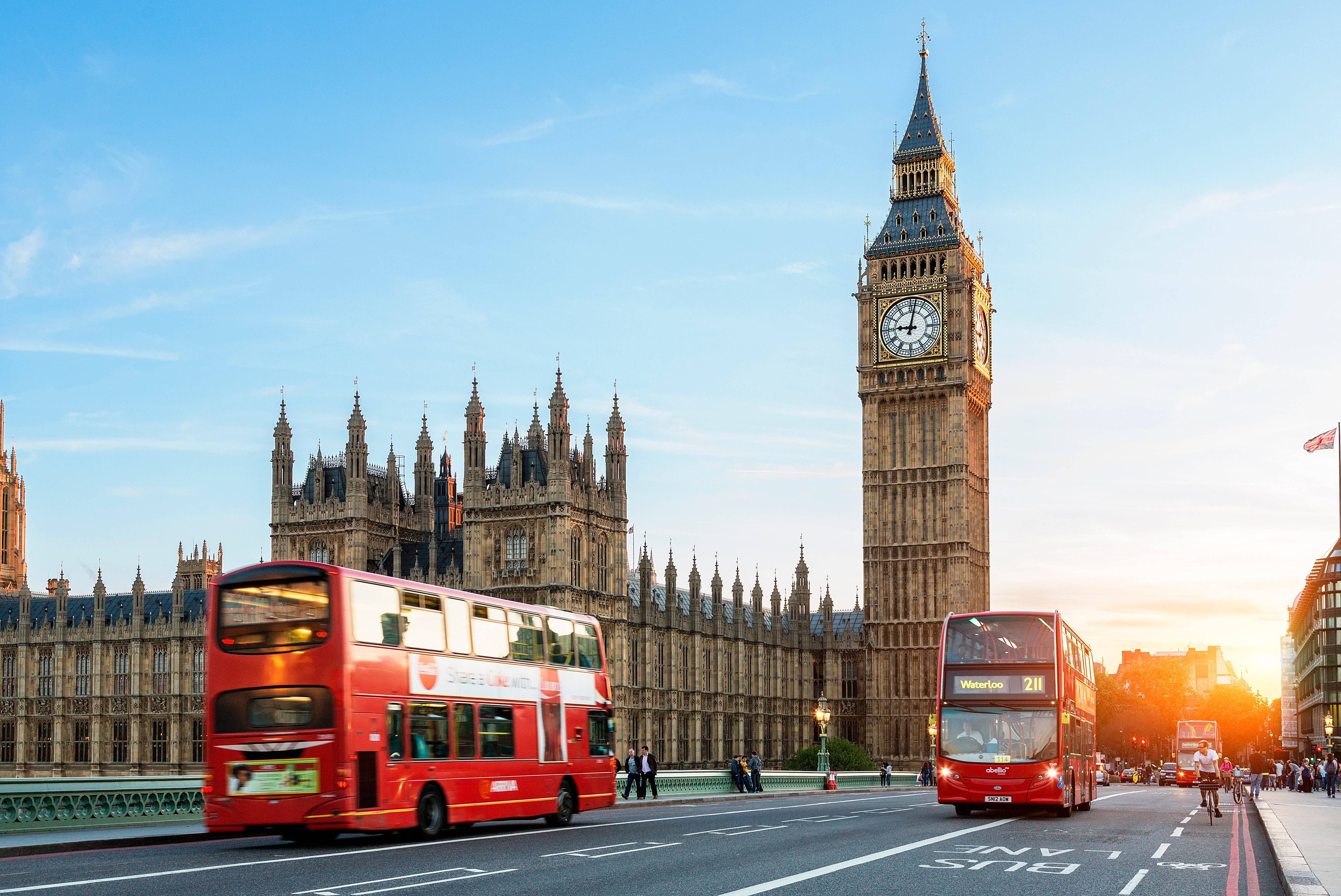
Links
Palace of Westminster - Wikipedia
Big Ben
Big Ben at the Houses of Parliament, London
The Palace of Westminster is the meeting place of the House of Commons and the House of Lords, the two houses of the Parliament of the United Kingdom. Commonly known as the Houses of Parliament after its occupants, the Palace lies on the north bank of the River Thames in the City of Westminster, in central London.
Its name, which is derived from the neighbouring Westminster Abbey, may refer to either of two structures: the Old Palace, a medieval building complex destroyed by fire in 1834, and its replacement, the New Palace that stands today. The palace is owned by the monarch in right of the Crown and for ceremonial purposes, retains its original status as a royal residence. The building is managed by committees appointed by both houses, which report to the Speaker of the House of Commons and the Lord Speaker.
The first royal palace was built on the site in the 11th century, and Westminster was the primary residence of the Kings of England until fire destroyed much of the complex in 1512. After that, it served as the home of the Parliament of England, which had been meeting there since the 13th century, and also as the seat of the Royal Courts of Justice, based in and around Westminster Hall. In 1834, an even greater fire ravaged the heavily rebuilt Houses of Parliament, and the only significant medieval structures to survive were Westminster Hall, the Cloisters of St Stephen's, the Chapel of St Mary Undercroft, and the Jewel Tower.
The subsequent competition for the reconstruction of the Palace was won by the architect Charles Barry, whose design was for new buildings in the Gothic Revival style, specifically inspired by the English Perpendicular Gothic style of the 14th–16th centuries. The remains of the Old Palace (except the detached Jewel Tower) were incorporated into its much larger replacement, which contains over 1,100 rooms organized symmetrically around two series of courtyards and has a floor area of 112,476 m2 (1,210,680 sq ft).[1] Part of the New Palace's area of 3.24 hectares (8 acres) was reclaimed from the Thames, which is the setting of its nearly 300-metre long (980 ft) façade,[1] called the River Front. Barry was assisted by Augustus Pugin, a leading authority on Gothic architecture and style, who designed the interior of the Palace. Construction started in 1840 and lasted for 30 years, suffering great delays and cost overruns, as well as the death of both leading architects; works for the interior decoration continued intermittently well into the 20th century. Major conservation work has been carried out since then to reverse the effects of London's air pollution, and extensive repairs took place after the Second World War, including the reconstruction of the Commons Chamber following its bombing in 1941.
The Palace is one of the centres of political life in the United Kingdom; "Westminster" has become a metonym for the UK Parliament, and the Westminster system of government has taken its name after it. The Elizabeth Tower, in particular, which is often referred to by the name of its main bell, Big Ben, is an iconic landmark of London and the United Kingdom in general, one of the most popular tourist attractions in the city, and an emblem of parliamentary democracy. The Palace of Westminster has been a Grade I listed building since 1970 and part of a UNESCO World Heritage Site since 1987.
Links
Palace of Westminster - Wikipedia
Big Ben
Big Ben at the Houses of Parliament, London
- Thread starter
- #28
Palace of Versailles, France
The Palace of Versailles (French: Château de Versailles), or simply Versailles (English: /vɛərˈsaɪ/ vair-SY or /vərˈsaɪ/ vər-SY; French: [vɛʁsaj]), is a royal château in Versailles in the Île-de-France region of France. It is now open as a museum and is a very popular tourist attraction.
When the château was built, the community of Versailles was a small village dating from the 11th century. Today, however, it is a wealthy suburb of Paris, some 20 kilometres (12 mi) southwest of the centre of the French capital.[1] Versailles was the seat of political power in the Kingdom of France from 1682, when King Louis XIV moved the royal court from Paris, until the royal family was forced to return to the capital in October 1789, within three months after the beginning of the French Revolution. Versailles is therefore famous not only as a building, but as a symbol of the system of absolute monarchy of the Ancien Régime.
Especially under Louis XIV, the whole senior nobility were pressured to spend large amounts of time at Versailles, as a form of political control. Louis XIV evolved a rigid routine of court life as a performance, much of which took place in front of large groups of people, at some points in the day including tourists. Building the château and maintaining the court there was phenomenally expensive, but did a good deal to establish the dominance of French style and taste in the whole of Europe, giving French luxury manufacturing advantages that long outlasted the fall of the Ancien Régime.
Louis XIV's expansion of the building was begun around 1661, with Louis Le Vau as architect. It was not completed until about 1715, having been worked on by architects including François d'Orbay, Charles Le Brun (interiors especially), Jules Hardouin-Mansart and Robert de Cotte. André Le Nôtre began the gardens and structures in them. There were a range of satellite buildings around the grounds. While the main château building remains essentially intact, though without much of its contents, some of these other buildings have been destroyed.

Links
Palace of Versailles - Wikipedia
Palace of Versailles: Facts & History
The Palace of Versailles (French: Château de Versailles), or simply Versailles (English: /vɛərˈsaɪ/ vair-SY or /vərˈsaɪ/ vər-SY; French: [vɛʁsaj]), is a royal château in Versailles in the Île-de-France region of France. It is now open as a museum and is a very popular tourist attraction.
When the château was built, the community of Versailles was a small village dating from the 11th century. Today, however, it is a wealthy suburb of Paris, some 20 kilometres (12 mi) southwest of the centre of the French capital.[1] Versailles was the seat of political power in the Kingdom of France from 1682, when King Louis XIV moved the royal court from Paris, until the royal family was forced to return to the capital in October 1789, within three months after the beginning of the French Revolution. Versailles is therefore famous not only as a building, but as a symbol of the system of absolute monarchy of the Ancien Régime.
Especially under Louis XIV, the whole senior nobility were pressured to spend large amounts of time at Versailles, as a form of political control. Louis XIV evolved a rigid routine of court life as a performance, much of which took place in front of large groups of people, at some points in the day including tourists. Building the château and maintaining the court there was phenomenally expensive, but did a good deal to establish the dominance of French style and taste in the whole of Europe, giving French luxury manufacturing advantages that long outlasted the fall of the Ancien Régime.
Louis XIV's expansion of the building was begun around 1661, with Louis Le Vau as architect. It was not completed until about 1715, having been worked on by architects including François d'Orbay, Charles Le Brun (interiors especially), Jules Hardouin-Mansart and Robert de Cotte. André Le Nôtre began the gardens and structures in them. There were a range of satellite buildings around the grounds. While the main château building remains essentially intact, though without much of its contents, some of these other buildings have been destroyed.
Links
Palace of Versailles - Wikipedia
Palace of Versailles: Facts & History
- Thread starter
- #29
Chatsworth House, Derbyshire, England
Chatsworth House (/ˈtʃætswɜːrθ/[1]) is a stately home in Derbyshire, England, in the Derbyshire Dales 3.5 miles (5.6 km) north-east of Bakewell and 9 miles (14 km) west of Chesterfield (SK260700). The seat of the Duke of Devonshire, it has been home to the Cavendish family since 1549.
Standing on the east bank of the River Derwent, Chatsworth looks across to the low hills that divide the Derwent and Wye valleys. The house, set in expansive parkland and backed by wooded, rocky hills rising to heather moorland, contains an important collection of paintings, furniture, Old Master drawings, neoclassical sculptures, books and other artefacts. Chatsworth has been selected as the United Kingdom's favourite country house several times.[2][3]
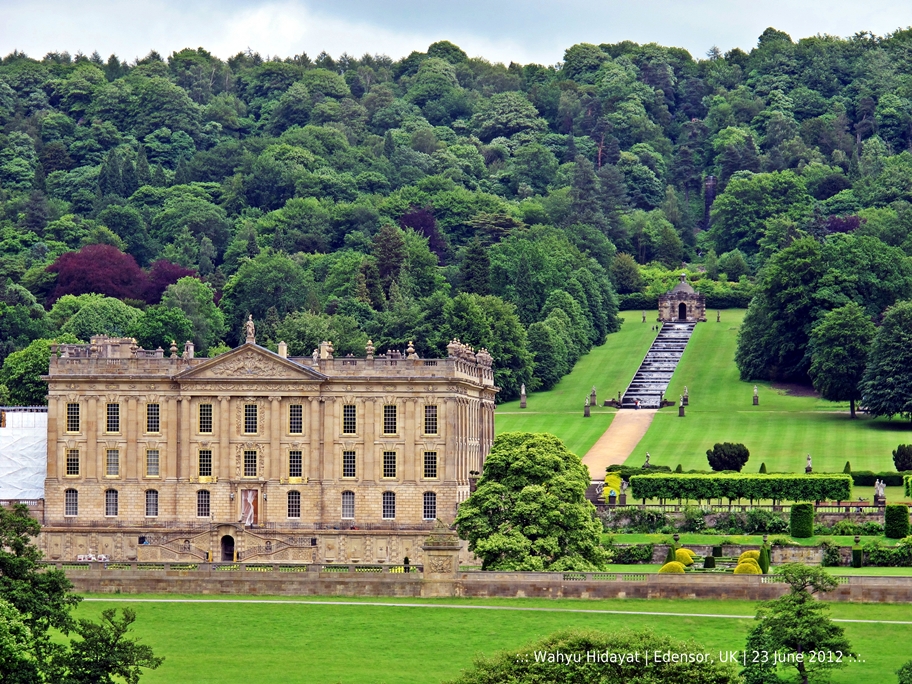

Links
Chatsworth House, Derbyshire, Peak District. Home of the Dukes of Devonshire.
Chatsworth House - Wikipedia
Chatsworth House (/ˈtʃætswɜːrθ/[1]) is a stately home in Derbyshire, England, in the Derbyshire Dales 3.5 miles (5.6 km) north-east of Bakewell and 9 miles (14 km) west of Chesterfield (SK260700). The seat of the Duke of Devonshire, it has been home to the Cavendish family since 1549.
Standing on the east bank of the River Derwent, Chatsworth looks across to the low hills that divide the Derwent and Wye valleys. The house, set in expansive parkland and backed by wooded, rocky hills rising to heather moorland, contains an important collection of paintings, furniture, Old Master drawings, neoclassical sculptures, books and other artefacts. Chatsworth has been selected as the United Kingdom's favourite country house several times.[2][3]
Links
Chatsworth House, Derbyshire, Peak District. Home of the Dukes of Devonshire.
Chatsworth House - Wikipedia
- Thread starter
- #30
Bran Castle in Romania

Bran Castle (Romanian: Castelul Bran; German: Törzburg; Hungarian: Törcsvár), situated near Bran and in the immediate vicinity of Brașov, is a national monument and landmark in Romania. The fortress is situated on the border between Transylvania and Wallachia, on DN73. Commonly known as "Dracula's Castle" (although it is one among several locations linked to the Dracula legend, including Poenari Castle and Hunyad Castle), it is often erroneously referred to as the home of the title character in Bram Stoker's Dracula. There is, however, no evidence that Stoker knew anything about this castle, which has only tangential associations with Vlad the Impaler, voivode of Wallachia, the putative inspiration for Dracula. As discovered by the Dutch author Hans Corneel de Roos,[1] the location Bram Stoker actually had in mind for Castle Dracula while writing his novel was an empty mountain top, Mount Izvorul Călimanului, 2,033 metres (6,670 ft) high, located in the Călimani Alps near the former border with Moldavia. Stoker's description of Dracula's crumbling fictional castle also bears no resemblance to Bran Castle.
The castle is now a museum dedicated to displaying art and furniture collected by Queen Maria.[2] Tourists can see the interior on their own or by a guided tour. At the bottom of the hill is a small open-air museum park exhibiting traditional Romanian peasant structures (cottages, barns, etc.) from across the country.[3]

Links
Bran Castle - Wikipedia
Bran Castle - Castles and Fortresses in Transylvania, Romania
Bran Castle (Romanian: Castelul Bran; German: Törzburg; Hungarian: Törcsvár), situated near Bran and in the immediate vicinity of Brașov, is a national monument and landmark in Romania. The fortress is situated on the border between Transylvania and Wallachia, on DN73. Commonly known as "Dracula's Castle" (although it is one among several locations linked to the Dracula legend, including Poenari Castle and Hunyad Castle), it is often erroneously referred to as the home of the title character in Bram Stoker's Dracula. There is, however, no evidence that Stoker knew anything about this castle, which has only tangential associations with Vlad the Impaler, voivode of Wallachia, the putative inspiration for Dracula. As discovered by the Dutch author Hans Corneel de Roos,[1] the location Bram Stoker actually had in mind for Castle Dracula while writing his novel was an empty mountain top, Mount Izvorul Călimanului, 2,033 metres (6,670 ft) high, located in the Călimani Alps near the former border with Moldavia. Stoker's description of Dracula's crumbling fictional castle also bears no resemblance to Bran Castle.
The castle is now a museum dedicated to displaying art and furniture collected by Queen Maria.[2] Tourists can see the interior on their own or by a guided tour. At the bottom of the hill is a small open-air museum park exhibiting traditional Romanian peasant structures (cottages, barns, etc.) from across the country.[3]
Links
Bran Castle - Wikipedia
Bran Castle - Castles and Fortresses in Transylvania, Romania
- Thread starter
- #31
Eltz Castle, FRG

Eltz Castle (German: Burg Eltz) is a medieval castle nestled in the hills above the Moselle River between Koblenz and Trier, Germany. It is still owned by a branch of the same family (the Eltz family) that lived there in the 12th century, 33 generations ago. Bürresheim Castle (Schloss Bürresheim), Eltz Castle and Lissingen Castle are the only castles on the left bank of the Rhine in Rhineland-Palatinate which have never been destroyed.
Location
The castle is surrounded on three sides by the Elzbach River, a tributary on the north side of the Moselle. It is on a 70-metre (230 ft) rock spur, on an important Roman trade route between rich farmlands and their markets. The Eltz Forest has been declared a nature reserve by Flora-Fauna-Habitat and Natura 2000.[1]
Description

Plan of Eltz Castle

Eltz Castle on the reverse side of the 500 Deutsche Mark note (1965–1990s)

Castle Eltz, Aerial view
The castle is a so-called Ganerbenburg, or castle belonging to a community of joint heirs. This is a castle divided into several parts, which belong to different families or different branches of a family; this usually occurs when multiple owners of one or more territories jointly build a castle to house themselves. Only a very rich medieval European lord could afford to build a castle on his land; many of them only owned one village, or even only a part of a village. This was an insufficient base to afford a castle. Such lords lived in a knight's house, which was a simple house, scarcely bigger than those of his tenants. In some parts of the Holy Roman Empire of the German Nation, inheritance law required that the estate be divided between all successors. These successors, each of whose individual inheritance was too small to build a castle of his own, could build a castle together, where each owned one separate part for housing and all of them together shared the defensive fortification. In the case of Eltz, the family comprised three branches and the existing castle was enhanced with three separate complexes of buildings.
The main part of the castle consists of the family portions. At up to eight stories, these eight towers reach heights of between 30 and 40 metres (98 and 131 ft). They are fortified with strong exterior walls; to the yard they present a partial framework. About 100 members of the owners' families lived in the over 100 rooms of the castle.
History
Platteltz, a Romanesque keep, is the oldest part of the castle, having begun in the 9th century as a simple manor with an earthen palisade. By 1157 the fortress was an important part of the empire under Frederick Barbarossa, standing astride the trade route from the Moselle Valley and the Eifel region.[2] In 1472 the Rübenach house, built in the Late Gothic style, was completed. Remarkable are the Rübenach Lower Hall, a living room, and the Rübenach bedchamber with its opulently decorated walls.
Between 1490 and 1540, the Rodendorf house was constructed, also in Late Gothic style. It contains the vaulted "banner-room".
The Kempenich houses were finished about 1530. Every room of this part of the castle could be heated; in contrast, other castles might only have one or two heated rooms.
- Thread starter
- #32
The Alcazar Castle, Spain
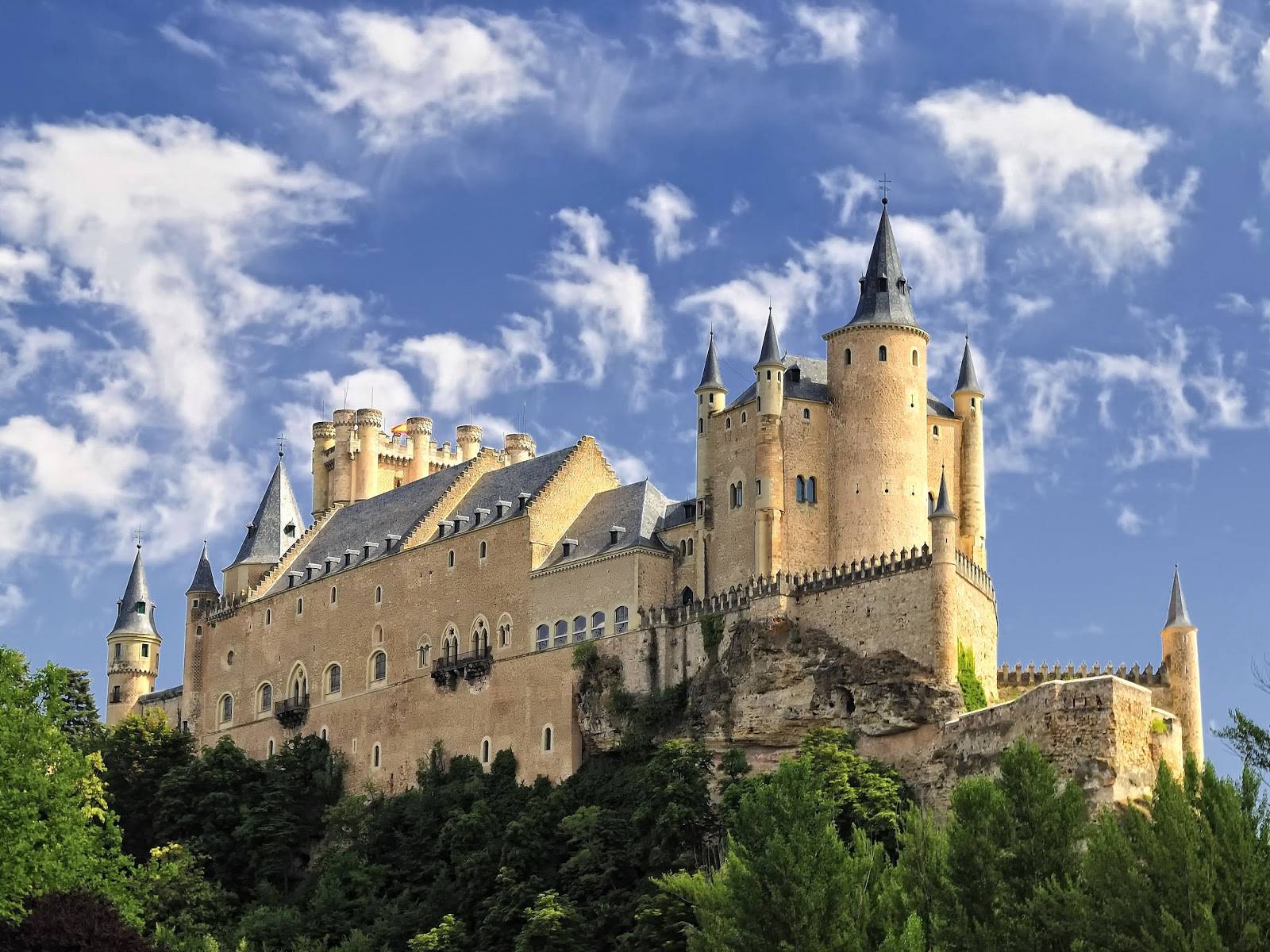
The Alcázar of Segovia (literally, "Segovia Fortress") is a castle, located in Segovia, Spain, a World Heritage Site. Rising out on a rocky crag above the confluence of two rivers near the Guadarrama mountains, it is one of the most distinctive castle-palaces in Spain by virtue of its shape – like the bow of a ship. The Alcázar was originally built as a fortress but has served as a royal palace, a state prison, a Royal Artillery College and a military academy since then. It is currently used as a museum and a military archives building.
The Alcázar of Segovia, like many fortifications in Spain, started off as Roman fort, but apart from the foundations, little of the original structure remains. A Muslim era fort, which was itself largely replaced by the present structure, was built by the Berber Almoravid dynasty. The first reference to this particular "alcázar" was in 1120, around 32 years after the city of Segovia returned to Christian hands (during the time when King Alfonso VI reconquered lands to the south of the Duero river down to Toledo and beyond).
The shape and form of the Alcázar was not known until the reign of King Alfonso VIII (1155–1214), however early documentation mentioned a wooden stockade fence. It can be concluded that prior to Alfonso VIII's reign, the Muslim era structure was no more than a wooden fort built over the old Roman foundations. Alfonso VIII and his wife, Eleanor of England, made this alcázar their principal residence and much work was carried out to erect the beginnings of the stone fortification we see today.

Alcazar, viewed from the south, outside of the city
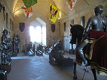
Armory Room
The Alcázar of Segovia was one of the favorite residences of the monarchs of Castile in the Middle Ages, and a key fortress in the defence of the kingdom. It was during this period that most of the current building was constructed by the Trastámara dynasty.
In 1258, parts of the Alcázar had to be rebuilt by King Alfonso X after a cave-in and the Hall of Kings was built to house Parliament soon after. However, the single largest contributor to the continuing construction of the Alcázar is King John II who built the "New Tower" (John II tower as it is known today).
In 1474, the Alcázar played a major role in the rise of Queen Isabella I. On 12 December news of the King Henry IV's death in Madrid reached Segovia and Isabella immediately took refuge within the walls of the Alcázar where she received the support of Andres Cabrera and Segovia's council. She was enthroned the next day as Queen of Castile and León.
The next major renovation at the Alcázar was conducted by King Philip II after his marriage to Anna of Austria. He added the sharp slate spires to reflect the castles of central Europe. In 1587, architect Francisco de Morar completed the main garden and the School of Honor areas of the castle.
The royal court eventually moved to Madrid and the Alcázar then served as a state prison for almost two centuries before King Charles III founded the Royal Artillery School in 1762. It served this function for almost a hundred years until March 6, 1862 where a fire badly damaged the roofs of the treasury, keep, armory, sleeping quarters, and framework.
It was only in 1882 that the building was slowly restored to its original state. In 1896, King Alfonso XIII ordered the Alcázar to be handed over to the Ministry of War as a military college.

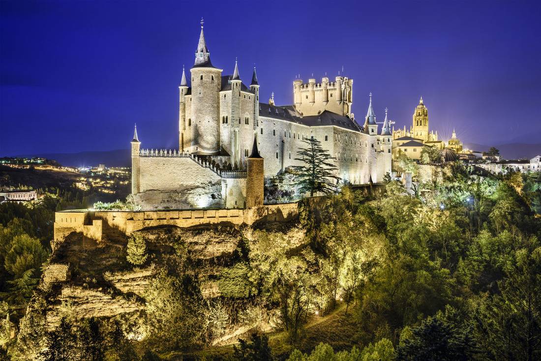
Links
Alcázar of Segovia - Wikipedia
History
The Alcázar of Segovia (literally, "Segovia Fortress") is a castle, located in Segovia, Spain, a World Heritage Site. Rising out on a rocky crag above the confluence of two rivers near the Guadarrama mountains, it is one of the most distinctive castle-palaces in Spain by virtue of its shape – like the bow of a ship. The Alcázar was originally built as a fortress but has served as a royal palace, a state prison, a Royal Artillery College and a military academy since then. It is currently used as a museum and a military archives building.
The Alcázar of Segovia, like many fortifications in Spain, started off as Roman fort, but apart from the foundations, little of the original structure remains. A Muslim era fort, which was itself largely replaced by the present structure, was built by the Berber Almoravid dynasty. The first reference to this particular "alcázar" was in 1120, around 32 years after the city of Segovia returned to Christian hands (during the time when King Alfonso VI reconquered lands to the south of the Duero river down to Toledo and beyond).
The shape and form of the Alcázar was not known until the reign of King Alfonso VIII (1155–1214), however early documentation mentioned a wooden stockade fence. It can be concluded that prior to Alfonso VIII's reign, the Muslim era structure was no more than a wooden fort built over the old Roman foundations. Alfonso VIII and his wife, Eleanor of England, made this alcázar their principal residence and much work was carried out to erect the beginnings of the stone fortification we see today.

Alcazar, viewed from the south, outside of the city

Armory Room
The Alcázar of Segovia was one of the favorite residences of the monarchs of Castile in the Middle Ages, and a key fortress in the defence of the kingdom. It was during this period that most of the current building was constructed by the Trastámara dynasty.
In 1258, parts of the Alcázar had to be rebuilt by King Alfonso X after a cave-in and the Hall of Kings was built to house Parliament soon after. However, the single largest contributor to the continuing construction of the Alcázar is King John II who built the "New Tower" (John II tower as it is known today).
In 1474, the Alcázar played a major role in the rise of Queen Isabella I. On 12 December news of the King Henry IV's death in Madrid reached Segovia and Isabella immediately took refuge within the walls of the Alcázar where she received the support of Andres Cabrera and Segovia's council. She was enthroned the next day as Queen of Castile and León.
The next major renovation at the Alcázar was conducted by King Philip II after his marriage to Anna of Austria. He added the sharp slate spires to reflect the castles of central Europe. In 1587, architect Francisco de Morar completed the main garden and the School of Honor areas of the castle.
The royal court eventually moved to Madrid and the Alcázar then served as a state prison for almost two centuries before King Charles III founded the Royal Artillery School in 1762. It served this function for almost a hundred years until March 6, 1862 where a fire badly damaged the roofs of the treasury, keep, armory, sleeping quarters, and framework.
It was only in 1882 that the building was slowly restored to its original state. In 1896, King Alfonso XIII ordered the Alcázar to be handed over to the Ministry of War as a military college.
Links
Alcázar of Segovia - Wikipedia
History
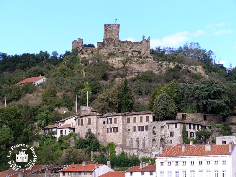
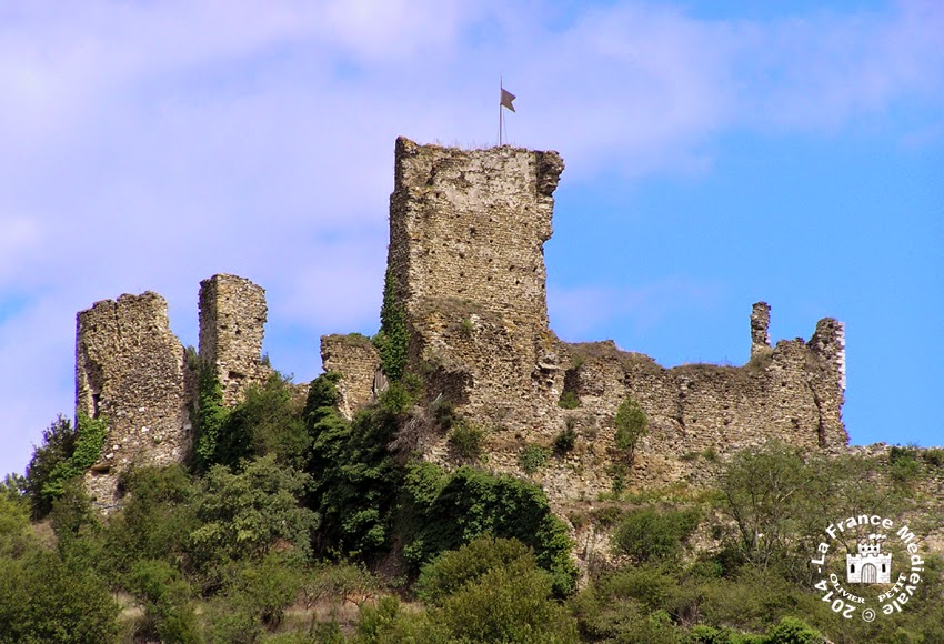
Since then, become private property, it is unfortunately not visitable!
LA FRANCE MEDIEVALE: VIENNE (38) - Le château de la Bâtie
- Thread starter
- #34
Castle Frankenstein in Germany
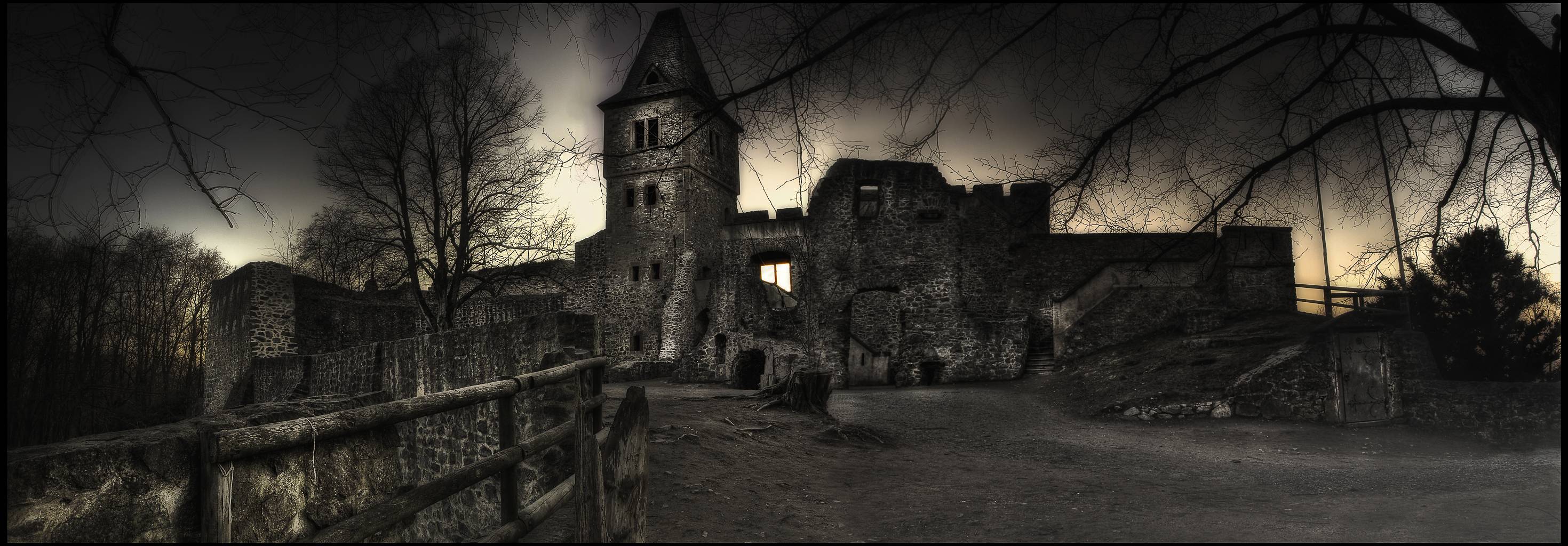
Frankenstein Castle (German: Burg Frankenstein) is a hilltop castle in the Odenwald overlooking the city of Darmstadt in Germany. It is thought that this castle may have been an inspiration for Mary Shelley when she wrote her 1818 Gothic novel Frankenstein.
Location
Frankenstein Castle is located (49°47' 35.84"N, 8°40' 5.58"E) in southern Hesse (Germany) on the spurs of the Odenwald mountain range at an elevation of 370 meter (1,200 ft.) close to the southern outskirts of Darmstadt. It is one of many historic castles along the Hessian Bergstrasse, also famous for its vineyards and its mild climate.
Meaning of "Frankenstein"
Frankenstein is a German name consisting of two words: The Franks are a Germanic tribe and "stein" is the German word for "stone". Accordingly, the meaning of Frankenstein is "Stone of the Franks". The word "stein" is common in names of landscapes, places and castles in Germany. Consequently, the term "Frankenstein" is a rather ordinary name for a castle in this region.
History
Frankenstein Castle - Chapel

Frankenstein Chapel inside
Before 1250, Lord Conrad II Reiz of Breuberg built Frankenstein Castle and thereafter named himself von und zu Frankenstein. The first document proving the existence of the castle in 1252 bears his name. He was the founder of the free imperial Barony of Frankenstein, which was subject only to the jurisdiction of the emperor, with possessions in Nieder-Beerbach, Darmstadt, Ockstadt, Wetterau and Hesse. Additionally the Frankensteins held other possession and sovereignty rights as burgraves in Zwingenberg (Auerbach (Bensheim)), in Darmstadt, Groß-Gerau, Frankfurt am Main and Bensheim. The hill on which the castle stands was probably occupied by another castle from the 11th century, which fell into ruins after Frankenstein Castle was built a short distance away to the northwest. Claims of an even older predecessor upon the hill are widespread, but historically unlikely.
In 1292 the Frankensteins opened the castle to the counts of Katzenelnbogen (County of Katzenelnbogen) Katzenelnbogen[1] and formed an alliance with them.
In 1363, the castle was split into two parts and owned by two different families of the lords and knights of Frankenstein. At the beginning of the 15th century, the castle was enlarged and modernized. The Frankenstein knights became independent of the counts of Katzenelnbogen again.
Being both strong opponents of the reformation and following territorial conflicts, connected disputes with the Landgraviate of Hesse-Darmstadt, as well as the adherence to the Roman Catholic faith and the associated "right of patronage", the family head Lord John I decided to sell the lordship to the Landgraves of Hesse-Darmstadt in 1662, after various lawsuits at the Imperial Chamber Court.
The castle was used as refuge and a hospital afterward, falling into ruins in the 18th century. The two towers that are so distinctive today are a historically inaccurate restoration carried out in the mid-19th century.


Links
Frankenstein Castle - Wikipedia
Frankenstein Castle Facts - Halloween in Germany
Frankenstein Castle (German: Burg Frankenstein) is a hilltop castle in the Odenwald overlooking the city of Darmstadt in Germany. It is thought that this castle may have been an inspiration for Mary Shelley when she wrote her 1818 Gothic novel Frankenstein.
Location
Frankenstein Castle is located (49°47' 35.84"N, 8°40' 5.58"E) in southern Hesse (Germany) on the spurs of the Odenwald mountain range at an elevation of 370 meter (1,200 ft.) close to the southern outskirts of Darmstadt. It is one of many historic castles along the Hessian Bergstrasse, also famous for its vineyards and its mild climate.
Meaning of "Frankenstein"
Frankenstein is a German name consisting of two words: The Franks are a Germanic tribe and "stein" is the German word for "stone". Accordingly, the meaning of Frankenstein is "Stone of the Franks". The word "stein" is common in names of landscapes, places and castles in Germany. Consequently, the term "Frankenstein" is a rather ordinary name for a castle in this region.
History

Frankenstein Castle - Chapel

Frankenstein Chapel inside
Before 1250, Lord Conrad II Reiz of Breuberg built Frankenstein Castle and thereafter named himself von und zu Frankenstein. The first document proving the existence of the castle in 1252 bears his name. He was the founder of the free imperial Barony of Frankenstein, which was subject only to the jurisdiction of the emperor, with possessions in Nieder-Beerbach, Darmstadt, Ockstadt, Wetterau and Hesse. Additionally the Frankensteins held other possession and sovereignty rights as burgraves in Zwingenberg (Auerbach (Bensheim)), in Darmstadt, Groß-Gerau, Frankfurt am Main and Bensheim. The hill on which the castle stands was probably occupied by another castle from the 11th century, which fell into ruins after Frankenstein Castle was built a short distance away to the northwest. Claims of an even older predecessor upon the hill are widespread, but historically unlikely.
In 1292 the Frankensteins opened the castle to the counts of Katzenelnbogen (County of Katzenelnbogen) Katzenelnbogen[1] and formed an alliance with them.
In 1363, the castle was split into two parts and owned by two different families of the lords and knights of Frankenstein. At the beginning of the 15th century, the castle was enlarged and modernized. The Frankenstein knights became independent of the counts of Katzenelnbogen again.
Being both strong opponents of the reformation and following territorial conflicts, connected disputes with the Landgraviate of Hesse-Darmstadt, as well as the adherence to the Roman Catholic faith and the associated "right of patronage", the family head Lord John I decided to sell the lordship to the Landgraves of Hesse-Darmstadt in 1662, after various lawsuits at the Imperial Chamber Court.
The castle was used as refuge and a hospital afterward, falling into ruins in the 18th century. The two towers that are so distinctive today are a historically inaccurate restoration carried out in the mid-19th century.
Links
Frankenstein Castle - Wikipedia
Frankenstein Castle Facts - Halloween in Germany
- Thread starter
- #35
Braunfels Castle ~ Hesse ~ Germany

Braunfels is a town in the Lahn-Dill-Kreis in Hesse, Germany. It is located on the German Timber-Frame Road.
Geography
Location
The climatic spa of Braunfels lies at a height of some 100 m above the Lahn valley. It is 9 km southwest of Wetzlar, and 28 km northeast of Limburg an der Lahn.
Neighbouring communities
Braunfels borders in the northwest on the town of Leun, in the north on the town of Solms, in the east on the community of Schöffengrund, in the southeast on the community of Waldsolms (all in the Lahn-Dill-Kreis), in the south on the community of Weilmünster, and in the west on the town of Weilburg and the community of Löhnberg (all three in Limburg-Weilburg).
Constituent communities
Besides the main town, which bears the same name as the whole, there are outlying centres called Altenkirchen, Bonbaden, Neukirchen, Philippstein and Tiefenbach
Currently, Bonbaden, is home to about 1600 people.[citation needed] Bonbaden has a primary school (levels 1-4) and an Evangelical and Catholic church. A cultural highlight is the Freilichtbühne Bonbaden (Bonbaden Open-Air Stage), which presents two different plays for children each summer, and an evening play for adults.[citation needed]
History
The town and stately seat of Braunfels were first mentioned in 1246. Braunfels has had town rights since 1607. In 1950 Braunfels had a population of 3,337. In the course of municipal reforms, the aforesaid constituent communities, formerly all independent villages, were amalgamated with Braunfels in 1972.
Bonbaden had its first documented mention in 772, and so celebrated 1200 years of existence in 1972. Bonbaden is therefore one of Lahn-Dill's oldest inhabited places.
Schloss Braunfels, a stately home that had been built from a castle built in the 13th century by the Counts of Nassau, served as of about 1260 as the Solms-Braunfels noble family's residential castle. After Solms Castle had been destroyed by the Rhenish League of Towns in 1384, Braunfels Castle became the seat of the Counts of Solms. Over the castle's more than 750-year-long history, building work was done many times. Particularly worthy of mention is the town and castle fire of 1679, which burnt much of Braunfels and its stately seat down. Both were then built into a Baroque residence. Schloss Braunfels was rebuilt out of materials that were still on hand. The town was given a regular marketplace, which is still preserved today and lies before the town wall.


Braunfels Castle Travel Guide
Braunfels is a town in the Lahn-Dill-Kreis in Hesse, Germany. It is located on the German Timber-Frame Road.
Geography
Location
The climatic spa of Braunfels lies at a height of some 100 m above the Lahn valley. It is 9 km southwest of Wetzlar, and 28 km northeast of Limburg an der Lahn.
Neighbouring communities
Braunfels borders in the northwest on the town of Leun, in the north on the town of Solms, in the east on the community of Schöffengrund, in the southeast on the community of Waldsolms (all in the Lahn-Dill-Kreis), in the south on the community of Weilmünster, and in the west on the town of Weilburg and the community of Löhnberg (all three in Limburg-Weilburg).
Constituent communities
Besides the main town, which bears the same name as the whole, there are outlying centres called Altenkirchen, Bonbaden, Neukirchen, Philippstein and Tiefenbach
Currently, Bonbaden, is home to about 1600 people.[citation needed] Bonbaden has a primary school (levels 1-4) and an Evangelical and Catholic church. A cultural highlight is the Freilichtbühne Bonbaden (Bonbaden Open-Air Stage), which presents two different plays for children each summer, and an evening play for adults.[citation needed]
History
The town and stately seat of Braunfels were first mentioned in 1246. Braunfels has had town rights since 1607. In 1950 Braunfels had a population of 3,337. In the course of municipal reforms, the aforesaid constituent communities, formerly all independent villages, were amalgamated with Braunfels in 1972.
Bonbaden had its first documented mention in 772, and so celebrated 1200 years of existence in 1972. Bonbaden is therefore one of Lahn-Dill's oldest inhabited places.
Schloss Braunfels, a stately home that had been built from a castle built in the 13th century by the Counts of Nassau, served as of about 1260 as the Solms-Braunfels noble family's residential castle. After Solms Castle had been destroyed by the Rhenish League of Towns in 1384, Braunfels Castle became the seat of the Counts of Solms. Over the castle's more than 750-year-long history, building work was done many times. Particularly worthy of mention is the town and castle fire of 1679, which burnt much of Braunfels and its stately seat down. Both were then built into a Baroque residence. Schloss Braunfels was rebuilt out of materials that were still on hand. The town was given a regular marketplace, which is still preserved today and lies before the town wall.
Braunfels Castle Travel Guide
- Jun 18, 2009
- 34,331
- 18,625
- 1,915
I am SOOOOOOOOOOooooooooooooooooooooooooooooooo glad I don't have to mow that lawn!Château de Vaux-le-Vicomte, France
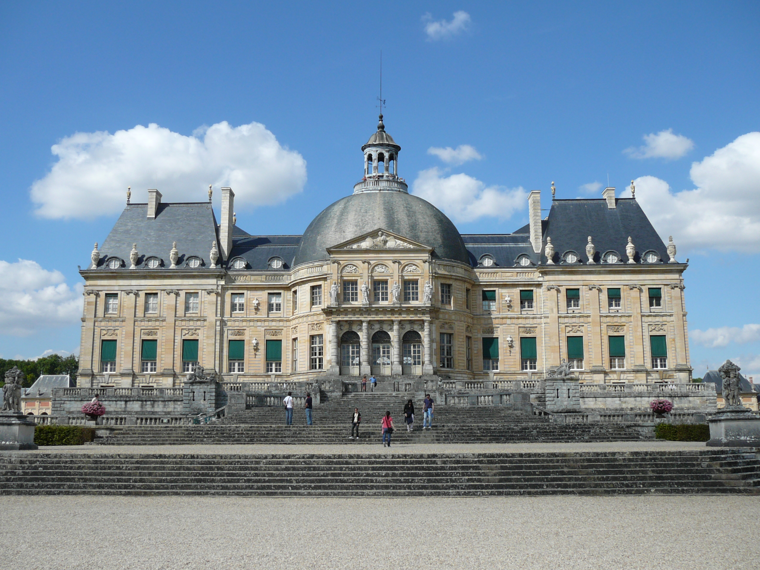
The Château de Vaux-le-Vicomte is a baroque French château located in Maincy, near Melun, 55 kilometres (34 mi) southeast of Paris in the Seine-et-Marne département of France.
Constructed from 1658 to 1661 for Nicolas Fouquet, Marquis de Belle Île, Viscount of Melun and Vaux, the superintendent of finances of Louis XIV, the château was an influential work of architecture in mid-17th-century Europe. At Vaux-le-Vicomte, the architect Louis Le Vau, the landscape architect André le Nôtre, and the painter-decorator Charles Le Brun worked together on a large-scale project for the first time. Their collaboration marked the beginning of the "Louis XIV style" combining architecture, interior design and landscape design. The garden's pronounced visual axis is an example of this style.[1]

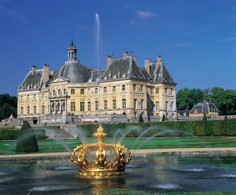
Once a small château between the royal residences of Vincennes and Fontainebleau, the estate of Vaux-le-Vicomte was purchased in 1641 by Nicolas Fouquet, an ambitious 26-year-old member of the Parlement of Paris. Fouquet was an avid patron of the arts, attracting many artists with his generosity.
When Fouquet became King Louis XIV's superintendant of finances in 1657, he commissioned Le Vau, Le Brun and Le Nôtre to renovate his estate and garden to match his grand ambition. Fouquet’s artistic and cultivated personality subsequently brought out the best in the three.[2]
To secure the necessary grounds for the elaborate plans for Vaux-le-Vicomte’s garden and castle, Fouquet purchased and demolished three villages. The displaced villagers were then employed in the upkeep and maintenance of the gardens. It was said to have employed 18 thousand workers and cost as much as 16 million livres.[3]
The château and its patron became for a short time a focus for fine feasts, literature and arts. The poet Jean de La Fontaine and the playwright Molière were among the artists close to Fouquet. At the inauguration of Vaux-le-Vicomte, a Molière play was performed, along with a dinner event organized by François Vatel and an impressive firework show.[4]
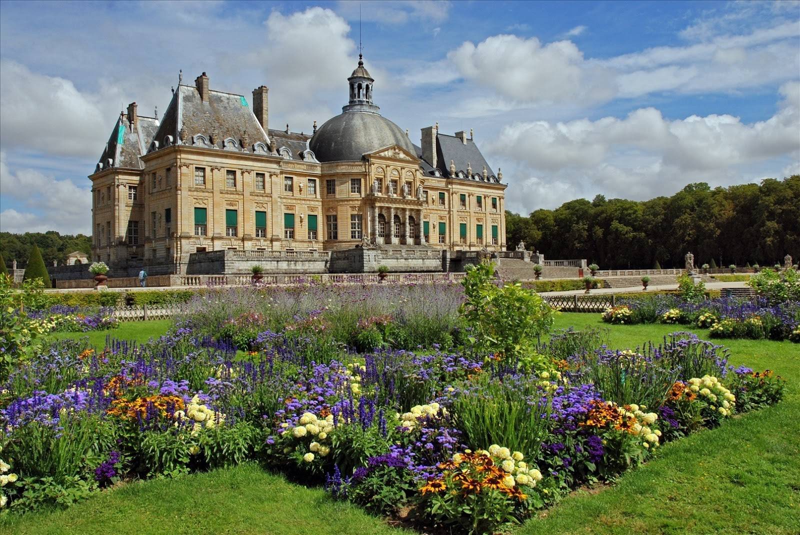
Links
Vaux-le-Vicomte - Wikipedia
Day trip from Paris to Vaux le Vicomte
Château de Vaux-le-Vicomte - Vaux le Vicomte
I love this stuff. Its one of My bucket list items to tour all the castles in West and Eastern Europe.
- Thread starter
- #37
Bojnice Castle in Slovakia
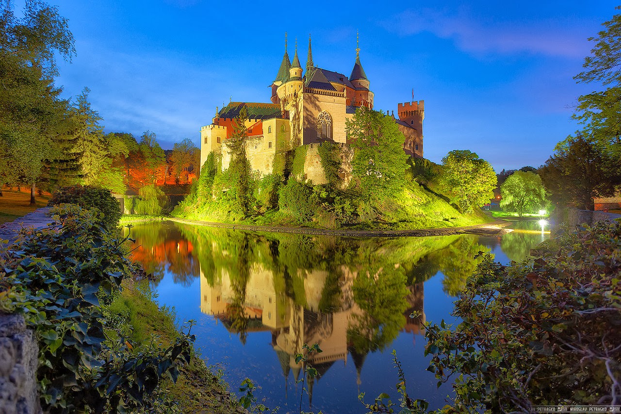
Bojnice Castle (Slovak: Bojnický zámok, Hungarian: Bajmóci vár) is a medieval castle in Bojnice, Slovakia. It is a Romantic castle with some original Gothic and Renaissance elements built in the 12th century. Bojnice Castle is one of the most visited castles in Slovakia, receiving hundreds of thousands of visitors every year and also being a popular filming stage for fantasy and fairy-tale movies.
History
Bojnice Castle was first mentioned in written records in 1013, in a document held at the Zobor Abbey. Originally built as a wooden fort, it was gradually replaced by stone, with the outer walls being shaped according to the uneven rocky terrain. Its first owner was Matthew III Csák, who received it in 1302 from the King Ladislaus V of Hungary. Later, in the 15th century, it was owned by King Matthias Corvinus, who gave it to his illegitimate son John Corvinus in 1489. Matthias liked to visit Bojnice and it was here that he worked on his royal decrees. He used to dictate them under his beloved linden tree, which is now known as the "Linden tree of King Matthias". After his death the castle became the property of the Zápolya family (see John Zápolya). The Thurzós, the richest family in the northern Kingdom of Hungary, acquired the castle in 1528 and undertook its major reconstruction. The former fortress was turned into a Renaissance castle. From 1646 on, the castle's owners were the Pálffys, who continued to rebuild the castle.
Finally, the last famous castle owner from the Pálffy family, Count János Ferenc Pálffy (1829-1908), made a complex romantic reconstruction from 1888 to 1910 and created today's beautiful imitation of French castles of the Loire valley. He not only had the castle built, but also was the architect and graphic designer. He utilized his fine artistic taste and love for collecting pieces of art. He was one of the greatest collectors of antiques, tapestries, drawings, paintings and sculptures of his time. After his death and long quarrels, his heirs sold many precious pieces of art from the castle and then, on 25 February 1939, sold the castle, the health spa, and the surrounding land to Ján Baťa (of the shoe firm Bata).
After 1945, when Bata's property was confiscated by the Czechoslovak government, the castle became the seat of several state institutions. On 9 May 1950, a huge fire broke out in the castle, but it was rebuilt at government expense. After this reconstruction, a museum specializing in the documentation and presentation of the era of architectural neo-styles was opened here. Bojnice Museum is now part of the Slovak National Museum today.
Description
The castle is renowned for its attractions, including the popular Castle Fairytale, the International Festival of Ghosts and Spirits and the Summer Music Festival. The romantic castle is also a popular location for filming fairy tale movies, such as Fantaghirò. In 2006, the castle attracted about 200,000 visitors. It hosts the single most popular museum in Slovakia and has featured in many movies[

Links
Bojnice Castle | Slovakia.com
Bojnice Castle (Slovak: Bojnický zámok, Hungarian: Bajmóci vár) is a medieval castle in Bojnice, Slovakia. It is a Romantic castle with some original Gothic and Renaissance elements built in the 12th century. Bojnice Castle is one of the most visited castles in Slovakia, receiving hundreds of thousands of visitors every year and also being a popular filming stage for fantasy and fairy-tale movies.
History
Bojnice Castle was first mentioned in written records in 1013, in a document held at the Zobor Abbey. Originally built as a wooden fort, it was gradually replaced by stone, with the outer walls being shaped according to the uneven rocky terrain. Its first owner was Matthew III Csák, who received it in 1302 from the King Ladislaus V of Hungary. Later, in the 15th century, it was owned by King Matthias Corvinus, who gave it to his illegitimate son John Corvinus in 1489. Matthias liked to visit Bojnice and it was here that he worked on his royal decrees. He used to dictate them under his beloved linden tree, which is now known as the "Linden tree of King Matthias". After his death the castle became the property of the Zápolya family (see John Zápolya). The Thurzós, the richest family in the northern Kingdom of Hungary, acquired the castle in 1528 and undertook its major reconstruction. The former fortress was turned into a Renaissance castle. From 1646 on, the castle's owners were the Pálffys, who continued to rebuild the castle.
Finally, the last famous castle owner from the Pálffy family, Count János Ferenc Pálffy (1829-1908), made a complex romantic reconstruction from 1888 to 1910 and created today's beautiful imitation of French castles of the Loire valley. He not only had the castle built, but also was the architect and graphic designer. He utilized his fine artistic taste and love for collecting pieces of art. He was one of the greatest collectors of antiques, tapestries, drawings, paintings and sculptures of his time. After his death and long quarrels, his heirs sold many precious pieces of art from the castle and then, on 25 February 1939, sold the castle, the health spa, and the surrounding land to Ján Baťa (of the shoe firm Bata).
After 1945, when Bata's property was confiscated by the Czechoslovak government, the castle became the seat of several state institutions. On 9 May 1950, a huge fire broke out in the castle, but it was rebuilt at government expense. After this reconstruction, a museum specializing in the documentation and presentation of the era of architectural neo-styles was opened here. Bojnice Museum is now part of the Slovak National Museum today.
Description
The castle is renowned for its attractions, including the popular Castle Fairytale, the International Festival of Ghosts and Spirits and the Summer Music Festival. The romantic castle is also a popular location for filming fairy tale movies, such as Fantaghirò. In 2006, the castle attracted about 200,000 visitors. It hosts the single most popular museum in Slovakia and has featured in many movies[
Links
Bojnice Castle | Slovakia.com
- Thread starter
- #38
Malbork Castle in Poland
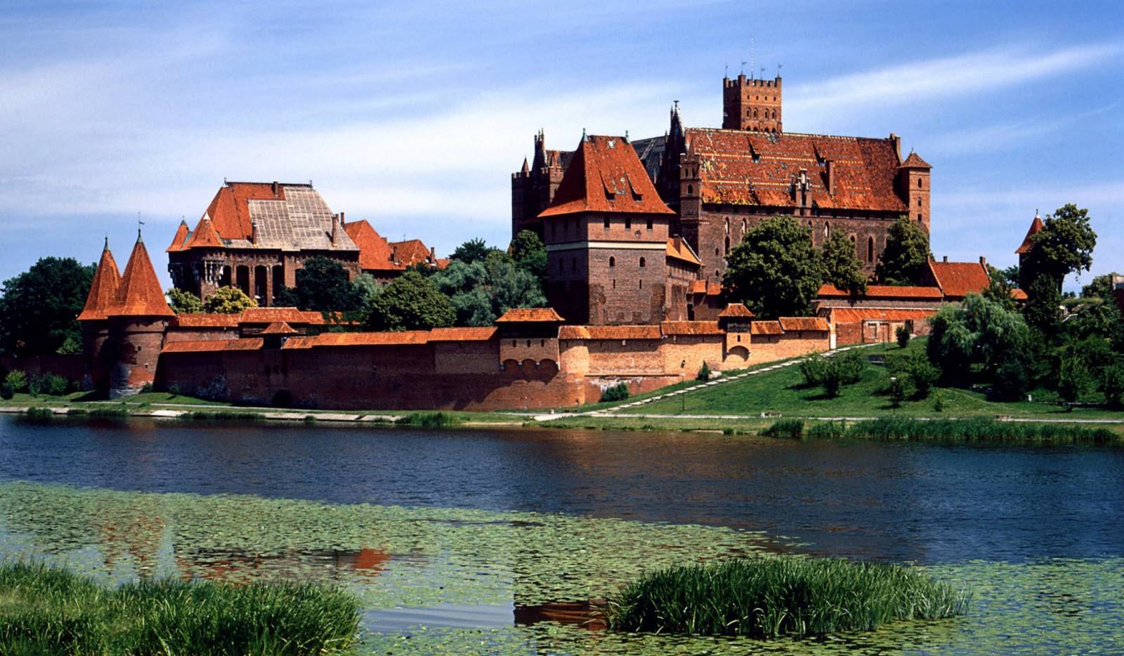
The Castle of the Teutonic Order in Malbork[1] (Polish: zamek w Malborku; German: Ordensburg Marienburg), located in the Polish town of Malbork, is the largest castle in the world measured by land area.[2]
It was originally built by the Teutonic Knights, a German Roman Catholic religious order of crusaders, in a form of an Ordensburg fortress. The Order named it Marienburg (Mary's Castle). The town which grew around it was also named Marienburg. In 1466, both castle and town became part of Royal Prussia, a province of Poland. It served as one of the several Polish royal residences, interrupted by several years of Swedish occupation, and fulfilling this function until Prussia claimed the castle as a result of the First Partition of Poland in 1772. Heavily damaged after World War II, the castle was renovated under the auspices of modern-day Poland in the second half of the 20th century and most recently in 2016. Nowadays, the castle hosts exhibitions and serves as a museum.
The castle is a classic example of a medieval fortress and, on its completion in 1406, was the world's largest brick castle.[3] UNESCO designated the "Castle of the Teutonic Order in Malbork" and the Malbork Castle Museum a World Heritage Site in December 1997.[4] It is one of two World Heritage Sites in the region with origins in the Teutonic Order. The other is the "Medieval Town of Toruń", founded in 1231 as the site of the castle Thorn.
Malbork Castle is also one of Poland's official national Historic Monuments (Pomnik historii), as designated September 16, 1994. Its listing is maintained by the National Heritage Board of Poland.

Links
Malbork Castle - Wikipedia
Malbork Castle - Malbork, Poland - History and Visitor Information
The Castle of the Teutonic Order in Malbork[1] (Polish: zamek w Malborku; German: Ordensburg Marienburg), located in the Polish town of Malbork, is the largest castle in the world measured by land area.[2]
It was originally built by the Teutonic Knights, a German Roman Catholic religious order of crusaders, in a form of an Ordensburg fortress. The Order named it Marienburg (Mary's Castle). The town which grew around it was also named Marienburg. In 1466, both castle and town became part of Royal Prussia, a province of Poland. It served as one of the several Polish royal residences, interrupted by several years of Swedish occupation, and fulfilling this function until Prussia claimed the castle as a result of the First Partition of Poland in 1772. Heavily damaged after World War II, the castle was renovated under the auspices of modern-day Poland in the second half of the 20th century and most recently in 2016. Nowadays, the castle hosts exhibitions and serves as a museum.
The castle is a classic example of a medieval fortress and, on its completion in 1406, was the world's largest brick castle.[3] UNESCO designated the "Castle of the Teutonic Order in Malbork" and the Malbork Castle Museum a World Heritage Site in December 1997.[4] It is one of two World Heritage Sites in the region with origins in the Teutonic Order. The other is the "Medieval Town of Toruń", founded in 1231 as the site of the castle Thorn.
Malbork Castle is also one of Poland's official national Historic Monuments (Pomnik historii), as designated September 16, 1994. Its listing is maintained by the National Heritage Board of Poland.
Links
Malbork Castle - Wikipedia
Malbork Castle - Malbork, Poland - History and Visitor Information
- Thread starter
- #39
Ksiaz Castle in Poland

Książ (pronounced [ˈkɕɔ̃ʂ], Polish: Zamek Książ, German: Schloss Fürstenstein) is the largest castle in the Silesia region, located north of Wałbrzych in Lower Silesian Voivodeship, Poland. It lies within Książ Landscape Park, a protected area which is part of the Waldenburg Mountains. The castle overlooks the gorge of the Pełcznica river and is one of the Wałbrzych's main tourist attractions.
History
A first fortification at the site was destroyed by the Bohemian forces of King Ottokar II in 1263. The Silesian duke Bolko I the Strict (d. 1301), ruler in Świdnica and Jawor, had a new castle built from 1288 to 1292 and took his residence here, adding Lord of Książ to his titles. The burgraviate included the neighbouring settlements of Świebodzice, Szczawno, and Pełcznica. When the last Świdnica duke Bolko II the Small died in 1368 without children, the castle's estates passed to the Luxembourg king Wenceslaus IV of Bohemia, the son of Bolko's niece Anne, while his widow Agnes of Habsburg reserved the usufruct for herself. After her death in the year 1392, King Wenceslaus, also King of the Romans since 1376, seized the Duchy of Świdnica and obtained Książ Castle.
As Agnes, contrary to her limited real rights, had sold the Książ estates, the castle passed through many hands. In 1401 it was obtained by the Bohemian noble Janko of Chotěmice (d. after 1442), who later rose to a governor of the Świdnica-Jawor lands. Durning the Hussite Wars, the castle was captured by the insurgents and occupied in 1428-1429. After Janko's death, the Bohemian king George of Poděbrady acquired Książ from his descendants and transferred the administration to the Moravian general Birka of Nasiedle. In 1466 Hans von Schellendorf obtained the castle from the Bohemian Crown.
The second castle complex was devastated in 1482 by Georg von Stein, a military commander in the service of the Hungarian king Matthias Corvinus while his forces campaigned the Silesian lands. Stein entrusted Frederick of Hohberg with the estates, his descendant Konrad I of Hoberg obtained the castle hill in 1509. The Hohberg (from 1714: Hochberg) family. The family, elevated to the rank of Freiherren in 1650, Grafen in 1666, and Imperial counts (Reichsgrafen) in 1683, owned the castle until the 1940s. From the mid 16th century onwards, the premises were rebuilt in a lavish Renaissance style.

Schloss Fürstenstein in the 1920s
During World War II, the castle was seized by the Nazi regime in 1944 after Count Hans Heinrich XVII of Hochberg, Prince of Pless (Pszczyna), had moved to England in 1932 and became a British citizen; moreover, his brother Count Alexander of Hochberg, a Polish citizen and owner of Pszczyna Castle, had joined the Polish army. Supervised by SS and Organisation Todt personnel, the building complex at Książ became part of the vast underground Project Riese complex, presumably a projected Führer Headquarter and a future abode for Adolf Hitler.[1]Construction works were carried out under inhumane conditions by forced labourers and inmates of Gross-Rosen concentration camp, until the castle was occupied by Red Army forces in the wake of the Vistula–Oder Offensive in 1945. A memorial marks the site of the Fürstenstein subcamp. Large parts of the historic building structure were demolished during construction; numerous artefacts were stolen or destroyed during the Soviet occupation.
After the war, the castle complex was used as a recreation home and cultureal centre. In recent years, large parts of the interior have been elaborately restored. Parts of the adit complex beneath the castle are currently used by the Polish Academy of Sciences for gravimeter measuring, while several tunnels are accessible to the public on guided tours.

Links
Książ - Wikipedia
Książ Castle
Książ (pronounced [ˈkɕɔ̃ʂ], Polish: Zamek Książ, German: Schloss Fürstenstein) is the largest castle in the Silesia region, located north of Wałbrzych in Lower Silesian Voivodeship, Poland. It lies within Książ Landscape Park, a protected area which is part of the Waldenburg Mountains. The castle overlooks the gorge of the Pełcznica river and is one of the Wałbrzych's main tourist attractions.
History
A first fortification at the site was destroyed by the Bohemian forces of King Ottokar II in 1263. The Silesian duke Bolko I the Strict (d. 1301), ruler in Świdnica and Jawor, had a new castle built from 1288 to 1292 and took his residence here, adding Lord of Książ to his titles. The burgraviate included the neighbouring settlements of Świebodzice, Szczawno, and Pełcznica. When the last Świdnica duke Bolko II the Small died in 1368 without children, the castle's estates passed to the Luxembourg king Wenceslaus IV of Bohemia, the son of Bolko's niece Anne, while his widow Agnes of Habsburg reserved the usufruct for herself. After her death in the year 1392, King Wenceslaus, also King of the Romans since 1376, seized the Duchy of Świdnica and obtained Książ Castle.
As Agnes, contrary to her limited real rights, had sold the Książ estates, the castle passed through many hands. In 1401 it was obtained by the Bohemian noble Janko of Chotěmice (d. after 1442), who later rose to a governor of the Świdnica-Jawor lands. Durning the Hussite Wars, the castle was captured by the insurgents and occupied in 1428-1429. After Janko's death, the Bohemian king George of Poděbrady acquired Książ from his descendants and transferred the administration to the Moravian general Birka of Nasiedle. In 1466 Hans von Schellendorf obtained the castle from the Bohemian Crown.
The second castle complex was devastated in 1482 by Georg von Stein, a military commander in the service of the Hungarian king Matthias Corvinus while his forces campaigned the Silesian lands. Stein entrusted Frederick of Hohberg with the estates, his descendant Konrad I of Hoberg obtained the castle hill in 1509. The Hohberg (from 1714: Hochberg) family. The family, elevated to the rank of Freiherren in 1650, Grafen in 1666, and Imperial counts (Reichsgrafen) in 1683, owned the castle until the 1940s. From the mid 16th century onwards, the premises were rebuilt in a lavish Renaissance style.

Schloss Fürstenstein in the 1920s
During World War II, the castle was seized by the Nazi regime in 1944 after Count Hans Heinrich XVII of Hochberg, Prince of Pless (Pszczyna), had moved to England in 1932 and became a British citizen; moreover, his brother Count Alexander of Hochberg, a Polish citizen and owner of Pszczyna Castle, had joined the Polish army. Supervised by SS and Organisation Todt personnel, the building complex at Książ became part of the vast underground Project Riese complex, presumably a projected Führer Headquarter and a future abode for Adolf Hitler.[1]Construction works were carried out under inhumane conditions by forced labourers and inmates of Gross-Rosen concentration camp, until the castle was occupied by Red Army forces in the wake of the Vistula–Oder Offensive in 1945. A memorial marks the site of the Fürstenstein subcamp. Large parts of the historic building structure were demolished during construction; numerous artefacts were stolen or destroyed during the Soviet occupation.
After the war, the castle complex was used as a recreation home and cultureal centre. In recent years, large parts of the interior have been elaborately restored. Parts of the adit complex beneath the castle are currently used by the Polish Academy of Sciences for gravimeter measuring, while several tunnels are accessible to the public on guided tours.
Links
Książ - Wikipedia
Książ Castle
- Thread starter
- #40
Charlottenburg Palace, Berlin, FRG
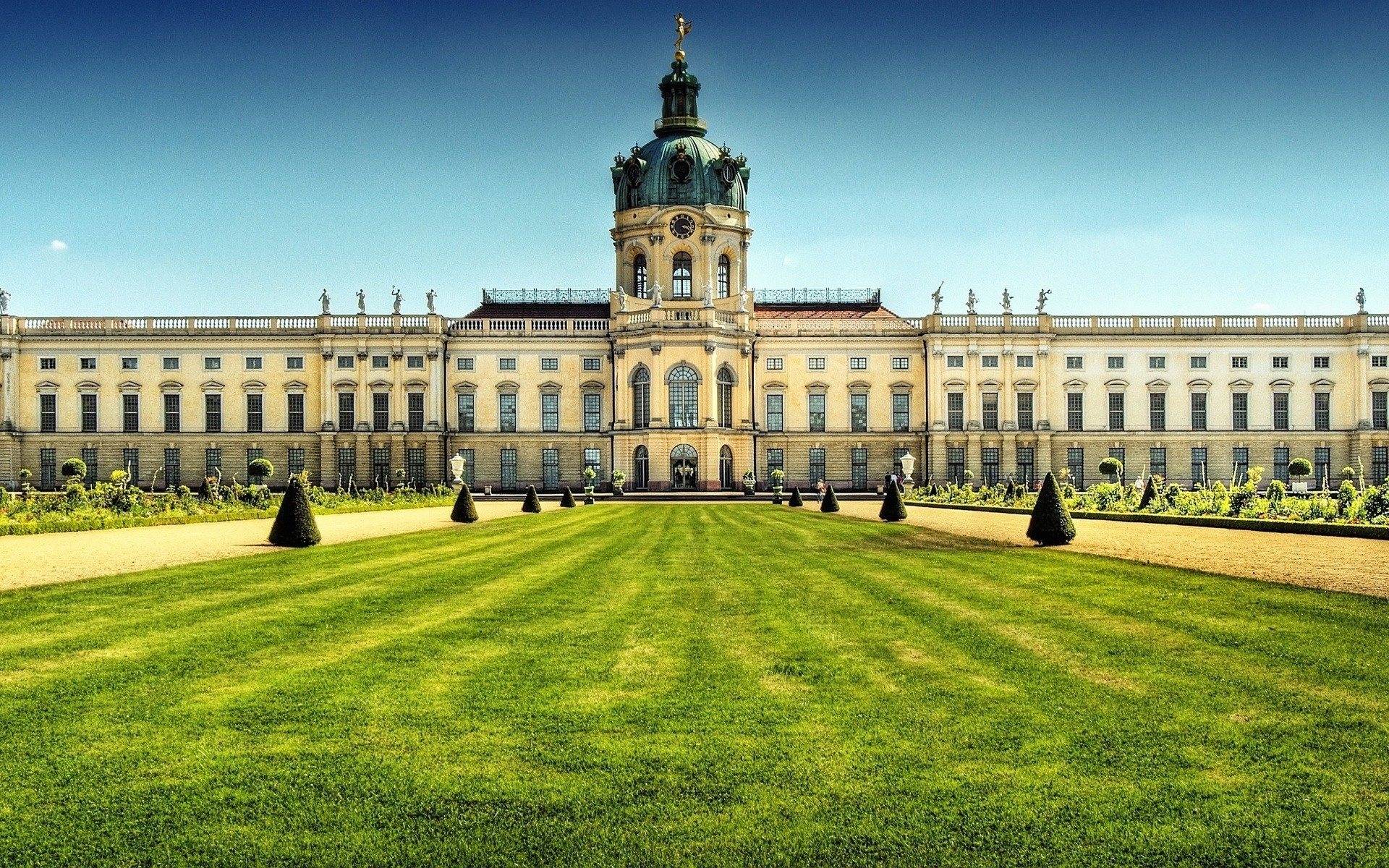
Charlottenburg Palace (German: Schloss Charlottenburg) is the largest palace in Berlin,[1] Germany.[2] It is in the Charlottenburg district of the Charlottenburg-Wilmersdorf borough.
The palace was built at the end of the 17th century and was greatly expanded during the 18th century. It includes much lavish internal decoration in baroque and rococo styles. A large formal garden surrounded by woodland was added behind the palace, including a belvedere, a mausoleum, a theatre and a pavilion. During the Second World War, the palace was badly damaged but has since been reconstructed. The palace with its gardens are a major tourist attraction.
History
Palace

Statue Friedrich Wilhelm I (der Große Kurfürst) elector of Brandenburg in the cour d'honneur of the palace
The original palace was commissioned by Sophie Charlotte, the wife of Friedrich III, Elector of Brandenburg in what was then the village of Lietzow. Named Lietzenburg, the palace was designed by Johann Arnold Nering in baroque style. It consisted of one wing and was built in 2 1⁄2 storeys with a central cupola. The façade was decorated with Corinthian pilasters. On the top was a cornice on which were statues. At the rear in the centre of the palace were two oval halls, the upper one being a ceremonial hall and the lower giving access to the gardens. Nering died during the construction of the palace and the work was completed by Martin Grünberg and Andreas Schlüter. The inauguration of the palace was celebrated on 11 July 1699, Frederick's 42nd birthday.[3]
Tea house "Belvedere" in palace garden
Friedrich crowned himself as King Friedrich I in Prussia in 1701 (Friedrich II, known as Frederick the Great, would later achieve the title King of Prussia). Two years previously, he had appointed Johann Friedrich von Eosander (also known as Eosander von Göthe) as the royal architect and sent him to study architectural developments in Italy and France, particularly the Palace of Versailles. On his return in 1702, Eosander began to extend the palace, starting with two side wings to enclose a large courtyard, and the main palace was extended on both sides. Sophie Charlotte died in 1705 and Friedrich named the palace and its estate Charlottenburg in her memory. In the following years, the Orangery was built on the west of the palace and the central area was extended with a large domed tower and a larger vestibule. On top of the dome is a wind vane in the form of a gilded statue representing Fortune designed by Andreas Heidt. The Orangery was originally used to overwinter rare plants. During the summer months, when over 500 orange, citrus and sour orange trees decorated the baroque garden, the Orangery regularly was the gorgeous scene of courtly festivities.
Inside the palace, was a room described as "the eighth wonder of the world", the Amber Room (Bernsteinzimmer), a room with its walls surfaced in decorative amber. It was designed by Andreas Schlüter and its construction by the Danish amber craftsman Gottfried Wolfram started in 1701. Friedrich Wilhelm I gave the Amber Room to Tsar Peter the Great as a present in 1716.[4]

Charlottenburg Palace, Orangerie
When Friedrich I died in 1713, he was succeeded by his son, Friedrich Wilhelm I whose building plans were less ambitious, although he did ensure that the building was properly maintained. Building was resumed after his son Friedrich II (Frederick the Great) came to the throne in 1740. During that year, stables for his personal guard regiment were completed to the south of the Orangery wing and work was started on the east wing. The building of the new wing was supervised by Georg Wenzeslaus von Knobelsdorff, the Superintendent of all the Royal Palaces, who largely followed Eosander's design. The decoration of the exterior was relatively simple but the interior furnishings were rich with painting and sculpture,textiles and mirror. The ground floor was intended for Frederick's wife Elisabeth Christine, who, preferring Schönhausen Palace however, was only an occasional visitor. The especially splendid decoration of the upper floor, which included the White Hall, the Banqueting Hall, the Throne Room and the Golden Gallery, was designed mainly by Johann August Nahl. In 1747, a second apartment for the king was prepared in the distant eastern part of the wing. During this time, Sanssouci was being built at Potsdam, and once this was completed Frederick was only an occasional visitor to Charlottenburg.[5]
In 1786, Frederick was succeeded by his nephew Friedrich Wilhelm II who transformed five rooms on the ground floor of the east wing into his summer quarters and part of the upper floor into Winter Chambers, although he did not live long enough to use them. His son, Friedrich Wilhelm III came to the throne in 1797 and reigned with his wife, Queen Luise for 43 years. They spent much of this time living in the east wing of Charlottenburg. Their eldest son, Friedrich Wilhelm IV, who reigned from 1840 to 1861, lived in the upper storey of the central palace building. After Friedrich Wilhelm IV died, the only other royal resident of the palace was Friedrich III who reigned for 99 days in 1888.[6]
The palace was badly damaged in 1943 during the Second World War.[7] In 1951, the war-damaged Stadtschloss in East Berlin was demolished and, as the damage to Charlottenburg was at least as serious, it was feared that it would also be demolished. However, following the efforts of Margarete Kühn, the Director of the State Palaces and Gardens, it was rebuilt to its former condition,[8] with gigantic modern ceiling paintings by Hann Trier. From 2004 till early 2006, Charlottenburg Palace was the seat of the President of Germany, whilst Schloss Bellevue was being renovated.[citation needed]
Grounds

Gardens of Charlottenburg Palace
The garden was designed in 1697 in baroque style by Simeon Godeau who had been influenced by André Le Nôtre, designer of the gardens at Versailles. Godeau's design consisted of geometric patterns, with avenues and moats, which separated the garden from its natural surroundings. Beyond the formal gardens was the Carp Pond. Towards the end of the 18th century, a less formal, more natural-looking garden design became fashionable. In 1787 the Royal Gardener Georg Steiner redesigned the garden in the English landscape style for Friedrich Wilhelm II, the work being directed by Peter Joseph Lenné. After the Second World War, the centre of the garden was restored to its previous baroque style.[9]
In 1788, Friedrich Wilhelm II arranged for the building of the Belvedere, designed by Carl Gotthard Langhans, in the grounds beyond the Carp Pond. The building was used as a teahouse and as a viewing-tower. Langhans also designed the Palace Theatre, which was built between 1788 and 1791 to the west of the Orangery wing.[10] The Mausoleum was built as a tomb for Queen Luise between 1810 and 1812 in neoclassical style to a design by Heinrich Gentz. After the death of Friedrich Wilhelm III, it was extended; this design being by Karl Friedrich Schinkel. It was extended again in 1890–91 by Albert Geyer to accommodate the graves of Wilhelm I and his wife Augusta.[11] In 1825, Friedrich Wilhelm III added the Neuer Pavilion, an Italianate villa designed by Schinkel, to the north of the palace. This was damaged in the war in 1943 and was reconstructed between 1957 and 1970.[12]
Links
Charlottenburg Palace - Wikipedia
Schloss Charlottenburg - Berlin.de
Charlottenburg Palace (German: Schloss Charlottenburg) is the largest palace in Berlin,[1] Germany.[2] It is in the Charlottenburg district of the Charlottenburg-Wilmersdorf borough.
The palace was built at the end of the 17th century and was greatly expanded during the 18th century. It includes much lavish internal decoration in baroque and rococo styles. A large formal garden surrounded by woodland was added behind the palace, including a belvedere, a mausoleum, a theatre and a pavilion. During the Second World War, the palace was badly damaged but has since been reconstructed. The palace with its gardens are a major tourist attraction.
History
Palace

Statue Friedrich Wilhelm I (der Große Kurfürst) elector of Brandenburg in the cour d'honneur of the palace
The original palace was commissioned by Sophie Charlotte, the wife of Friedrich III, Elector of Brandenburg in what was then the village of Lietzow. Named Lietzenburg, the palace was designed by Johann Arnold Nering in baroque style. It consisted of one wing and was built in 2 1⁄2 storeys with a central cupola. The façade was decorated with Corinthian pilasters. On the top was a cornice on which were statues. At the rear in the centre of the palace were two oval halls, the upper one being a ceremonial hall and the lower giving access to the gardens. Nering died during the construction of the palace and the work was completed by Martin Grünberg and Andreas Schlüter. The inauguration of the palace was celebrated on 11 July 1699, Frederick's 42nd birthday.[3]

Tea house "Belvedere" in palace garden
Friedrich crowned himself as King Friedrich I in Prussia in 1701 (Friedrich II, known as Frederick the Great, would later achieve the title King of Prussia). Two years previously, he had appointed Johann Friedrich von Eosander (also known as Eosander von Göthe) as the royal architect and sent him to study architectural developments in Italy and France, particularly the Palace of Versailles. On his return in 1702, Eosander began to extend the palace, starting with two side wings to enclose a large courtyard, and the main palace was extended on both sides. Sophie Charlotte died in 1705 and Friedrich named the palace and its estate Charlottenburg in her memory. In the following years, the Orangery was built on the west of the palace and the central area was extended with a large domed tower and a larger vestibule. On top of the dome is a wind vane in the form of a gilded statue representing Fortune designed by Andreas Heidt. The Orangery was originally used to overwinter rare plants. During the summer months, when over 500 orange, citrus and sour orange trees decorated the baroque garden, the Orangery regularly was the gorgeous scene of courtly festivities.
Inside the palace, was a room described as "the eighth wonder of the world", the Amber Room (Bernsteinzimmer), a room with its walls surfaced in decorative amber. It was designed by Andreas Schlüter and its construction by the Danish amber craftsman Gottfried Wolfram started in 1701. Friedrich Wilhelm I gave the Amber Room to Tsar Peter the Great as a present in 1716.[4]

Charlottenburg Palace, Orangerie
When Friedrich I died in 1713, he was succeeded by his son, Friedrich Wilhelm I whose building plans were less ambitious, although he did ensure that the building was properly maintained. Building was resumed after his son Friedrich II (Frederick the Great) came to the throne in 1740. During that year, stables for his personal guard regiment were completed to the south of the Orangery wing and work was started on the east wing. The building of the new wing was supervised by Georg Wenzeslaus von Knobelsdorff, the Superintendent of all the Royal Palaces, who largely followed Eosander's design. The decoration of the exterior was relatively simple but the interior furnishings were rich with painting and sculpture,textiles and mirror. The ground floor was intended for Frederick's wife Elisabeth Christine, who, preferring Schönhausen Palace however, was only an occasional visitor. The especially splendid decoration of the upper floor, which included the White Hall, the Banqueting Hall, the Throne Room and the Golden Gallery, was designed mainly by Johann August Nahl. In 1747, a second apartment for the king was prepared in the distant eastern part of the wing. During this time, Sanssouci was being built at Potsdam, and once this was completed Frederick was only an occasional visitor to Charlottenburg.[5]
In 1786, Frederick was succeeded by his nephew Friedrich Wilhelm II who transformed five rooms on the ground floor of the east wing into his summer quarters and part of the upper floor into Winter Chambers, although he did not live long enough to use them. His son, Friedrich Wilhelm III came to the throne in 1797 and reigned with his wife, Queen Luise for 43 years. They spent much of this time living in the east wing of Charlottenburg. Their eldest son, Friedrich Wilhelm IV, who reigned from 1840 to 1861, lived in the upper storey of the central palace building. After Friedrich Wilhelm IV died, the only other royal resident of the palace was Friedrich III who reigned for 99 days in 1888.[6]
The palace was badly damaged in 1943 during the Second World War.[7] In 1951, the war-damaged Stadtschloss in East Berlin was demolished and, as the damage to Charlottenburg was at least as serious, it was feared that it would also be demolished. However, following the efforts of Margarete Kühn, the Director of the State Palaces and Gardens, it was rebuilt to its former condition,[8] with gigantic modern ceiling paintings by Hann Trier. From 2004 till early 2006, Charlottenburg Palace was the seat of the President of Germany, whilst Schloss Bellevue was being renovated.[citation needed]
Grounds

Gardens of Charlottenburg Palace
The garden was designed in 1697 in baroque style by Simeon Godeau who had been influenced by André Le Nôtre, designer of the gardens at Versailles. Godeau's design consisted of geometric patterns, with avenues and moats, which separated the garden from its natural surroundings. Beyond the formal gardens was the Carp Pond. Towards the end of the 18th century, a less formal, more natural-looking garden design became fashionable. In 1787 the Royal Gardener Georg Steiner redesigned the garden in the English landscape style for Friedrich Wilhelm II, the work being directed by Peter Joseph Lenné. After the Second World War, the centre of the garden was restored to its previous baroque style.[9]
In 1788, Friedrich Wilhelm II arranged for the building of the Belvedere, designed by Carl Gotthard Langhans, in the grounds beyond the Carp Pond. The building was used as a teahouse and as a viewing-tower. Langhans also designed the Palace Theatre, which was built between 1788 and 1791 to the west of the Orangery wing.[10] The Mausoleum was built as a tomb for Queen Luise between 1810 and 1812 in neoclassical style to a design by Heinrich Gentz. After the death of Friedrich Wilhelm III, it was extended; this design being by Karl Friedrich Schinkel. It was extended again in 1890–91 by Albert Geyer to accommodate the graves of Wilhelm I and his wife Augusta.[11] In 1825, Friedrich Wilhelm III added the Neuer Pavilion, an Italianate villa designed by Schinkel, to the north of the palace. This was damaged in the war in 1943 and was reconstructed between 1957 and 1970.[12]
Links
Charlottenburg Palace - Wikipedia
Schloss Charlottenburg - Berlin.de
Similar threads
- Replies
- 382
- Views
- 56K
- Replies
- 0
- Views
- 1K
- Replies
- 3
- Views
- 1K
Latest Discussions
- Replies
- 25
- Views
- 83
- Replies
- 144
- Views
- 7K
- Replies
- 310
- Views
- 4K
Forum List
-
-
-
-
-
Political Satire 8039
-
-
-
-
-
-
-
-
-
-
-
-
-
-
-
-
-
-
-
ObamaCare 781
-
-
-
-
-
-
-
-
-
-
-
Member Usernotes 468
-
-
-
-
-
-
-
-
-
-