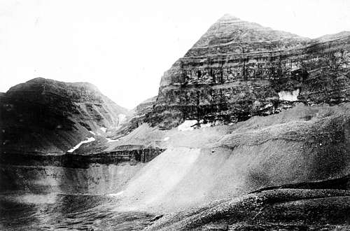
Glaciers on the iconic Teton Range are shrinking, researchers say, joining a growing list of glaciers in North America and beyond that are losing their surface area and potentially reducing the water supply for nearby regions.
Two of the Tetons' biggest glaciers have lost more than 20 percent of their surface area since the late 1960s, three University of Wyoming researchers concluded after comparing old and new aerial photographs of the glaciers.
The glaciers are a fairly substantial source of irrigation water, meaning the findings have wider implications than simply what the mountains look like to tourists by late summer. People in Wyoming and Idaho and to a lesser extent Utah use water from the glaciers.
"From an engineering-water supply perspective, we look at them as frozen reservoirs," said Glenn Tootle, a University of Tennessee-Knoxville assistant professor and co-principal investigator of the study funded by the Wyoming Water Development Commission.
The Wyoming Legislature appropriated $225,000 for the study in 2006, one of several water projects or studies lawmakers funded that year in the nation's fifth-driest state.
The findings are consistent with shrinking glaciers elsewhere. A recent U.S. Geological Survey study found that three long-observed glaciers in Alaska and Washington state have been shrinking at a faster rate in recent years. Other scientists have predicted that Montana's Glacier National Park will be devoid of glaciers by 2030.
Worldwide, the vast majority of glaciers measured below 15,000 feet have been shrinking in recent decades, said Richard Armstrong, a senior researcher with the National Snow and Ice Data Center at the University of Colorado in Boulder.
Researchers: shrinking Teton glaciers will affect Utah water - Salt Lake Tribune