
Billy_Bob
Diamond Member
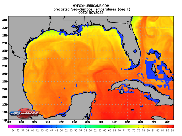
There is very little ocean surface heat, strong wind shear, and an almost flat temperature gradient.. I will be surprised to see any storm make more than cat 1 and that is a real if, in and of itself, due to wind shear and mid to upper level atmospheric cooling.Is the calm before the storms ending?

And then, he provides this:

Story w/chart @ Atlantic hurricanes: Is the calm before the storms ending? - ImaGeo
A lot would have to change for this season to change drastically. Ocean flows just don't seem to be complying with the alarmist hopes and dreams..


 It'll be the first in over a decade.......and actually what scientists would say is waaaaaaaaaaaaaaaaaaay overdue. But the nutters aid 10 years ago, size and frequency of hurricanes were about to be off the hook.